Best Hikes in Zermatt: Top 10 Trails, Hiking Map & Practical Tips
This site contains affiliate links, which means that we may earn a small commission, at no cost to you, for qualifying purchases. It supports the work that goes into keeping this content free. Thanks for reading! More info: Privacy Policy.
Looking for the best hikes in Zermatt, Switzerland, and wondering which trails are actually worth your time? This guide to hiking in Zermatt covers 10 of the best day hikes, with distances, difficulty levels, a practical hiking map, and tips to help you choose the right trails for your trip.
We’ve done almost all of these hikes ourselves with our kids (aged 10–12 at the time), so this selection focuses on routes that are realistic to fit into a normal visit and suitable for a wide range of hikers.
Zermatt is one of the best-known mountain resorts in Switzerland, but most visitors only go up to Gornergrat and Klein Matterhorn and then leave. If you want to see more of the area beyond the main viewpoints, hiking is one of the best ways to explore the surroundings.
To help you choose which hikes to do in Zermatt, this list starts with our personal favorites – the trails we recommend most. If you’re short on time, focus on the top 3–4 hikes on the list – these are the most scenic trails in Zermatt. If you have more time, or you’re looking for even easier or more demanding routes, read through the full selection.
How This Guide Works
- Most of the best hikes in Zermatt can only be done in the summer season. For each hike, you’ll find the recommended months in the individual descriptions. Zermatt also has several winter hiking trails, and a few hikes from this selection can be done year-round.
- All trails in this guide are day hikes, and most take less than three hours. A few can be combined if you want a longer route.
- All hiking times and distances refer to the full route, from start to finish. Most hikes in Zermatt are one-way hikes, meaning you start at one location and finish at another, using gondolas or trains to reach the trailhead and return afterward. This guide also includes two loop hikes and two out-and-back hikes. For each route, we clearly indicate the start and end stations to make planning easy.
- Zermatt has hiking trails for all levels. Most of the hikes in this guide can be done with kids from about 4–6 years old, assuming they are used to walking on mountain trails. A few more challenging hikes are not suitable for kids under 12. We did almost all of these hikes with our children aged 10, 10, and 12, and had trouble keeping up with them.
- This guide does not include the Matterhorn summit climb. It focuses on hikes that offer great Matterhorn views without requiring technical climbing skills.
- To help you plan your time, we created a map showing all the best Zermatt hikes featured in this guide (see below). It gives you a quick overview of where each hike is located and which routes can be combined.
TIP: You’ll need to use trains and mountain transport while hiking in Zermatt. Check our Swiss Travel Pass guide to see whether it makes sense for your entire Switzerland trip – and how it can help you save a lot on transport, including Zermatt.
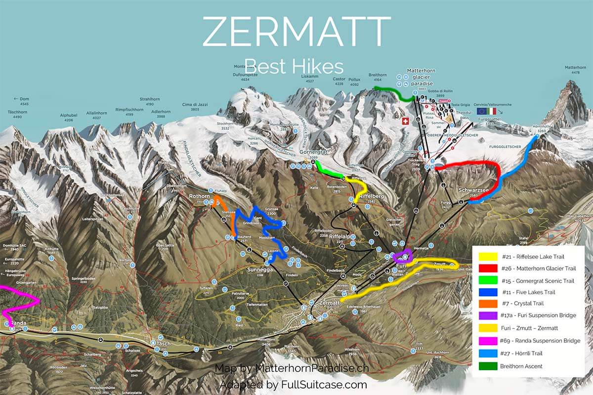
Here are the best hikes in Zermatt:
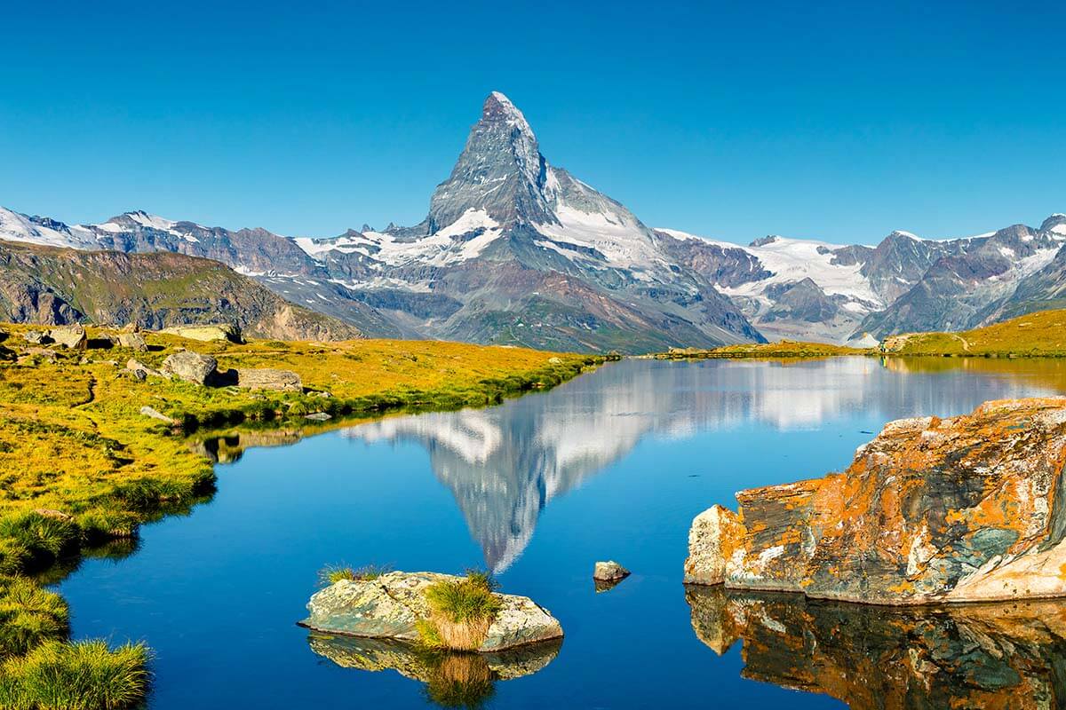
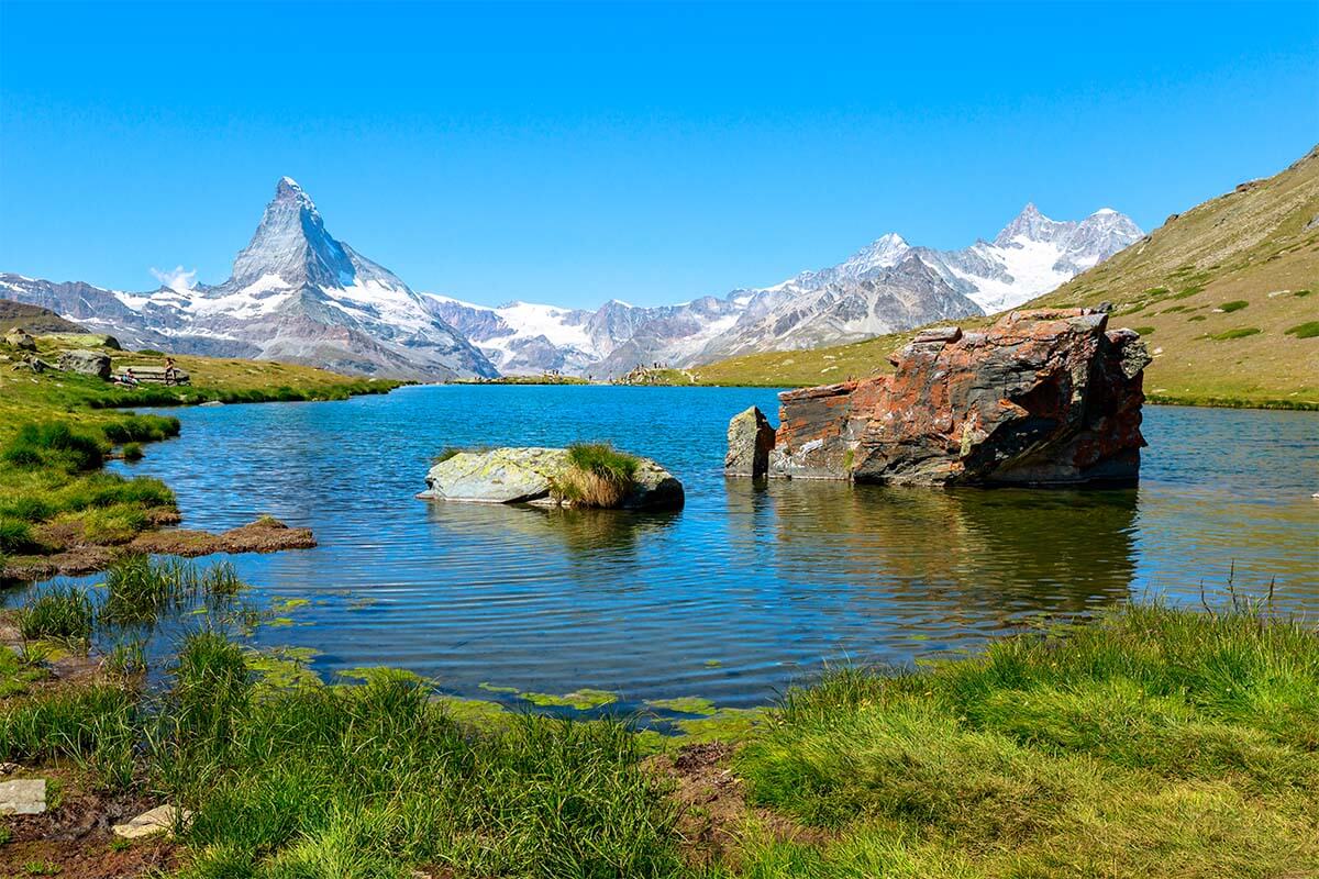
1. Riffelsee Lake Trail
Great short and easy hike with some of the best Matterhorn reflections.
- Official trail name/number: Riffelseeweg – Zermatt hike 21.
- Distance: 3 km (1.86 miles).
- Duration: 1 hour.
- Difficulty: easy.
- Elevation change: ascent 53 m/ descent 289 m.
- Start/ end of the trail: Rotenboden to Riffelberg (one-way, downhill hike).
- Season: July to October.
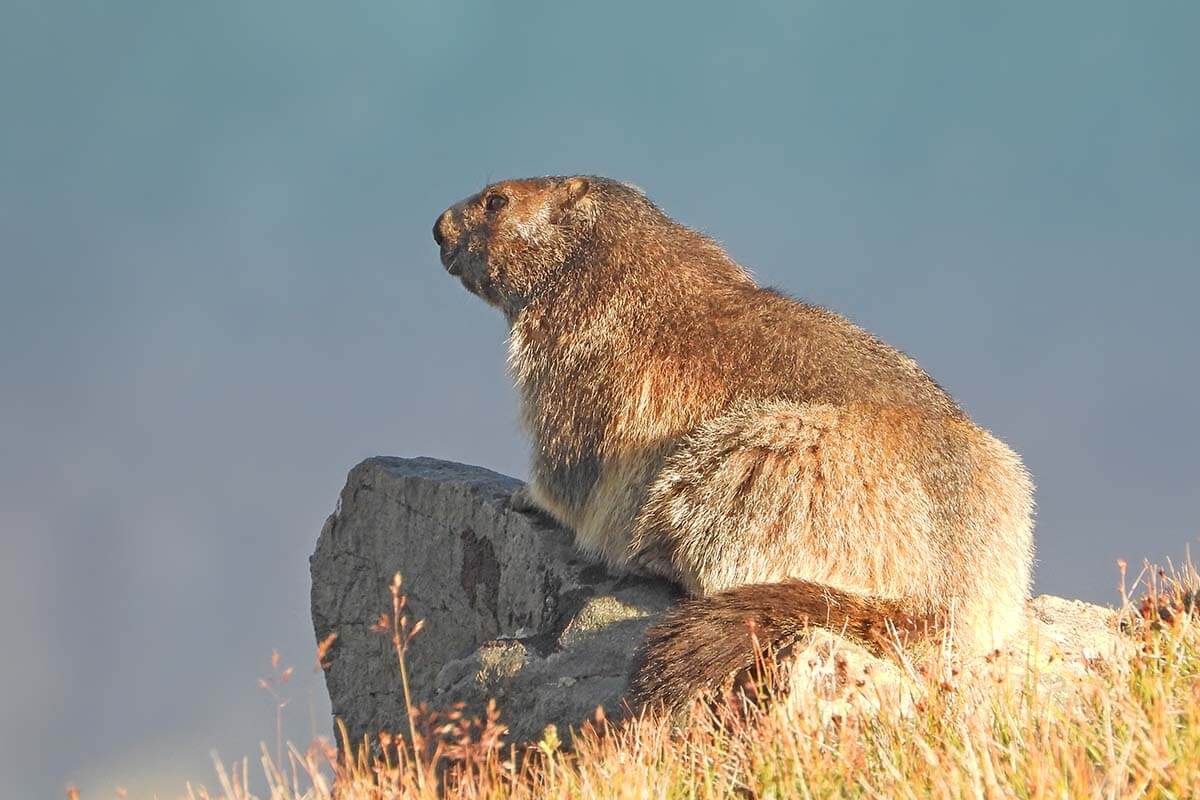
- Main highlights: Riffelsee Lake and its sister lake, just a short walk downhill from it. Matterhorn reflections on the lakes. Possibility to spot marmots and blacknose sheep.
- Can be done with kids from about 4 years old.
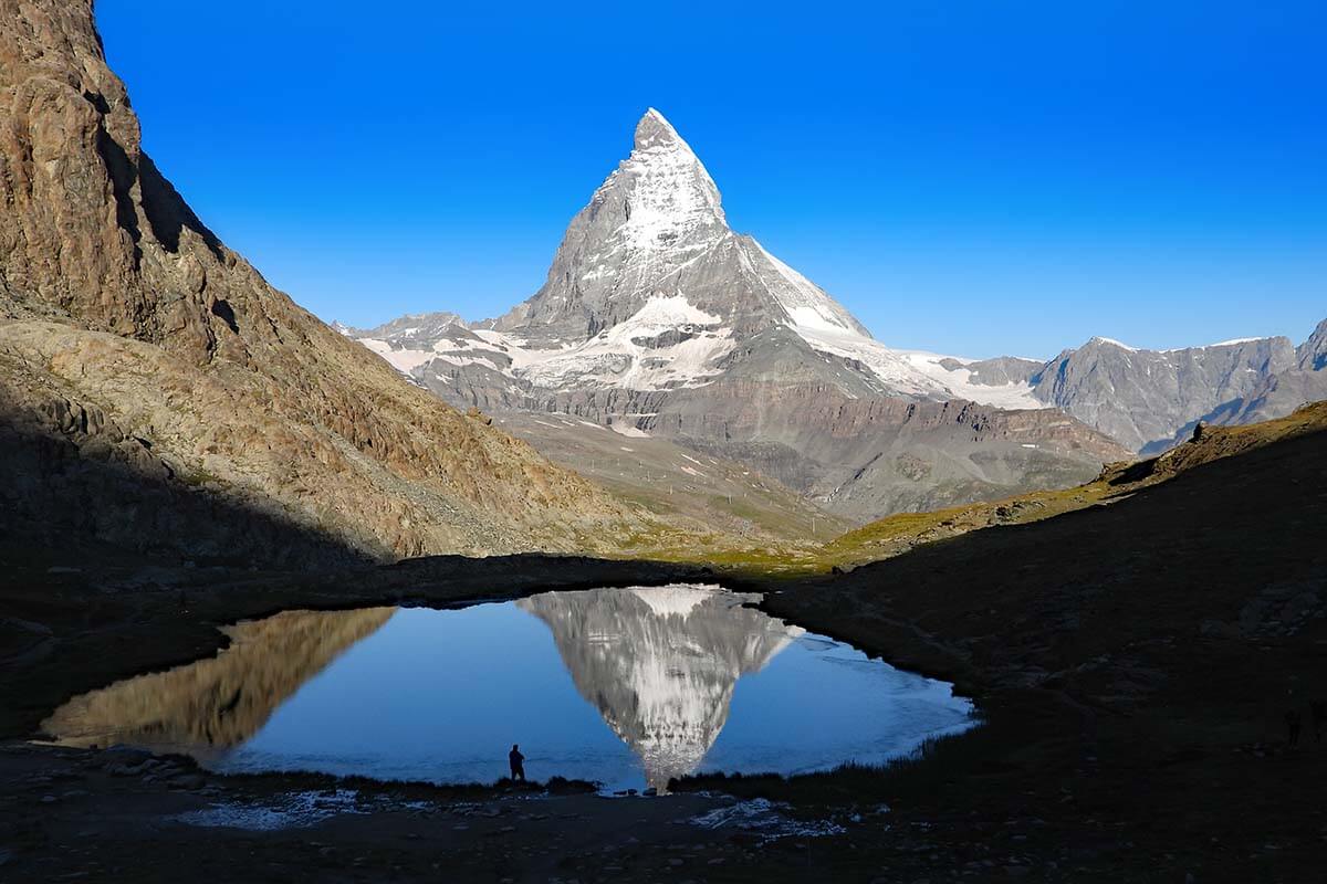
Riffelsee Lake Trail (Zermatt hike no. 21) is a very easy and rewarding downhill walk offering easy access to some truly spectacular scenery.
On this hike, you pass two small lakes – Riffelsee Lake and its even smaller sister-lake with no name. Both lakes are really tiny and seemingly not too special. But – when the conditions are right (usually early morning and sometimes at around sunset) – you can see the most amazing reflections of the Matterhorn mirrored on the surface of these lakes.
Early morning is also a great time to see marmots along this hike.
Riffelsee Lake Trail is an easy, and family-friendly hike that should be doable for everyone. And because it doesn’t take that much time, it can be included in any itinerary, even if you are only visiting Zermatt for a day.
TIP: Start your day in Zermatt with this hike! Early in the morning, you have the best chance to see the most beautiful reflections on the lakes AND are most likely to spot marmots.
LEARN MORE: Riffelsee Lake Hike
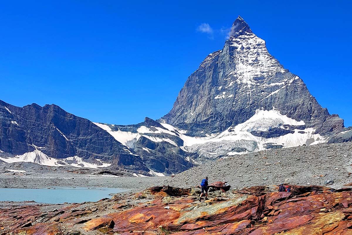
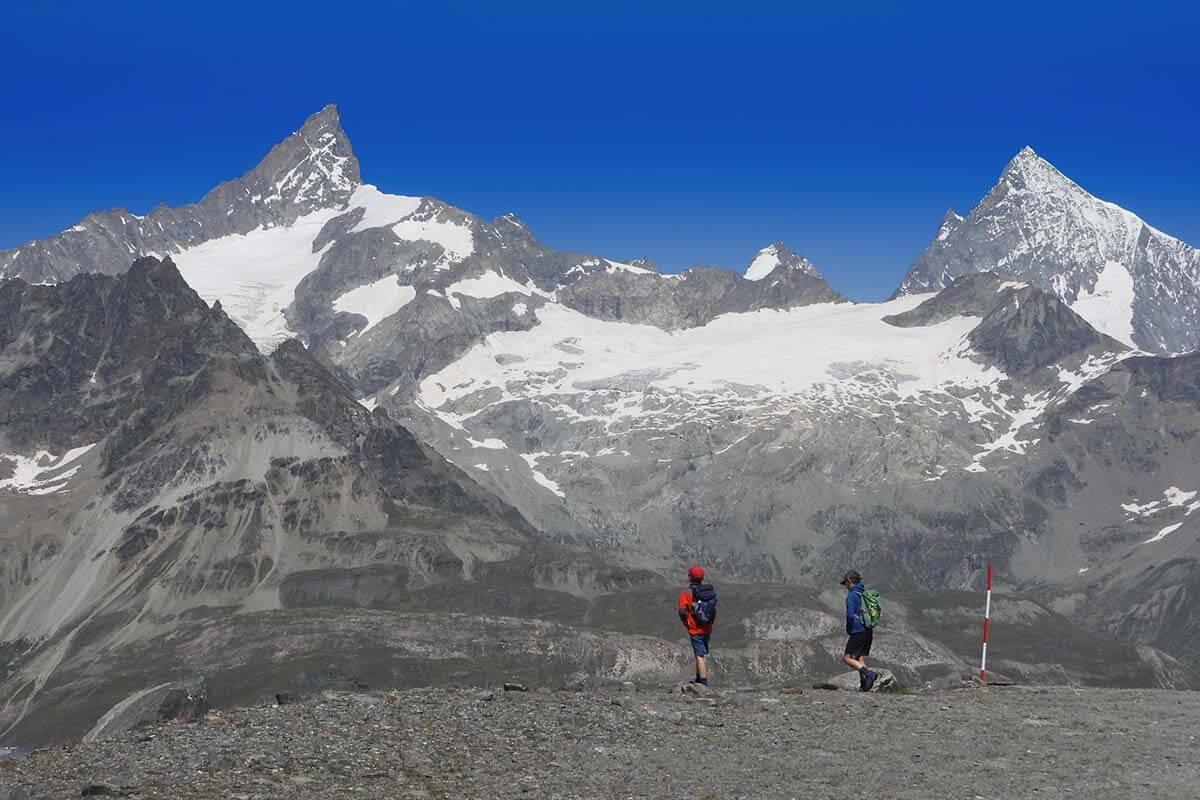
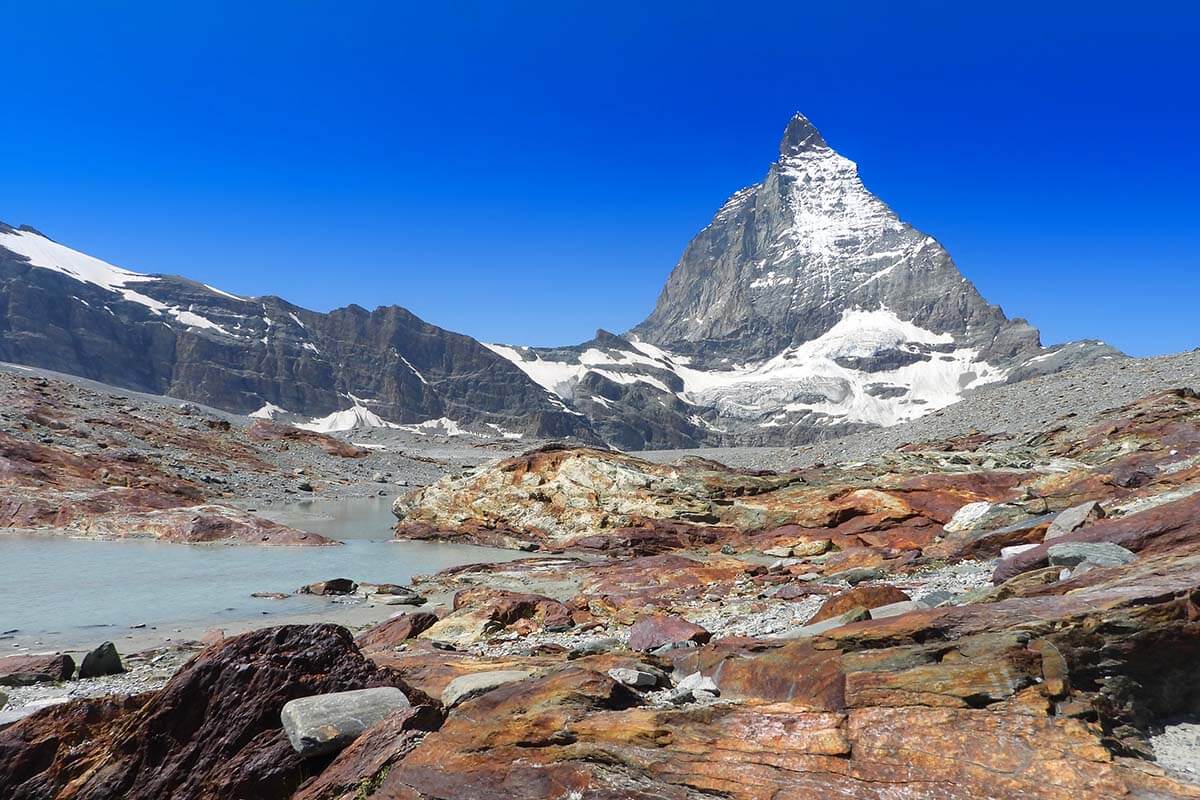
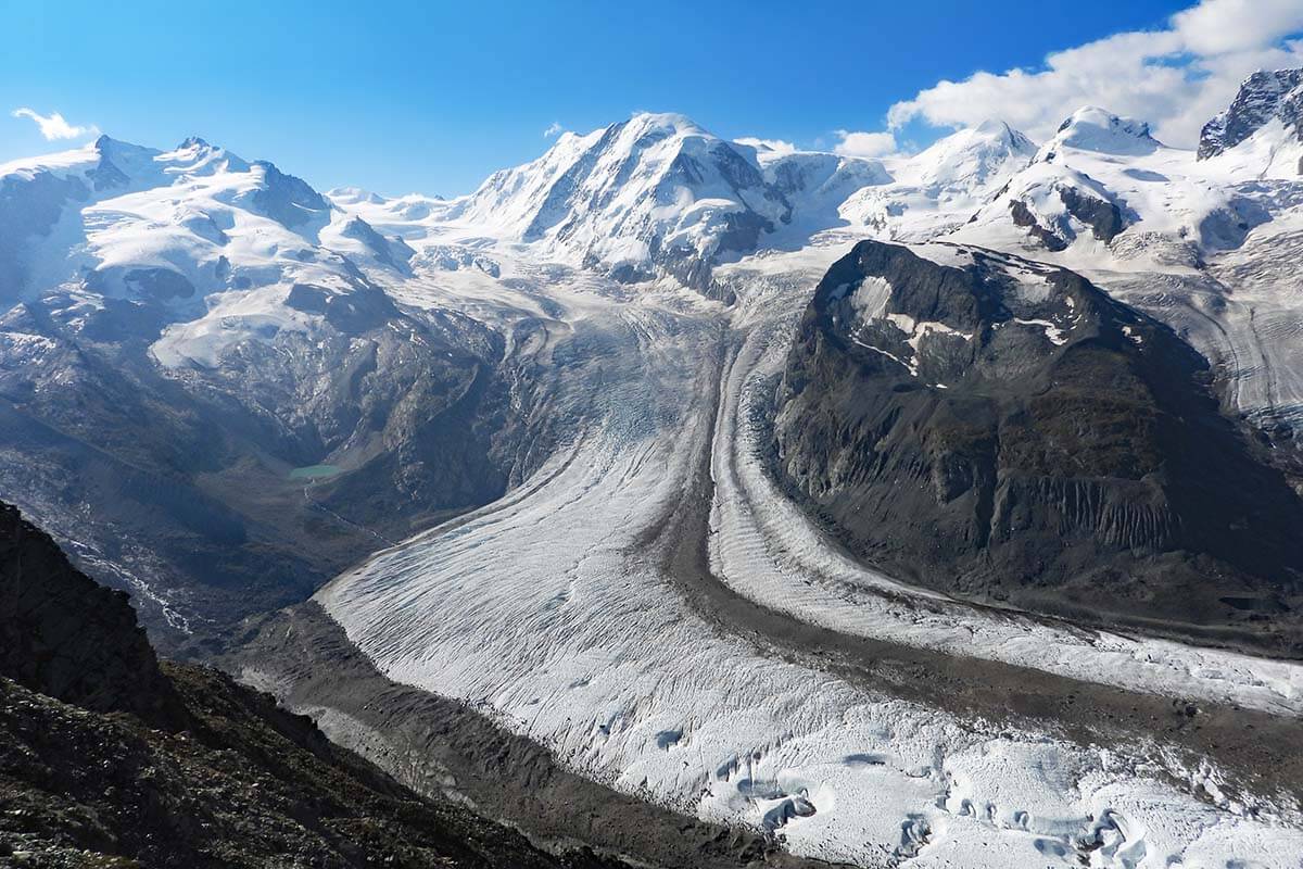
2. Matterhorn Glacier Trail
Best longer hike for close-up Matterhorn views and unique glacier landscapes.
- Official trail name/ number: Matterhorn Glacier Trail – Zermatt hike 26.
- Distance: 6.6 km (4.1 miles).
- Duration: 2-2.5 hours if going downhill.
- Difficulty: medium.
- Elevation change: ascent 174 m/ descent 515m.
- Start/ end of the trail: Trockener Steg to Schwarzsee (one-way, downhill hike).
- Season: June to September.
- Main highlights: The proximity of the retreating glacier and constant views of the Matterhorn. Unique landscapes with glacial lakes and colorful rocks.
- Can be done with kids from about 7-8 years old.
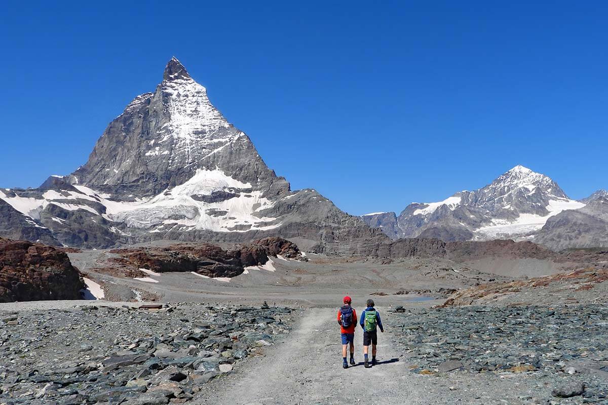
Matterhorn Glacier Trail (Zermatt hike no. 26) is my personal favorite of the longer hikes in Zermatt.
This trail takes you over the area that used to be covered by a glacier. If you are looking for some truly unique scenery, this hike will not disappoint! In addition, the Matterhorn is literally by your side during the entire hike.
You won’t find much greenery here, but the barren landscapes are really special. And while the landscape might look rather grey and uninspiring at first, there are plenty of colors – from white glacier waters to bright red and orange rocks, blue sky, and snowcapped mountains in the distance… On this trail, you can see some of the most special landscapes in the Zermatt area.
If you come here very early in the morning, you might be able to see some stunning reflections of the Matterhorn on the many lakes along this trail. However, because of the gondola schedule, it’s not easy to get here as early as, for example, to the above-mentioned Riffelsee.
TIP: Don’t miss the ZERMATT sign at Schwarzsee at the end of this hike. You can also go for a (cold) swim at Schwarzsee Lake in summer.
LEARN MORE: Hiking the Matterhorn Glacier Trail
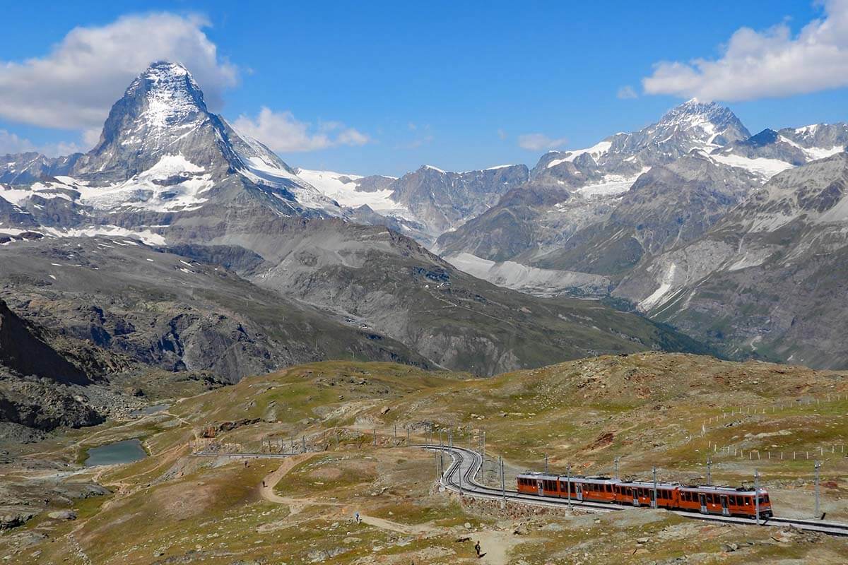
3. Gornergrat Scenic Trail
Easy and very short downhill walk with big glacier and railway views.
- Official trail name/number: Aussichtsweg – Zermatt hike 15.
- Distance: 2 km (1.25 miles).
- Duration: 40 minutes.
- Difficulty: easy/moderate.
- Elevation change: ascent 11 m/ descent 284 m.
- Start/ end of the trail: Gornergrat to Rotenboden (one-way, downhill hike).
- Season: July to October.
- Main highlights: View over the glaciers, the Matterhorn, and Gornergrat Railway. Possibility to see blacknose sheep.
- Can be done with kids from about 4-5 years old.
Gornergrat Scenic Trail (Zermatt hike no. 15) is one of the shortest hikes in Zermatt with the most phenomenal views.
You start at the Gornergrat station at the very top and walk downhill following the railway line. On this hike, you can admire the fantastic views of the Gorner Glacier (the second-largest glacier in the Alps), take some iconic pictures of the Gornergrat railway with the Matterhorn in the background, and maybe even see some of the famous blacknose sheep, typical to the Valais region in Switzerland.
This hike ends at Rotenboden, just next to the earlier-mentioned Riffelsee lake. Depending on what time of the day you do this hike, you could potentially see nice reflections here.
TIP: If you have some extra time, you can easily extend this hike by continuing down to Riffelberg (see the Riffelsee Lake Trail info above). So, basically, you combine the two hikes together.
LEARN MORE: Hiking Gornergrat Scenic Trail
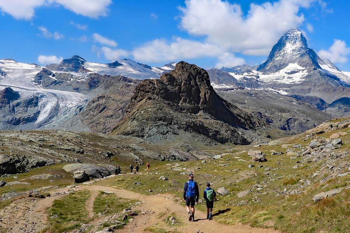
4. Five Lakes Trail
Best half-day hike if you want more variety, lakes, and optional swimming.
- Official trail name/number: 5 Seenweg – Zermatt hike 11.
- Distance: 9.8 km (6 miles).
- Duration: 2.5 – 3 hours.
- Difficulty: moderate.
- Elevation change: ascent 165 m/ 454 m descent.
- Start/ end of the trail: Blauherd to Sunnegga (one-way, mostly downhill hike).
- Season: June to September.
- Main highlights: 5 lakes, reflections at Stellisee, swimming at Grünsee or Leisee.
- Can be done with kids from about 6 years old, or parts of the hike with younger kids.
5 Lakes Walk (Zermatt hike no. 11) is often mentioned as the best hike in Zermatt. While I think that the three hikes mentioned above are worth it more, I have to agree that it’s one of the more impressive trails indeed.
It’s a family-friendly and rather easy hike, but also quite long and so not something that many tourists find the time for. But if you have half a day to spare in Zermatt and are looking for some pretty Alpine scenery, this hike is a great option!
The Five Lakes trail is a really nice Alpine hike with lots of greenery, colorful wildflowers, mountain streams, and snowcapped mountains in the distance. As the name suggests – this hike takes you past 5 lakes: Stellisee, Grindjisee, Grünsee, Moosjisee, and Leisee.
Each of the lakes is different and all quite picturesque. If you are hiking on a sunny summer day, you can also go for a swim at two of the lakes (pack your swimwear and a travel towel!).
Good to know: When the conditions are right, you can see nice Matterhorn reflections on some of these lakes. The mirror image of the Matterhorn is probably the most impressive at Stellisee, but also Leisee can be nice. For that, you’d have to come here first thing in the morning when there’s the most chance that the water of the lakes will be calm.
LEARN MORE: 5 Lakes Hike in Zermatt

5. Crystal Trail
- Official trail name/number: Kristallweg – Zermatt hike 7.
- Distance: 5.4 km (3.35 miles).
- Duration: 1.45 – 2 hours.
- Difficulty: moderate.
- Elevation change: ascent 118 m/ descent 638 m.
- Start/ end of the trail: Rothorn to Blauherd (one-way, downhill hike).
- Season: June to September.
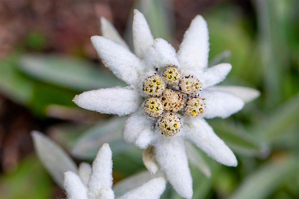
- Main highlights: Views on Findel Glacier and reflections on Stellisee. You might be able to spot chamois mountain goats, and – in July – August – see edelweiss.
- Can be done with kids from about 5-6 years old.
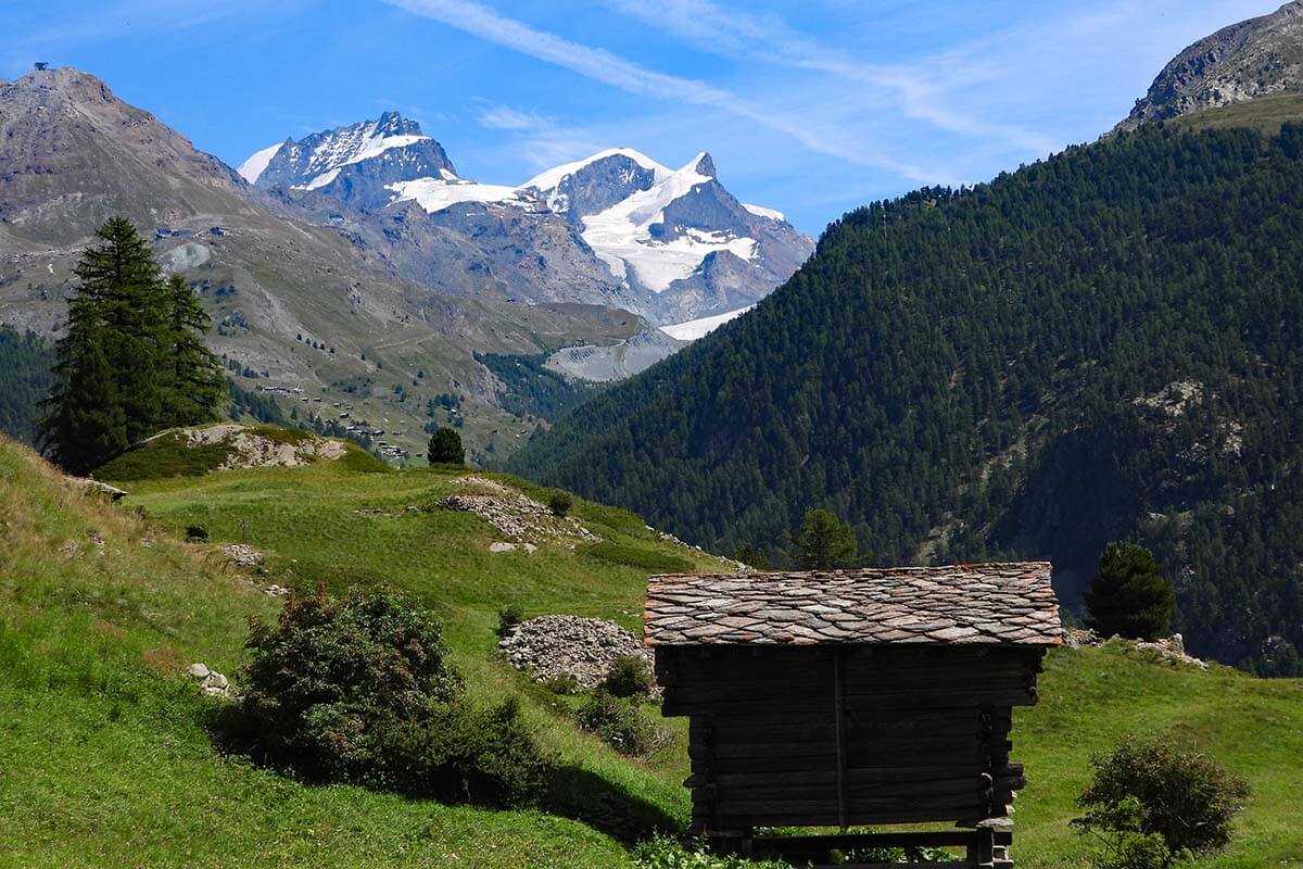
The Crystal Trail (Zermatt hike no. 7) is located just above the 5 Lakes Trail, but – due to the higher altitude – the scenery here is quite different. You’ll be hiking on a more barren terrain, with stunning views of Findel Glacier. Parts of this trail take you along the former moraines of the retreating glacier.
This is a moderate but not too long and downhill hike, so it’s not too challenging. Along the way, you can also stop at the Fluhalp mountain hut, which has a nice restaurant terrace where you can have some cake while enjoying the views over the mountains and the Matterhorn.
In season, you might be able to spot some chamois here. And in the warmest months of the summer, look out for the edelweiss flowers along the trail! And if you come here early in the morning or at around sunset, you might be able to enjoy amazing mirror reflections of the Matterhorn on Stellisee (the first lake on the earlier-mentioned 5 Lakes hike).
TIP: If you have at least 4 – 4.5 hours and are looking for some of the best hiking experiences in Zermatt, combine the Crystal Trail (hike 7) with the Five Lakes Trail (hike 11). The two hikes overlap a bit, so the total hiking time is somewhat shorter than if you would do them separately.
LEARN MORE: Crystal Trail
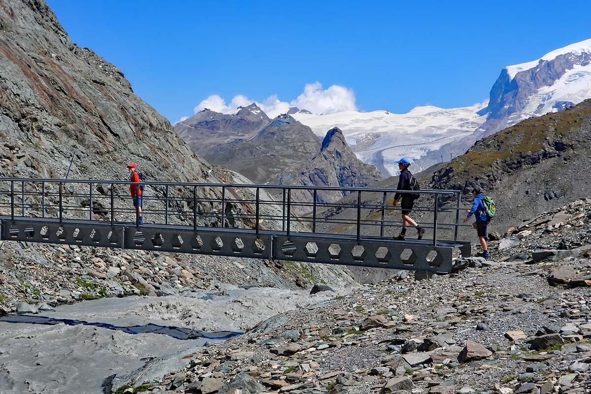
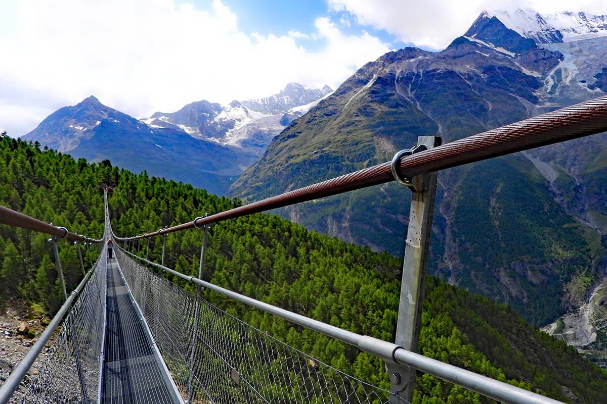
6. Furi Suspension Bridge Trail
- Official trail name/number: Hängebrückenweg – Zermatt hike 17a.
- Distance: 2.9 km (1.8 miles).
- Duration: 1 hour.
- Difficulty: easy.
- Elevation change: ascent 175 m/ descent 174 m.
- Start/ end of the trail: Furi (loop hike).
- Season: June to October.
- Main highlights: Suspension bridge and glacier garden.
- Can be done with kids from about 4 years old.
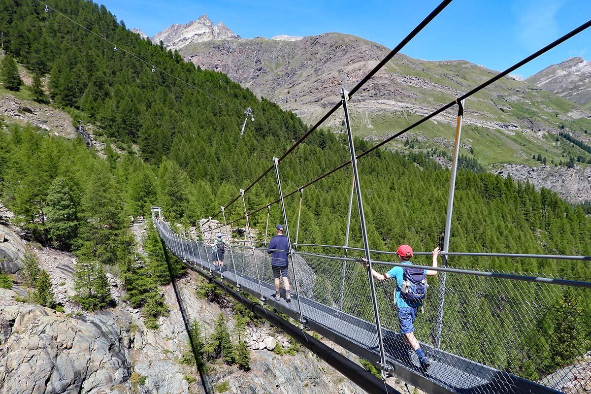
The Furi Suspension Bridge Trail (Zermatt hike no. 17a) is one of the easiest of the best hikes in Zermatt. It’s a family-friendly hike that is very popular among visitors of all ages.
This circular hike starts and ends at the Furi cable car station and it takes you to the nearby Dossen glacier garden and a suspension bridge. You can do this hike in any direction – it really doesn’t matter that much. The most popular way seems to be hiking counter-clockwise, so the bridge first and then the glacier garden. We were coming from the other side and did it the other way around, and it was just fine too – the elevation change is about the same either way.
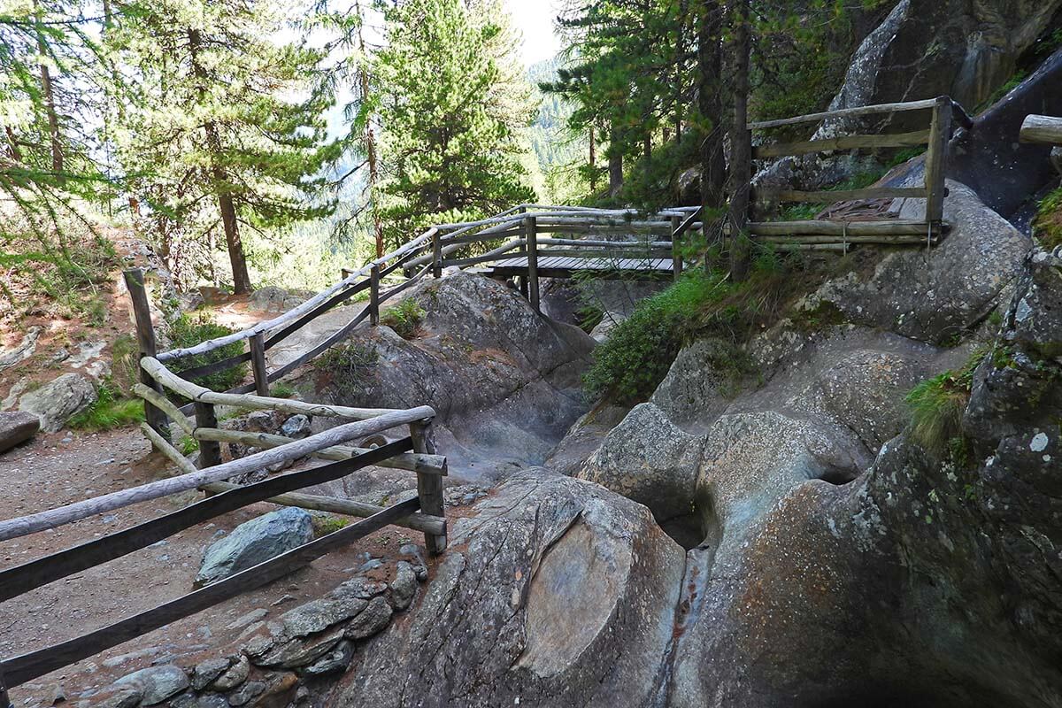
At the glacier garden, you can see unique landscapes that are normally concealed by glaciers: smooth boulders, rock cauldrons eroded by meltwater from the glacier, glacial mills, and strange rock formations. This area used to be covered by the Gorner Glacier and is a paradise for geology enthusiasts.
The Furi suspension bridge is about 100 meters (328 ft) long and spans over the Gorner Gorge offering nice views of the surroundings and the gorge below. It doesn’t have an official name and is simply indicated as ‘Hängebrücke’. It’s not to be confused with a much longer and more famous Charles Kuonen Suspension Bridge in Randa, which requires a much longer and more strenuous hike (see further below).
TIP: Pack a picnic or even some meat for the grill. There’s a nice picnic area with bbq facilities and a playground just next to the hanging bridge.
LEARN MORE: Furi Suspension Bridge Trail
7. Furi – Zmutt – Zermatt
- Distance: 4.8 km (3 miles).
- Duration: 1 – 1.5 hours.
- Difficulty: easy.
- Elevation change: ascent 83 m/ descent 319 m.
- Start/ end of the trail: Furi to Zermatt (one-way, downhill hike).
- Season: year-round, but best in summer.
- Main highlights: Zmutt village. Possibility to spot marmots.
- Can be done with kids from about 4-5 years old.
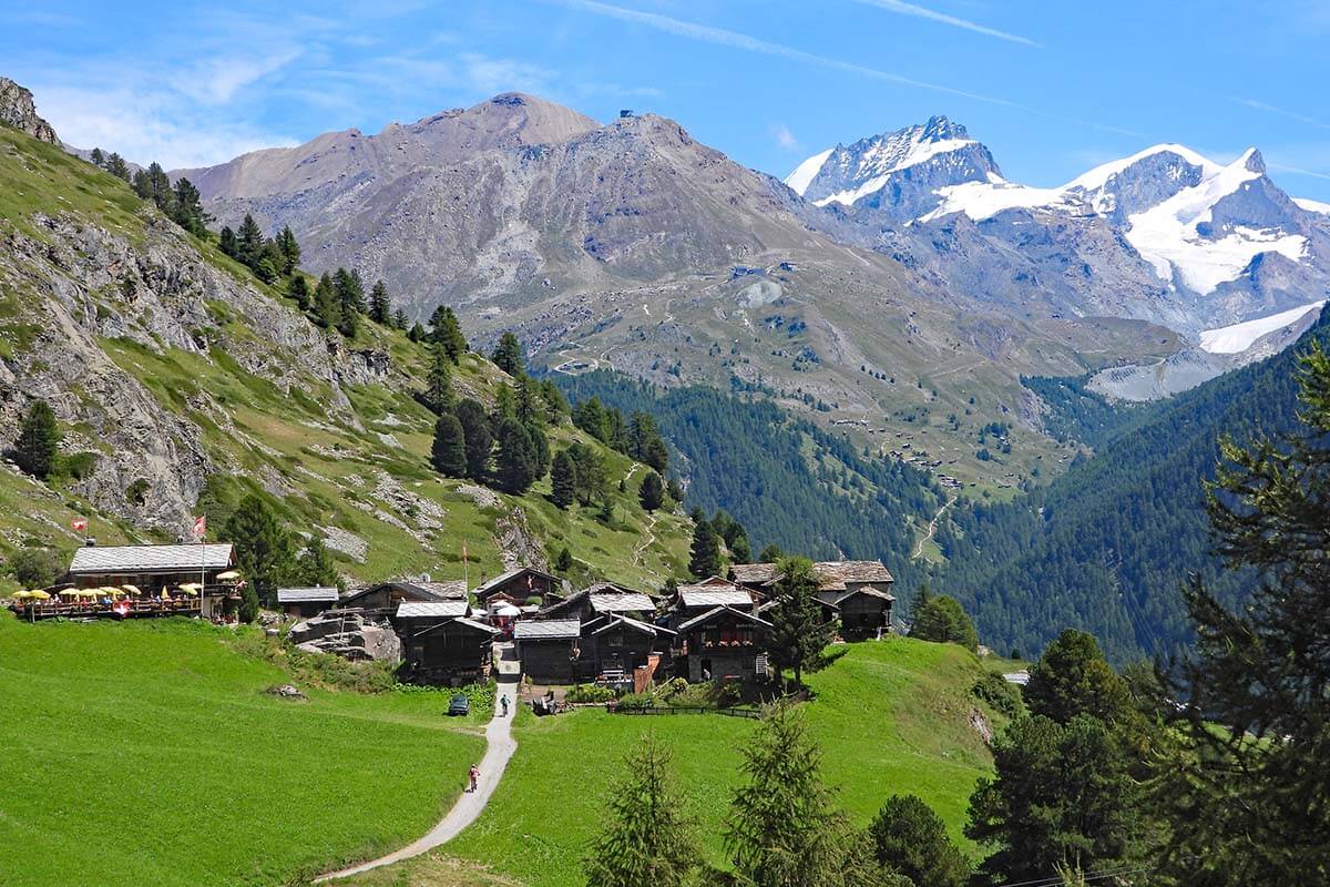
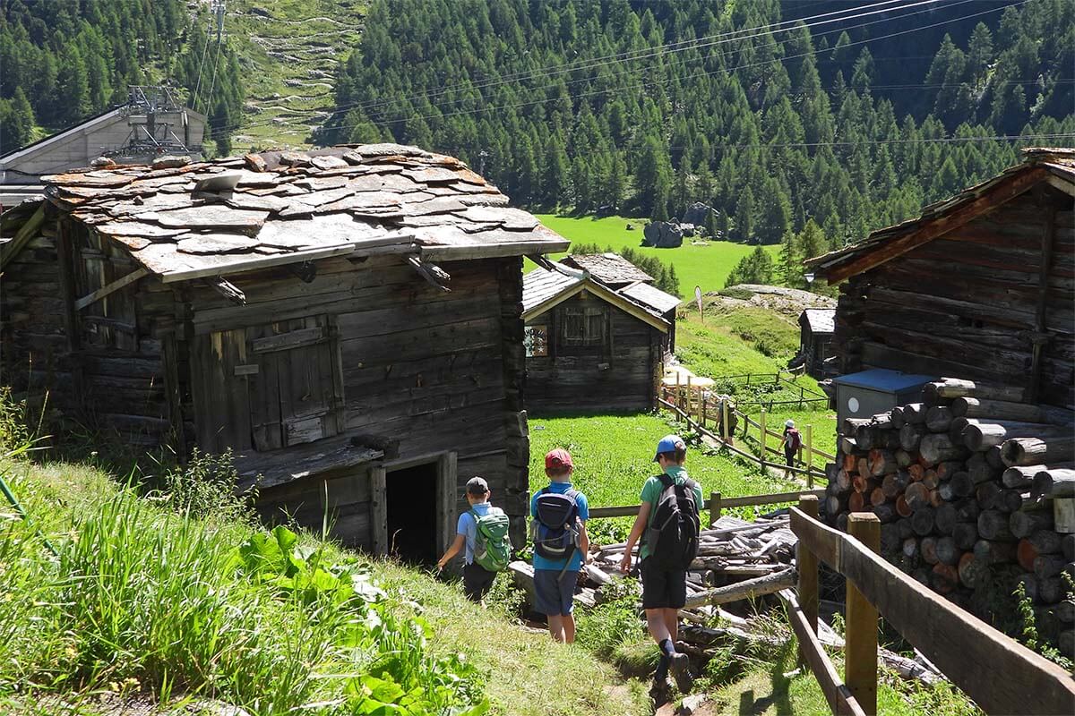
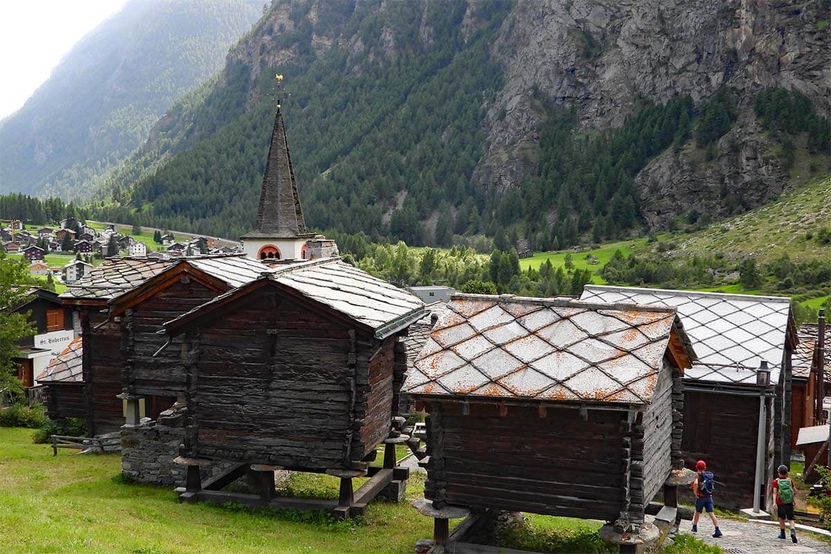
There are many hiking trails between Zermatt and Furi, and one of the nicest ones is probably the trail that takes you to Zmutt.
The hamlet of Zmutt is a tiny 500-year-old mountain village with traditional dark wooden houses and a small chapel. It has a few lively mountain restaurants where you can stop for a drink or some lunch. It’s a very picturesque place to see near Zermatt, and is very popular, also because there are many trails in the area that aren’t too long or too difficult.
The hiking trail from Furi to Zmutt has no official name or number, but it’s quite easy to locate. From the Furi cable car station, follow the signs to Zmutt, and you’ll be walking on a wide road that is also used for supplies. From Zmutt, take the shortest hike down to Zermatt (very scenic) or a slightly longer “Kulturweg Zermatt-Zmutt” which takes you past several historic houses, the oldest of which date back to the 13th century.
TIP: You can easily combine this hike with the above-mentioned Furi Suspension Bridge trail. Even the two hikes together will only take about 2-3 hours.
8. Charles Kuonen Suspension Bridge Hike
- Official trail name/number: Randa Rundweg Hängebrücke – Zermatt hike 69.
- Distance: 8.6 km (5.3 mi).
- Duration: 4 hours.
- Difficulty: moderate.
- Elevation change: ascent 988 m/descent 988 m (3,241 ft).
- Start/ end of the trail: Randa (loop hike).
- Season: May to October.
- Main highlights: Charles Kuonen Suspension Bridge and traditional houses in Randa village.
- Can be done with kids from about 5-6 years old, but keep in mind the steep climb/ descent.
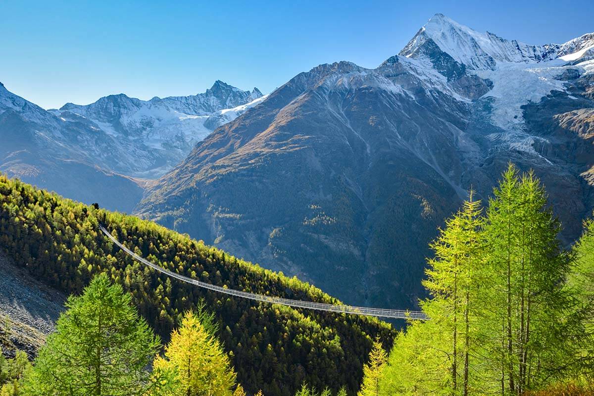
The Charles Kuonen Suspension Bridge (aka Randa Suspension Bridge) is the longest pedestrian suspension bridge in the Alps. It can only be reached on foot, via the circular ‘Hängebrücke’ hike no. 69 from Randa village just near Zermatt.
Good to know: Randa is located just a few kilometers from Täsch, which is the gateway to the car-free Zermatt. This is the only one of the best hikes in the Zermatt area that can be reached by car. And if you don’t have a car, you can simply take a train to Randa.
The 494 meters (0.3 miles) – long Charles Kuonen Suspension Bridge is absolutely impressive. It takes 10 minutes (!) just to walk from one side of the bridge to another, and the views are spectacular. But the hike to get to the bridge is really steep, long, and quite boring.
On the other hand, how often do you have a chance to walk over one of the longest suspension bridges in the world… So if you want to do some hiking in the Zermatt area and are looking for something special and unique, it’s well worth considering.
TIP: Be sure to check out the old part of Randa village. If you do this hike, you’ll pass some of the oldest houses on your way, but even if you decide not to embark on this long hike, it’s worth visiting Randa either way.
LEARN MORE: Hiking to Charles Kuonen Suspension Bridge
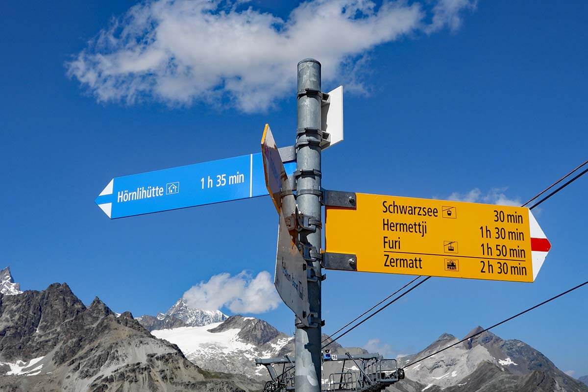
9. Hörnli Trail
- Official trail name/number: Hörnliweg – Zermatt hike 27.
- Distance: 4.3 km (2.67 miles) one way, so 8.6 km in total.
- Duration: 2.5 hours one way, so about 5 hours in total.
- Difficulty: hard.
- Elevation change: ascent/ descent 693 m.
- Start/ end of the trail: Schwarzsee to Hörnli Hut Matterhorn (you take the same trail there and back).
- Season: July to September.
- Main highlights: Hörnli Hut and seeing the Matterhorn up-close.
- Can be done with kids from about 10-12 years old.
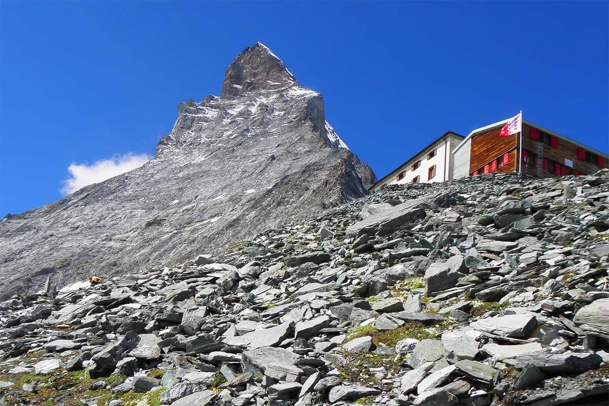
Hörnlihütte is a mountain hut where the Matterhorn climbers start their ascent to the peak of this iconic mountain. It was at this location that the first people who reached the top of the Matterhorn started their climb on 14 July 1865 (although the first overnight hut here was only built later, in 1880).
Hörnli Trail (Zermatt hike no. 27) is, therefore, considered one of the most iconic hikes in Zermatt.
It brings you as close to the Matterhorn as possible without actually climbing it. And as you sit on the terrace of the mountain hut at the foot of the Matterhorn, you can watch the climbers on their way to the top (bring good binoculars!).
Good to know: The Hörnli trail is a rather challenging hike that involves a steep climb, a walk on the exposed mountain ridge and a few sections on metal staircases and walkways. It’s not a hike for those with a fear of heights, but it’s also not overly difficult if you take your time for it.
TIP: The Hörnlihütte hike (no. 27) can be combined with the Matterhorn Glacier Trail (no. 26) mentioned higher above. In that case, start your day as early as possible with a downhill hike from Trockener Stegg and then take a turn-off to Hörnlihütte. This will save you a big part of the initial climb, but you will also need at least 5 hours for the entire hike (more likely 6 hours or even more with breaks and lunch, etc). Return to Schwarzsee.
Of course, you can also book a stay at the Hörnlihütte and make it a relaxing two-day hike.
LEARN MORE: Hörnli Trail or for information on how to combine the two hikes together – Matterhorn Glacier Trail & detour to Hörnlihütte
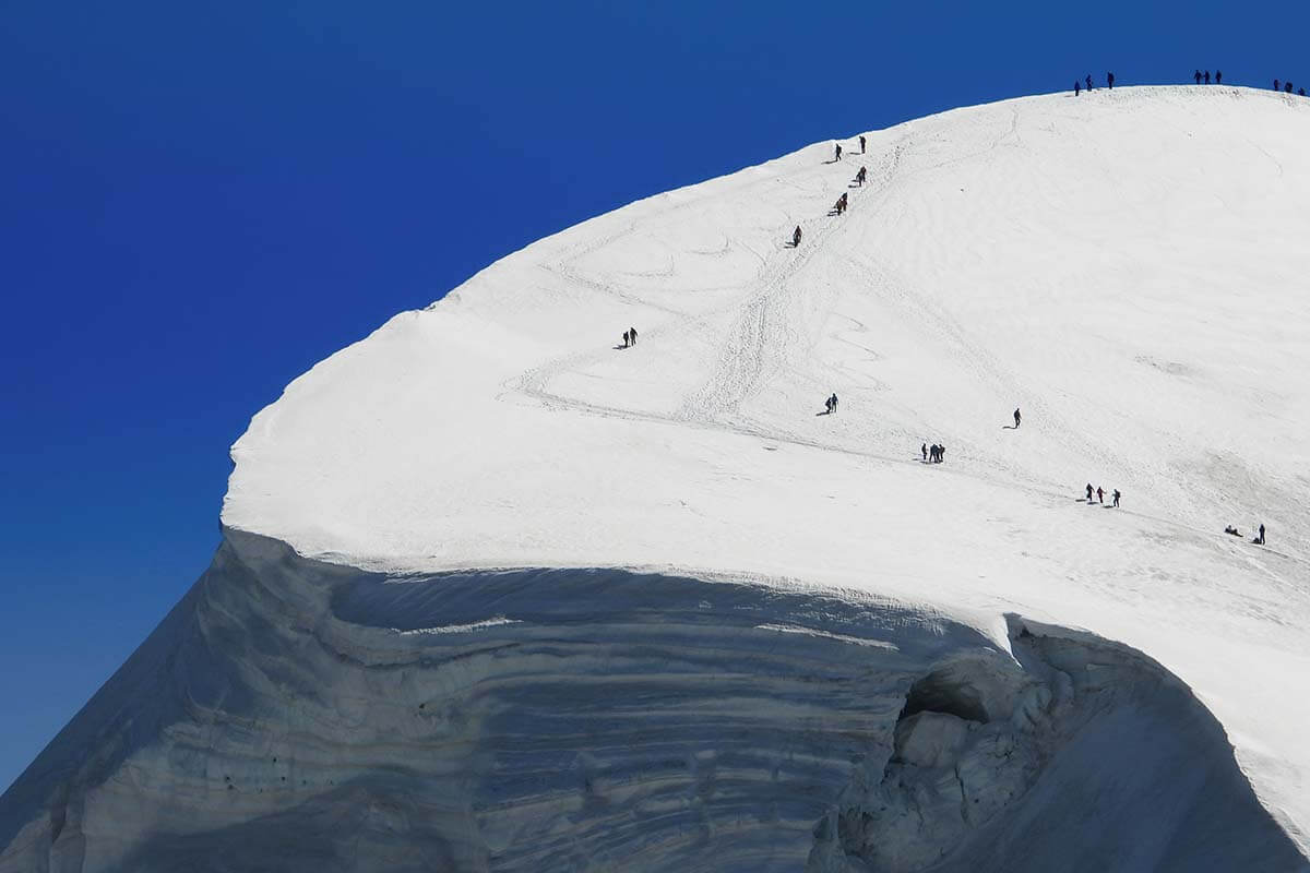
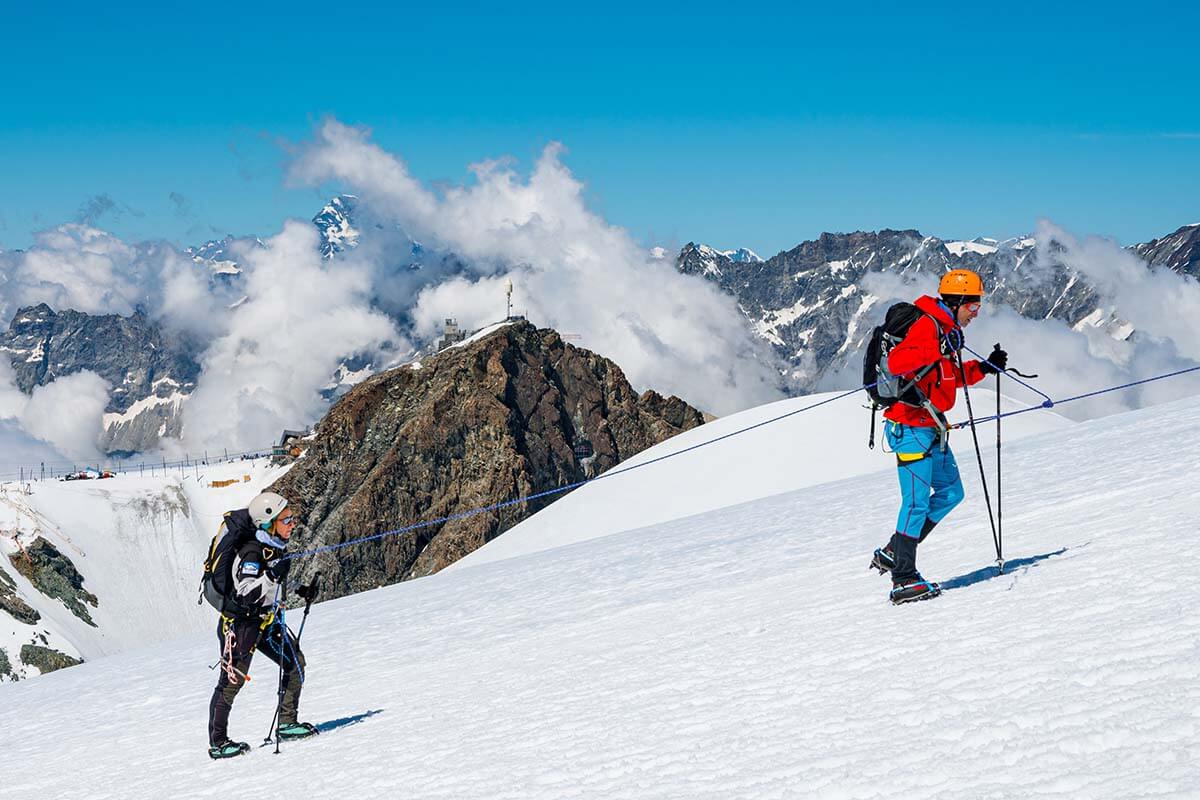
10. Breithorn Ascent
- Official trail name: Breithorn Ascent.
- Distance: 5.4 km (3.35 miles).
- Duration: 3.5 – 4 hours.
- Difficulty: moderate.
- Elevation change: ascent/ descent 415 m.
- Start/ end of the trail: Klein Matterhorn (Matterhorn Glacier Paradise) (you take the same trail there and back).
- Season: year-round.
- Main highlights: Walking on a glacier.
- Can be done with kids from about 12 years old.
- This hike is best done with a local guide!
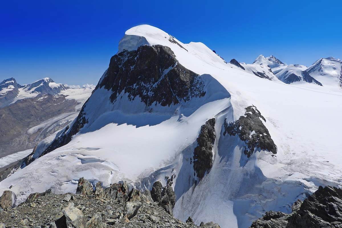
If you are looking for a truly unique hike in Zermatt, you can consider the Breithorn ascent. The Breithorn is a mountain crest with several summits reaching 4,164 m (13,661 ft). It’s one of the easiest-to-climb 4-thousanders in Switzerland, and this is one of the few hikes in Zermatt that can be done the whole year round.
The Breithorn hike starts at Klein Matterhorn – the top gondola station where Matterhorn Glacier Paradise is located. You walk over snow and on a glacier, so it’s not a simple walk in the park. You have to be careful of glacier crevasses and need appropriate clothing and gear such as crampons, etc.
If you decide to do the Breithorn hike, start early in the morning. Ideally, you do this hike on a beautiful sunny day and with an experienced local guide. There are local companies that organize hiking tours to Breithorn, and while it’s not cheap, it’s really the best way to do this.
We saw quite some people hiking on the glacier without a group or proper equipment. But while it might be possible, I don’t know if it’s worth taking a risk. And since we didn’t do this hike ourselves (our kids were too young for it), I cannot comment based on personal experience.
If you decide to go on your own, be sure to do more research, get appropriate gear (you can also rent crampons, climbing harnesses, and helmets in Zermatt), and be careful!
LEARN MORE: Breithorn Ascent
So, this is our guide to some of the very best day hikes in Zermatt. It’s just a small selection of countless hiking trails in Zermatt, but it’s also very diverse taking you from the green Alpine landscapes to retreating glaciers and mountain peaks… Even if you do just a few of these trails, it will make your visit to Zermatt so much more special!
The list and ranking order are based on our own personal opinion — and on what we think is most worth your time and realistic to do during a short visit. So please don’t throw virtual stones at me if your opinion is different (but feel free to leave a comment at the end of this article and share your favorite hikes in Zermatt).
For more tips on what to see and do in the area (in addition to hiking), be sure to check out our complete guide to the best things to do in Zermatt. It includes all the musts and a few lesser-known places.
READ ALSO: Switzerland Itinerary for First Trip
More inspiration for hiking in Switzerland:
- Best Hikes at Schynige Platte – a hidden gem and one of our personal favorites.
- Oeschinensee Hike – jaw-dropping panoramas in Berner Oberland – one of the best hikes ever!
- Four Lakes Hike in Engelberg – Swiss Alps at its best (mountain lakes, cows, villages, and stunning views).
- Bachalpsee Lake – an easy hike to a beautiful lake in Grindelwald. Probably one of the most popular hikes in Switzerland.
- Stoos Ridge Hike – a locals’ favorite with amazing views of Lake Lucerne.
TIP: Planning a hiking trip to Zermatt? Bookmark this guide for later, share it with your travel companions, and save it on Pinterest so you can easily find it again when planning your routes.
Some of our favorite places in Switzerland:
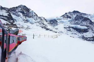
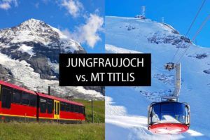
- Mt Titlis
- Jungfraujoch
- Lucerne
- Best day trips from Lucerne
- Geneva
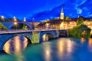
- Bern
- Mt Pilatus Golden Round Trip
- Interlaken
- Schynige Platte
- Grindelwald – First
- … for more destinations, please check our Switzerland travel guide.
READ ALSO: Swiss Travel Pass (what is included, what’s not, and whether it’s worth it)
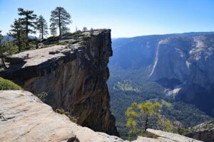
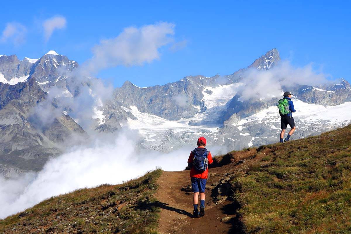
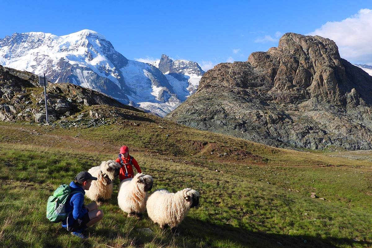
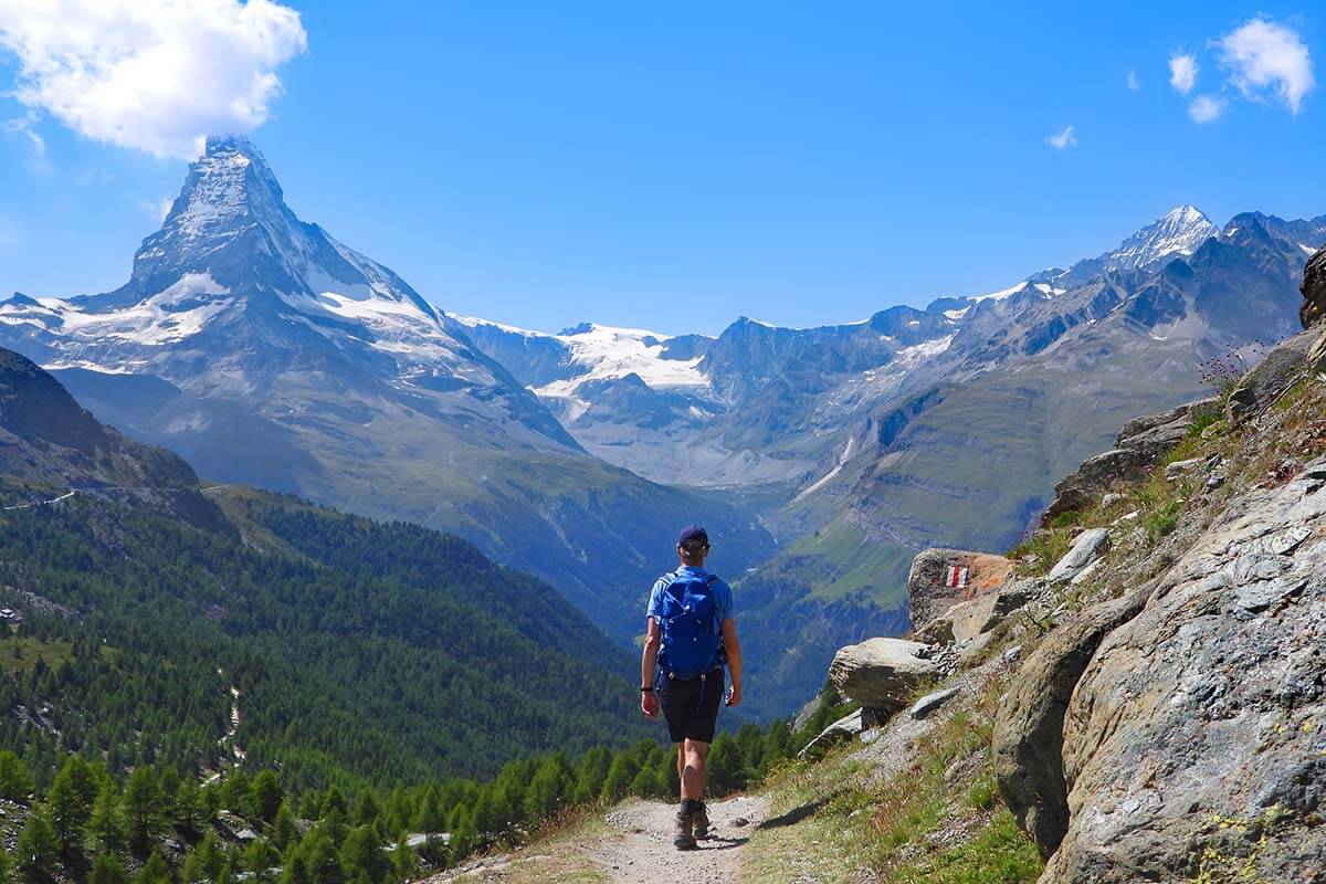
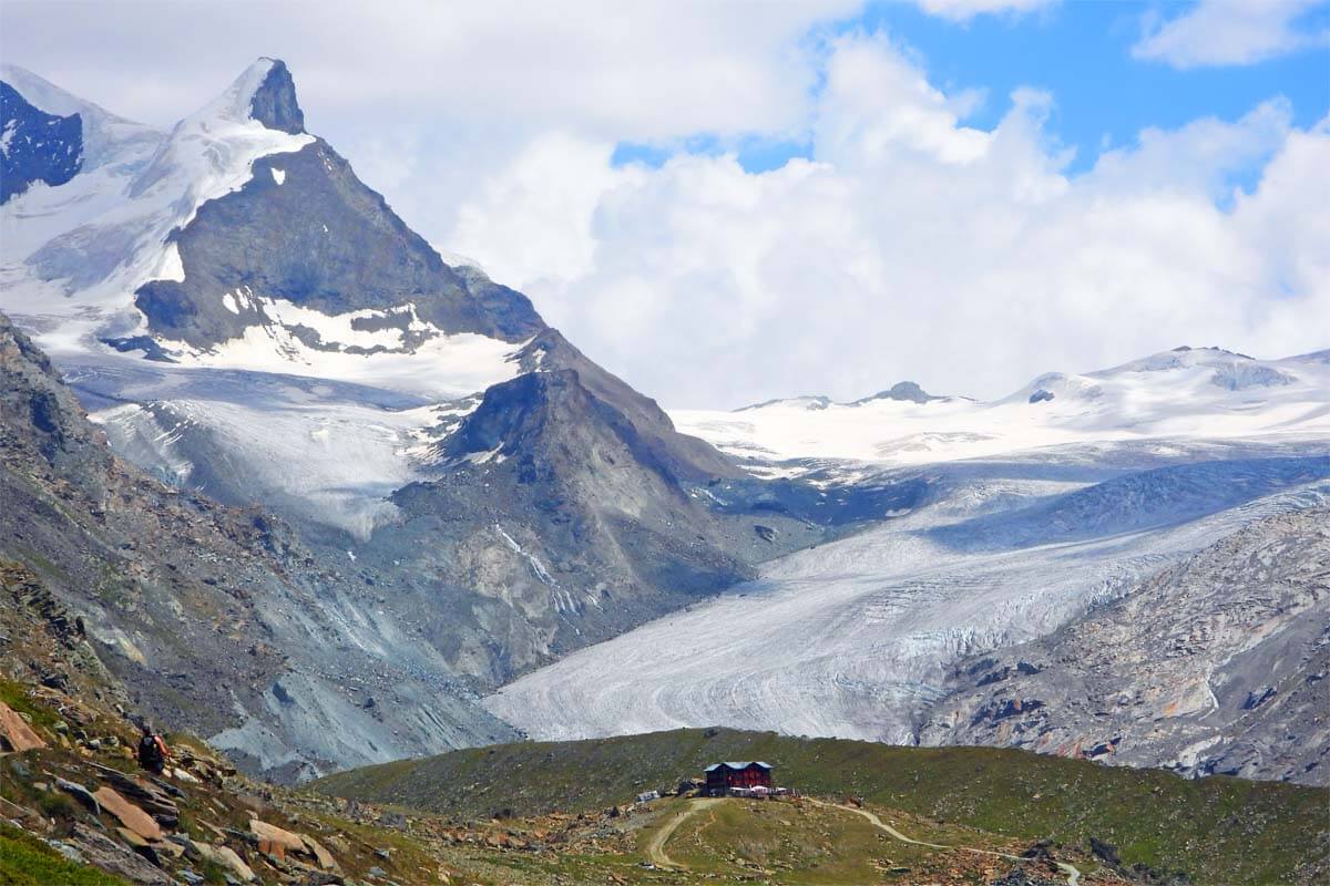
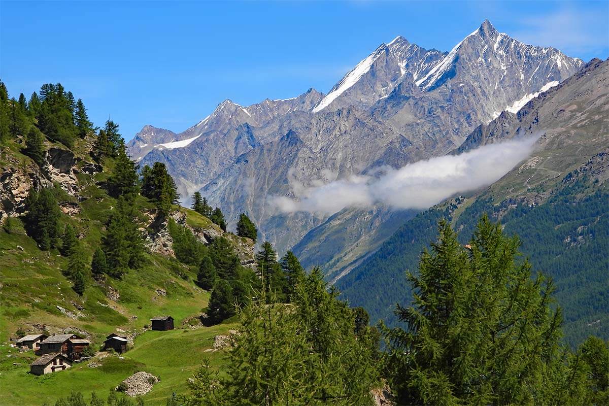
Hi, which hike corresponds to the first picture of the article (with the child and the clouds) ? Thank you.
Hi Gabriel, that picture is taken between Riffelsee and Riffelberg – the Riffelsee Lake Trail (hike #1 in our article).
Hope this helps.
Hi Jurga. What a fantastic site and blog. I’m not sure if this is the best place to post for help but here goes. We will be in Switzerland form 9 Oct – 23 Oct. We will be in the areas of Zermatt, Locarno, St. Moritz, Bad Ragaz, Lauterbrunen, Grindelwald, etc. We would love to see and interact with the beautiful black nose sheep but have been unsuccessful in identifying where this is possible. Family Julen in Zermatt said their sheep will back in the stables and will be unavailable to the public. I reached out to the Black Nose Sheep Society of Valais but they did not respond. I hoped with your knowledge and contacts you might be able to assist. My wife has her heart set on this. Hope you or a blogger can assist. Thanks!
Hello, I am afraid I can’t really help you with this at all. I don’t have any connections and it seems that you have already tried all possible ways.
I wouldn’t focus on this too much though – there are a million reasons to visit Switzerland beyond these cute sheep 🐑. Have a great trip!
Hallo, Jurga!
Wir weilen gerade in Zermatt. In Vorbereitung auf diesen Urlaub, habe ich mich intensiv damit beschäftigt, Ausflüge, Wanderung und sehenswertes schon in Erfahrung zu bringen. Deine gesamte Beschreibung von Zermatt, dem Matterhorn und Umgebung ist mein wichtigster Reisebegleiter !!! Deine Beschreibungen, Tips und Hinweise sind so interessant und vor allem kann ich es bestätigen, dass alles genau so ist. Wir haben fast alles schon “abgearbeitet”, was du vorgeschlagen hast. Alles toll. Das Wetter ist bei uns sooo gut👍 , somit gelingt uns ja alles in besonders guter Form zu erleben.
Also, ganz herzlichen Dank für die zahlreichen Tipps!!!
MfG Anke
Dear Anke, thank you so much for the kind feedback. Glad to hear that you find our guides so useful. Enjoy the rest of your vacation!
Hi Jurga. Glad I cam across your site. Its very informative and detailed. May I seek your advice on my trip? Geneva will be my base since my sister lives there, and Id like to visit Zermatt and Interlaken, Grindelwald, Lauterbrunnen. I can spare two nights although on a budget. Where do you suggest I spend it, 1 night in zermatt and 1 in grindelwald? Also which is better to visit first from geneva? Btw, its my first time in Switzerland and i will be travelling solo to these locations. My travel dates are late Feb to early March. Thank you.
Hi, since you are traveling in the winter, you should first research what you want to actually see and do at each place. Especially since you have a lower budget. Pretty much anything you’ll do in the mountains will involve some kind of a gondola or a train. You won’t be able to visit the nicest places in the mountains without spending at least 60-100 CHF per day. This doesn’t include travel to those towns, accommodation, or food.
If you want to just see the towns, then you could indeed walk around Grindelwald and Zermatt, and also Lauterbrunnen or Interlaken without having to take any of the expensive mountain gondolas. Also, keep in mind that it’s the peak ski season and so accommodations will be quite expensive, especially if closer to the ski lifts.
So I really don’t know what to suggest. If you absolutely want to see those towns, then go for it, but be sure to do your research so that you know what to expect when you get there. Most pictures you probably have in mind when thinking of Grindelwald are taken from the mountains and not from town. Zermatt is better for that – the town itself is more scenic.
Otherwise, it might be more interesting to visit the bigger cities like Bern or Lucerne (or Lausanne or Basel, etc.). In the cities, you can see and do a lot more without having to spend a fortune and it will also be much simpler to get there from Geneva and to find budget-friendly accommodations, etc.
So it’s really all about what your expectations are. Either way be sure to also check train schedules and prices to better understand how long it takes to get from place to place and how expensive the tickets are.
Good luck!
Hi Jurga,
We will be in Zermatt the third week in September for three full days. Two sufficiently fit in our 60’s and one in their 20’s.
–Would you skip any of the hikes listed as being too far out of the summer season by the end of September?
–Also, any hikes you might rule out as one of us might have a challenge with prolonged steep downhill on unsteady or uneven surfaces.
–And, are there any other outdoor activities you might recommend as an another way to enjoy the outdoors & sights, along with hiking, such as the kick bikes or other ideas?
–Lastly, do you have a printable version of the details on your hikes? I’ve tried to print this blog, but it includes all the ads which makes it too many pages. And, I can’t copy/paste from your site – so I can’t just select the information I need.
Thank you,
Gail
Hi Gail, to answer your questions:
– I think the 3rd week of September should be fine for all these hikes, but it really depends on the weather. So far, it’s quite warm everywhere in Europe and I can’t imagine it would snow in a few weeks already, but you never know. If it rains, it might not be fun at the highest altitudes either.
– All the hikes have some sections of uneven surfaces – these are all mountain hikes. So I’m not sure I understand this question. If you want to avoid steep downhill sections, then I’d probably skip Charles Kuonen Bridge – it’s very steep going up and even more so going down. Also the Matterhorn Glacier Trail – the last section just before the end – is quite steep downhill. It’s about 20-30 minutes if I recall well. I’d also refrain from attempting the Hörnli hike or Breithorn based on your questions. But there are plenty of easier alternatives to keep you busy for a few days: Riffelsee, Gornergrat, 5 Lakes Trail (potentially in combination with Crystal Trail), Furi area (suspension bridge and Zmutt).
– Yes, there are many other types of outdoor activities. See our guide to the best things to do in Zermatt for some recommendations – more towards the end of the article. You could also walk to Gorner Gorge.
– No, we don’t have printables – it’s already difficult to keep things up to date as it is. 🙂 You can try Ctrl+p. Also, they have free wifi on the trains/ train stations in Zermatt, so you can just bookmark this page and check whatever info you need once you are there. But you really don’t need printouts. Just get to the hike trailhead and you’ll find signs everywhere. All these hikes in Zermatt are really well signposted.
Have a great trip!
We will be in Zermatt for 3 days, early September. We would like to do a few combination hikes, we are 2 fit adults, are there maps available in Zermatt? I can’t seem to find downloadable maps and don’t want to lug around tour books, don’t want to depend on internet. Thanks!
Hi Brenda, yes, you’ll find free maps at all train/ gondola stations. The hikes are also well indicated.
Lots of thanks for all the great, detailed articles!
My wife and i planning to visit Switzerland, and she is pregnant,
I saw your articles about places in Switzerland, but i couldn’t see any indication about if the hikes suitable for pregnant women.
Can you please address it and explain more about how suitable is it for pregnant women?
Hi Maor,
Every woman and every pregnancy is different. A lot depends on your wife’s physical condition too. If she is used to hiking, then most moderate hikes might be suitable, but again – it depends.
How is the weather, how does she feel that day, how are the trail conditions, etc. If I were you, I’d opt for some easier downhill/ flat hikes and avoid the ones that are really rocky or have lots of steeper uphill/ downhill sections. I’d also pack hiking poles and really good hiking shoes.
There are lots of really nice hikes that offer amazing views without too much effort, so maybe concentrate on those.
For example, in Zermatt, the Riffelsee Lake Trail should be certainly doable. I’d avoid the Matterhorn Glacier Trail, mostly because it has lots of loose stones and some steep uphill/ downhill sections where you could easily slip. But you can just visit the lake at the beginning of that trail. You could also definitely visit Gornergrat and do the short panoramic loop at the top. I’m not sure I’d hike down from there to Riffelsee – that hike is also rather easy, but you need good shoes and there’s a bigger risk of slipping on gravel. The hike to Furi Suspension Bridge and to Zmutt is also very nice. You could also take a gondola to Blauherd and visit the first lake of the 5 Lakes Trail (Stellisee) and then walk back to the gondola without doing the entire hike.
Near Lucerne, you could visit Mt Titlis and walk around the Trübsee Lake – that’s a very easy walk and quite nice, especially in the morning when you have beautiful reflections. There are some other lakes nearby that you could visit with a cable car too, but it depends a bit on how much time you have.
Also Bachalpsee in Grindelwald is an easy beautiful hike. And Panorama Trail between Männlichen and Kleine Scheidegg in the same area is also very nice. I don’t have an article about it, mainly because it’s so easy, but you can find more info here.
At Oeschinensee, you could easily visit the lake without doing the hike above it. It’s beautiful.
You don’t absolutely have to hike much or do more strenuous hikes to enjoy the scenery. And it’s better to avoid risky situations. There will always be more opportunities to travel and enjoy the mountains later as well.
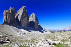
Thanks for all your excellent articles. They were indispensable in the Dolomites and expect them to be again in Zermatt.
QUESTION – are the hiking distances one-way or round-trip?
Hi Moshe, if you’ll look closer, you’ll see that almost all of these hikes are one-way hikes that start at one place and end at another one (usually hiking downhill from one cable car station and ending at the lower one). So you hike one way and don’t need to go back. There are also a few circular hikes – it’s all explained and you can also see them on the map.
In all cases, the hiking times/ distances indicated are for the entire hike from start to finish.
Have a great time in Zermatt!
@Jurga,
Thanks for the reply. This all became clear when I clicked on the links for more details on each hike.
Also, perhaps I missed this, but would it not be quite simple to combibe hikes #1 & #3? If so, is it worth it?
Hi, yes, as already mentioned in this and other articles about these hikes, you can easily combine the Gornergrat Scenic Trail with the Riffelsee Lake Trail. They are both short and you can do the two together in less than 2 hours. And yes, totally worth it since the scenery is very different (the lower you get the more greenery).
As for how to do it… If you can start at Riffelsee very early in the morning, I’d go there first. That way, you can see the reflections on the lake. You can then return to the station and take the train to Gornergrat and hike down from there, or you can also first do the entire Riffelsee Lake Trail, see the second lake just a bit further down, etc. and then take a train from Riffelberg to Gornergrat and do the Gornergrat Scenic Trail hike afterward.
But if you are hiking during the day when the chances to see the reflections are minimal, just start at Gornergrat and hike all the way down to Riffelberg, passing Riffelsee along the way.
This is such a great summary. Thanks, Jurga.
We’re going to Zermatt in June and will have two days. I was thinking of Matterhorn glacier hike one day and 5 Lakes hike next day. Do you think it’s too much?
Hi Amy, these trails should be ok by June, but it also depends on how the weather is on the days when you visit. If it’s sunny, then yes, you could probably do both of these hikes and still see all the other musts in 2 days.
In that case, I’d probably start with the Matterhorn Glacier Paradise, followed by Matterhorn Glacier Trail, and then a visit to Zermatt town itself. Before doing down to town, you could potentially add a hike to Furi Suspension Bridge or from Furi to Zmutt and then to Zermatt if you want to do more hiking.
On day two, you could start with the 5 Lakes Trail first thing in the morning, and then afterwards visit Gornergrat in the afternoon. Maybe do one of the shorter hikes there too (or as a minimum walk to Riffelsee at around sunset to see if there are any nice reflections).
I’d let it depend on the weather a bit. If it’s cloudy/ rainy, Matterhorn Glacier Trail might not be the best idea since it’s really high and quite exposed. But there are plenty of shorter/ easier alternatives, and you can also see quite a few places just by taking short walks from the cable car.
Hope this helps. Have a great time in Zermatt!