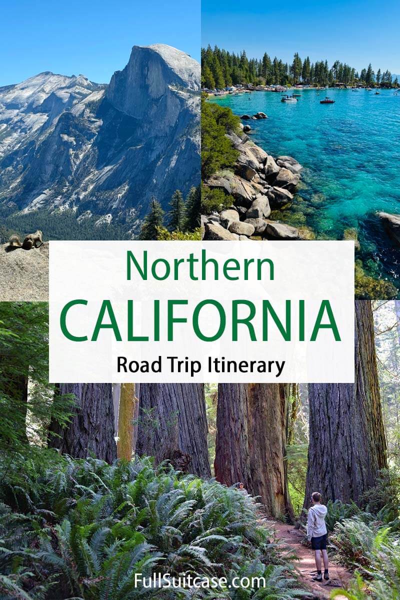
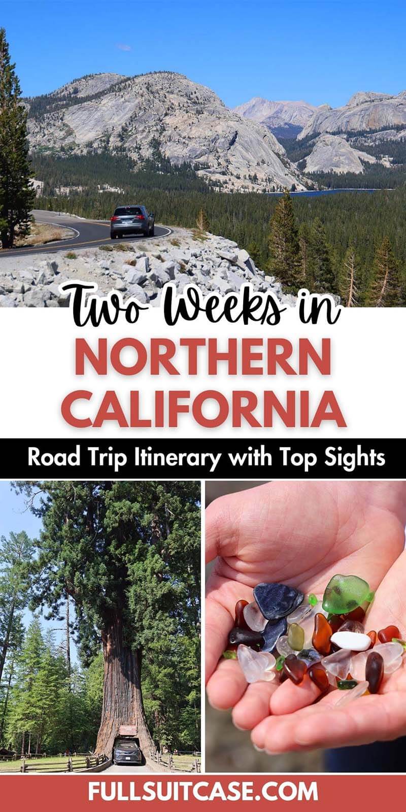
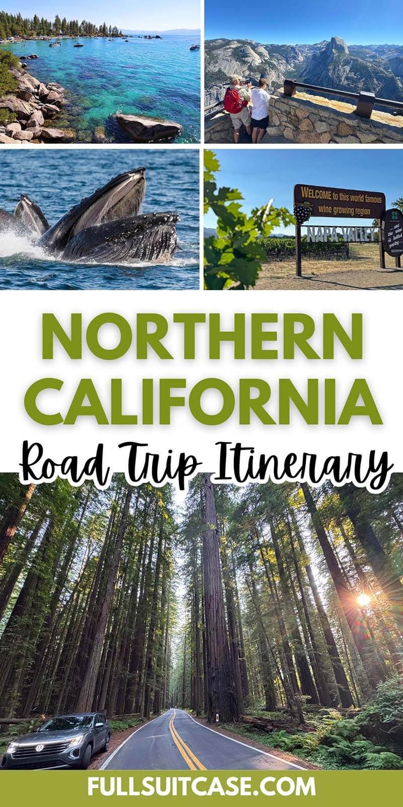
Northern California Road Trip Itinerary (2-Week Loop from San Francisco)
This site contains affiliate links, which means that we may earn a small commission, at no cost to you, for qualifying purchases. It supports the work that goes into keeping this content free. Thanks for reading! More info: Privacy Policy.
From rugged coastlines to giant sequoias and iconic national parks, this 2-week Northern California road trip shows you the very best of the region, with practical tips to make the most of every day.
Planning a road trip through Northern California and wondering what to see and how to plan your time? This sample itinerary is based on our recent trip and includes a bit of everything: vibrant towns, scenic coastlines, redwood forests, mountain lakes, and iconic national parks.
We started and ended in San Francisco, explored the giant trees along the northern coast, briefly dipped into Oregon, and looped back through Crater Lake, Lassen, Lake Tahoe, Yosemite, and the Central Coast, including Hearst Castle, Big Sur, and Monterey.
This 2-week Northern California itinerary covers all the must-sees and is great for first-time visitors who want a mix of popular highlights and lesser-known spots. Depending on your interests and how much time you have, you could easily shorten this trip to 10-12 days or extend it to three weeks.
To help you plan your trip, we’ve included a map, a day-by-day breakdown with driving times, recommendations on what exactly to see and do, and suggestions on where to stay and eat.
Practical Info & Map
Season: This itinerary works best between late June and early October, when all high-elevation roads and parks are fully open, including Tioga Pass (Yosemite), Lassen Volcanic National Park, and Crater Lake. July and August offer the most reliable weather but are also the busiest months, and it’s often foggy at the coast. September can be a great alternative: fewer crowds, warm days, and clearer air (though wildfires can occasionally be an issue in late summer). We did this trip in July.
Driving times listed in this itinerary don’t account for stops. Distances are based on our recommended route and overnight stays.
Good to know: Since you’re visiting several national parks and federally managed sites on this route (including Yosemite, Lassen Volcanic, Crater Lake, and Muir Woods), I recommend getting the America the Beautiful Annual National Parks Pass. It’s a lot cheaper than paying for each park separately. You can purchase it online or at one of the parks.
Planning tips: Book accommodations early, especially inside or near the parks, and check seasonal road openings like Tioga Pass or Lassen National Park. If you need to rent a car for this trip, we use and recommend Booking.com’s car hire site. If you don’t need a car in San Francisco, it’s best to rent one on the day you leave because parking is really expensive.
If you have less time, you can easily shorten the route and still see the highlights. For example, spend less time in San Francisco or Lake Tahoe, and end after Yosemite (plan for 10–12 days). You can also just stick to California and skip Oregon altogether. That said, Crater Lake is one of the highlights that I wouldn’t have wanted to miss!
With more time, you could add extra nights or side trips. For example, you could spend a few extra days at Lake Tahoe, extend your stay in the Monterey area, or even drive further south and spend a few days in LA. You can also do this itinerary in reverse, or start with the nature stops and end in the city. There’s no single “right” way, so use this as inspiration to create your own perfect itinerary.
Map: To help you plan your trip, we’ve marked all the main points of interest from our itinerary, along with recommended accommodations and restaurants. See below.
Here is our Northern California itinerary:
Day 1-2: San Francisco
San Francisco is one of the most fascinating cities in the U.S. Whether you have one day or a full week, there’s no shortage of things to see and do. We spent two days in the city, and here are some of the highlights we enjoyed the most:
- Fisherman’s Wharf & Pier 39.
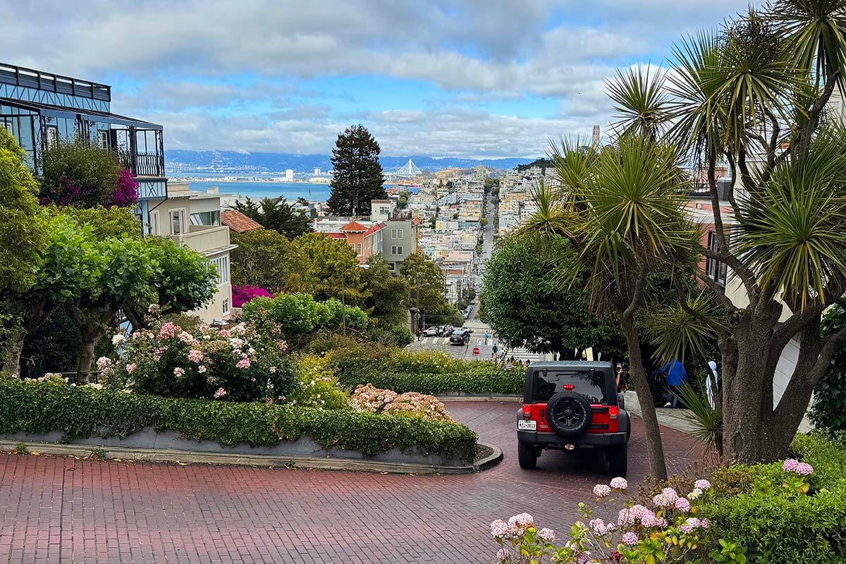
- Cable cars, Lombard Street.
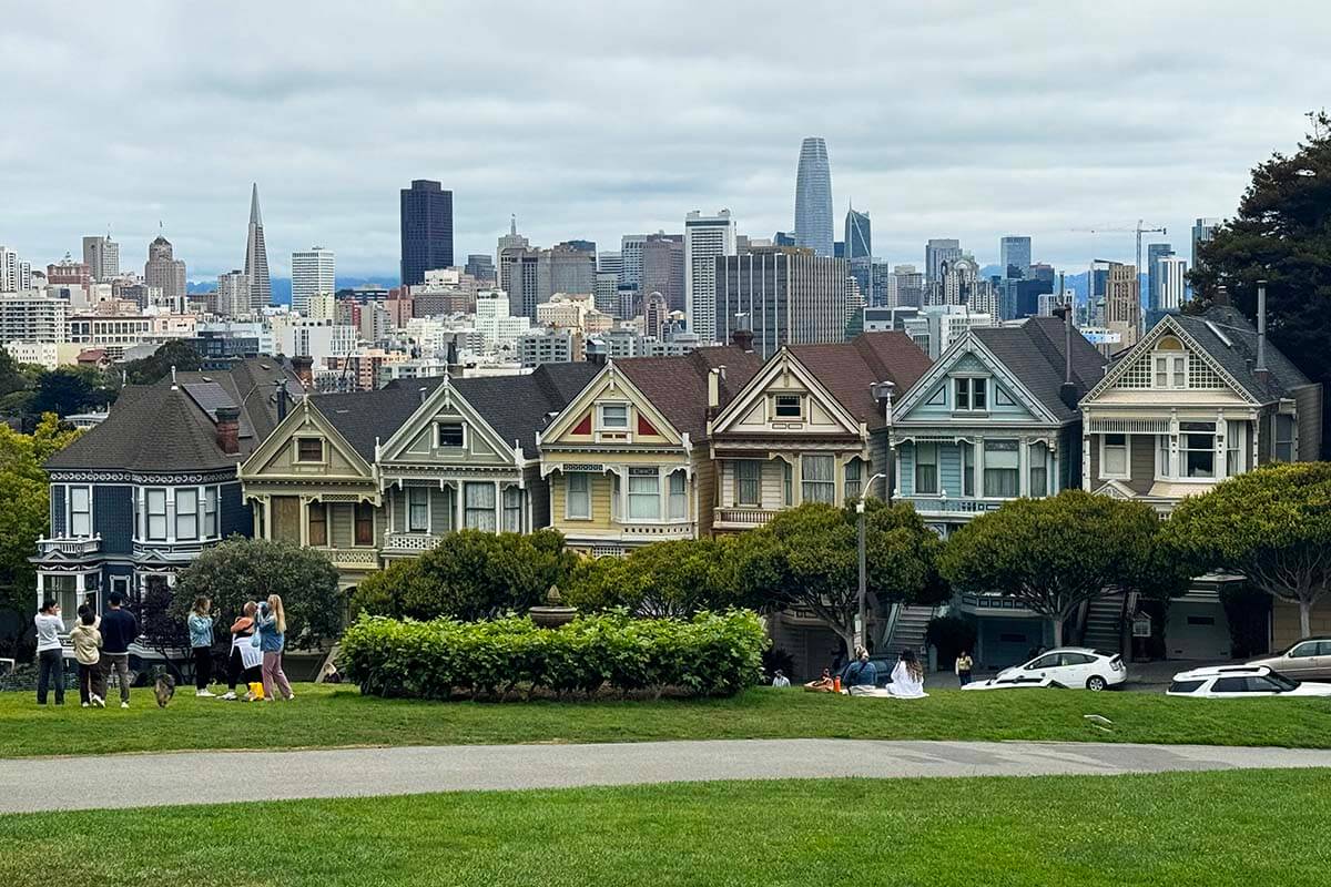
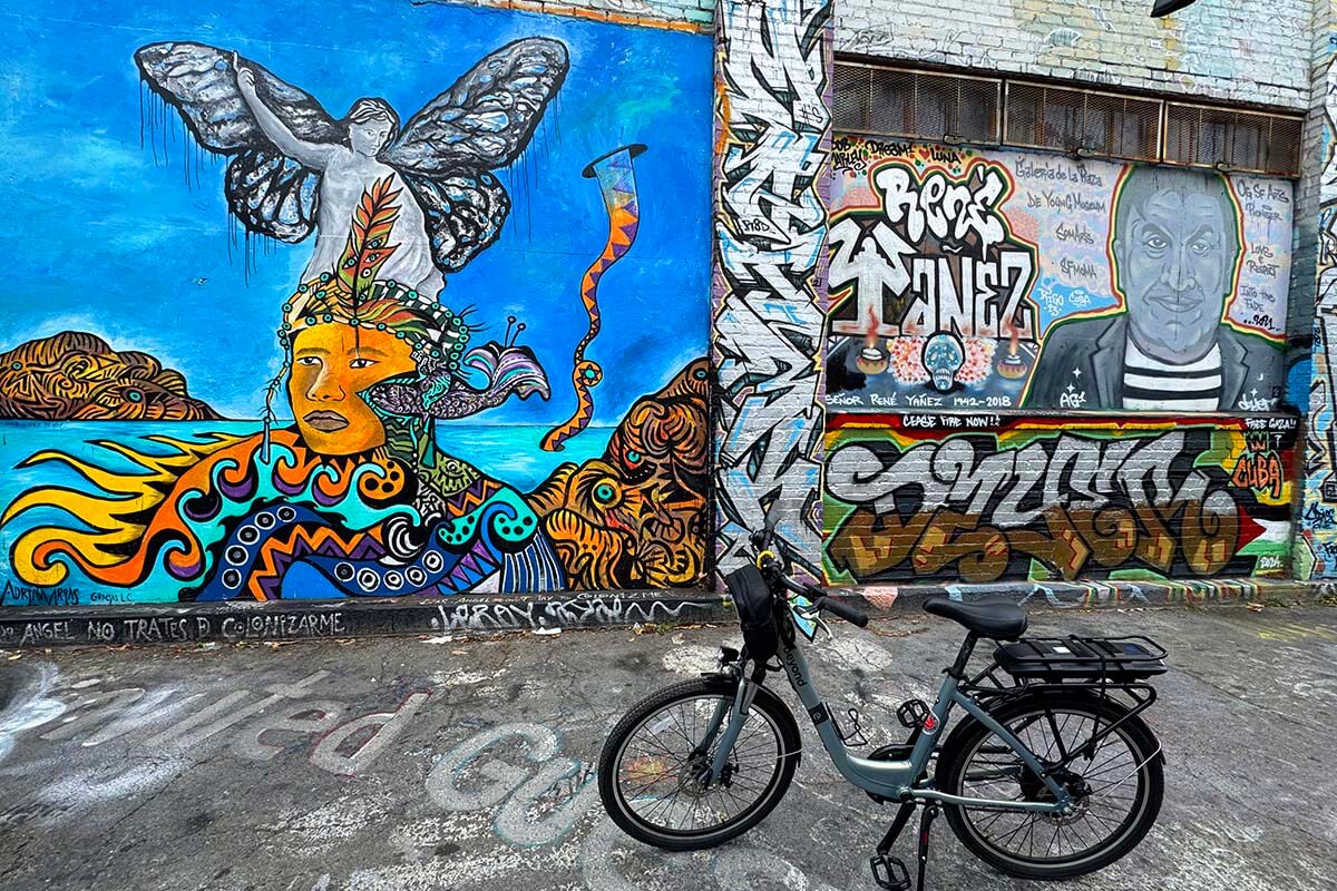
- E-bike tour of the hidden gems (we opted for a private tour) – it’s the BEST way to see a lot of the city in a short time!). In just a few hours, we visited the Painted Ladies, Oracle Park, The Embarcadero, Mission District, and so much more.
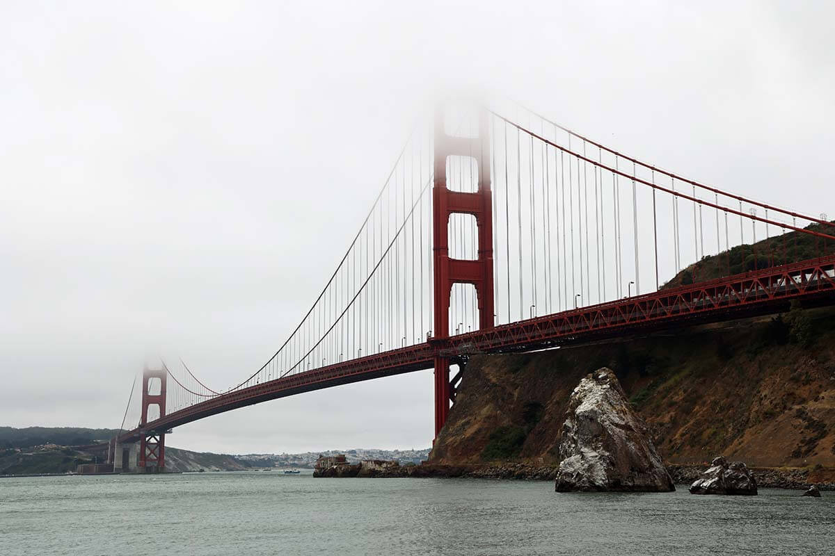
- Golden Gate Bridge (can be visited by e-bike, which you can keep at no extra charge after the tour).
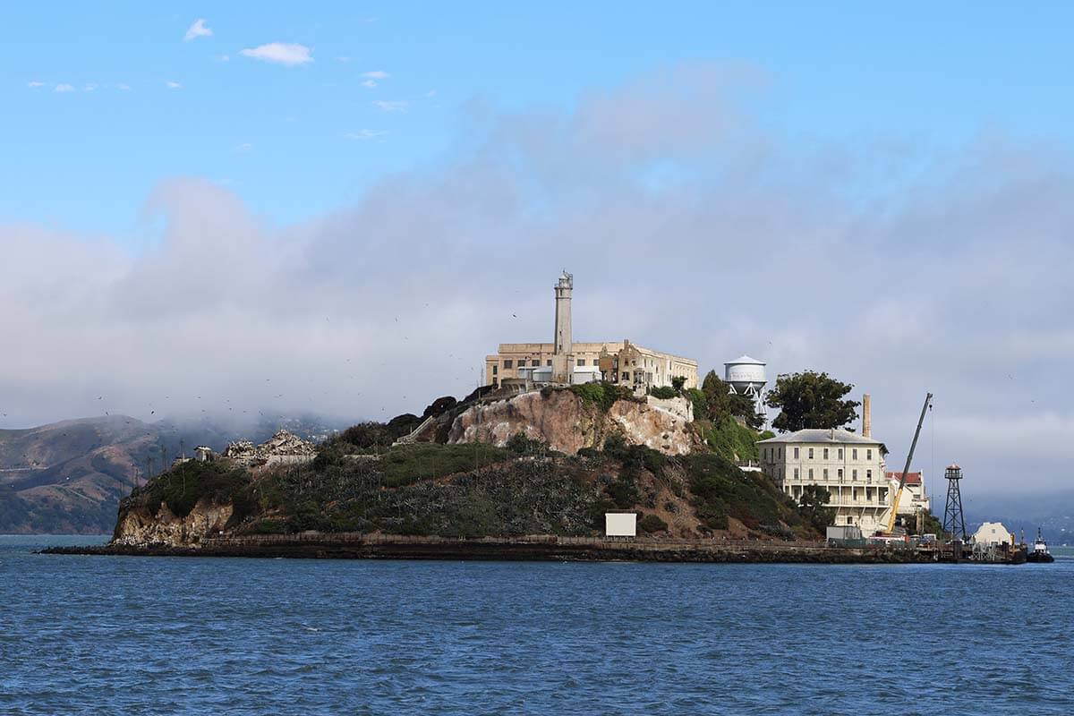
- Alcatraz (book in advance!).
- North Beach (Italian neighborhood) and Chinatown.
- Shopping at Union Square.
Where to stay: For first-time visitors, Fisherman’s Wharf is the most convenient area to stay in San Francisco. It’s safe, close to major attractions, and has plenty of restaurants and hotels. We stayed at the Holiday Inn at Fisherman’s Wharf, and I would definitely recommend it, especially if you need parking. Other nice options in the area include Riu Plaza Fisherman’s Wharf and Argonaut Hotel.
Where to eat: There are soooo many good restaurants in San Francisco. Here are some personal recommendations: North Beach Gyros, Tony’s Pizza, Boudin Bakery (upstairs restaurant), Wipeout Bar & Grill, Bubba Gump Shrimp Co., and Fog Harbor Fish House. For a quick bite: Golden Boy Pizza and The Codmother Fish & Chips.
READ MORE: How to See the Best of San Francisco in 2 Days
Day 3: Muir Woods, Sausalito & Napa Valley
DRIVING TIME/DISTANCE: 2h20. 90 miles (145km).
Good to know: We visited Muir Woods and Sausalito by car, but you can easily visit these places from San Francisco, if you prefer. In that case, stay in the city for an extra day and do a half-day tour to Muir Woods & Sausalito. You can also opt to stay in Sausalito longer and get back to the city by ferry.
If you rent a car, as we did, start the day with a drive over the iconic Golden Gate Bridge and stop at Golden Gate Bridge North Vista Point. There are more viewpoints along the coast, so if the weather is great and the views are open, you may want to allow some extra time here (or return after visiting Muir Woods/Sausalito).
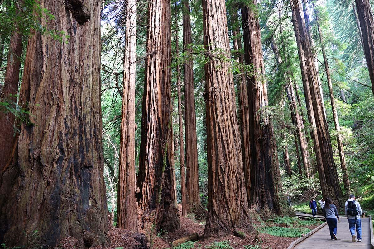
In the morning, visit the impressive redwood forest in Muir Woods (reserve parking at Muir Woods in advance!). We recommend doing the entire Main Trail. Allow about 2 hours for a visit.
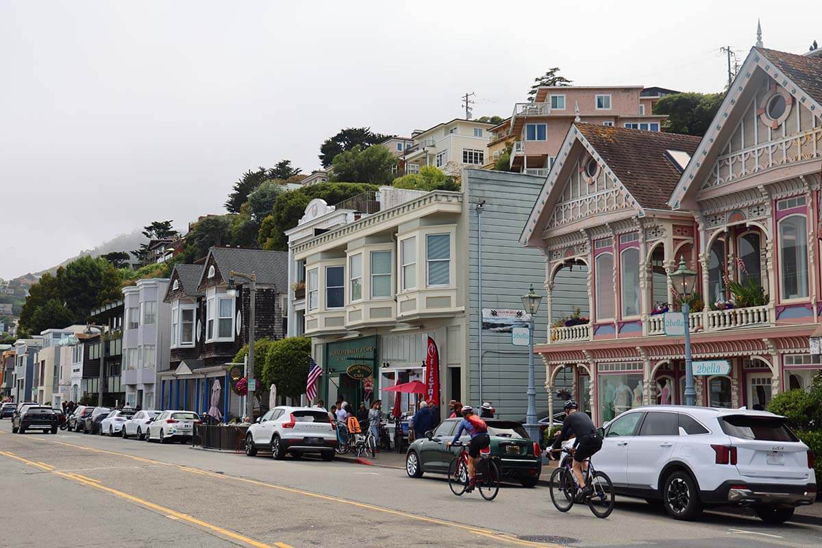
Next, visit Sausalito, a charming little town known for its art galleries, shops, cafes, and lots of dining options. We had lunch at Taste of Rome.
READ ALSO: Best Day Trips from San Francisco
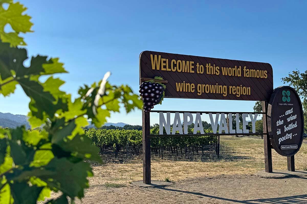
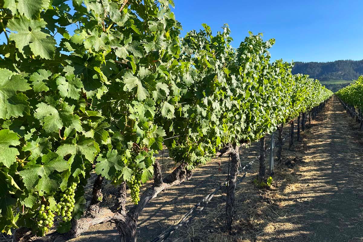
In the afternoon, continue to Napa Valley for wine tasting and a scenic drive. There are tons of wineries offering tasting experiences, but we opted to just drive through the region, admire the scenery, and then have some good local wine at dinner.
If you have a dedicated driver and want to visit some wineries, do some research in advance, since most of them require reservations. Castello di Amorosa is a popular option, but quite pricey for what it is.
Where to stay: If you want to visit some wineries in the late afternoon, stay in Calistoga. For example, UpValley Inn & Hot Springs Napa Valley offers free bikes to explore the town. Keep in mind, however, that most wineries close around 5 pm, so you should get there a few hours before that. Alternatively, stay an extra day and explore the Napa Valley deeper.
Day 4: Navarro River, Mendocino Coast, Glass Beach & Avenue of the Giants
DRIVING TIME/DISTANCE: 5h20. 230 miles (370km).
This is one of the longest driving days on this Northern California itinerary, but there are plenty of great stops along the way to make it both manageable and enjoyable. Aim to leave no later than 8:30 am so you have time for sightseeing and still arrive in time for dinner.
We thought the drive might feel too long, but it turned out to be one of the most enjoyable days; filled with highlights without feeling rushed.
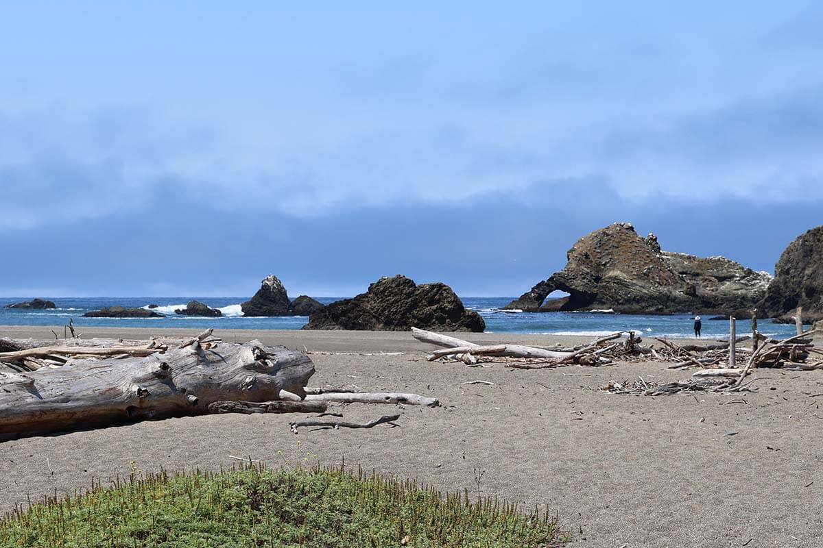
Our first stretch took us through Navarro River Redwoods State Park, a beautiful scenic drive with several pull-offs for photos or a quick leg stretch. We also stopped at Navarro Beach for a short walk on a driftwood-strewn shoreline.
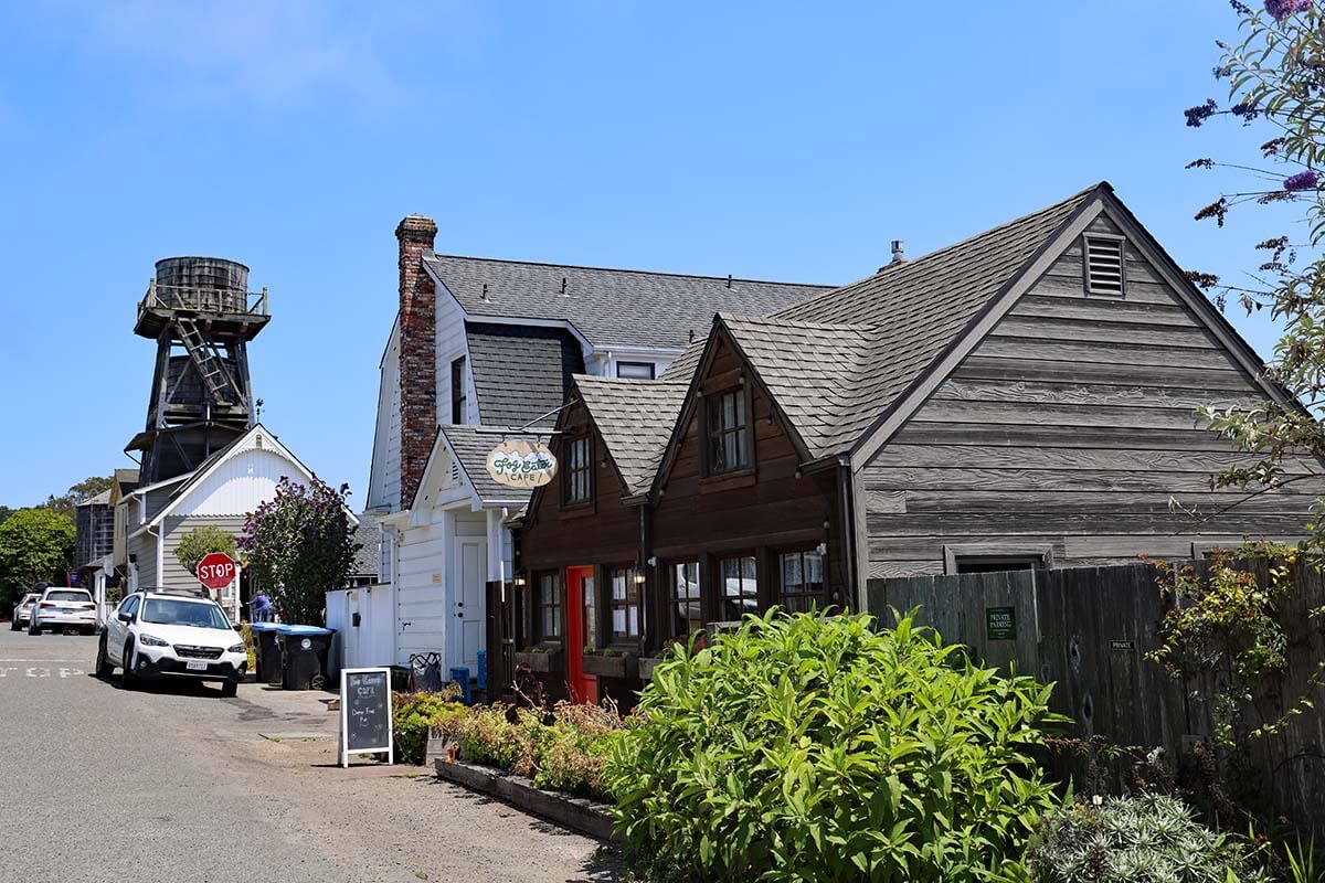
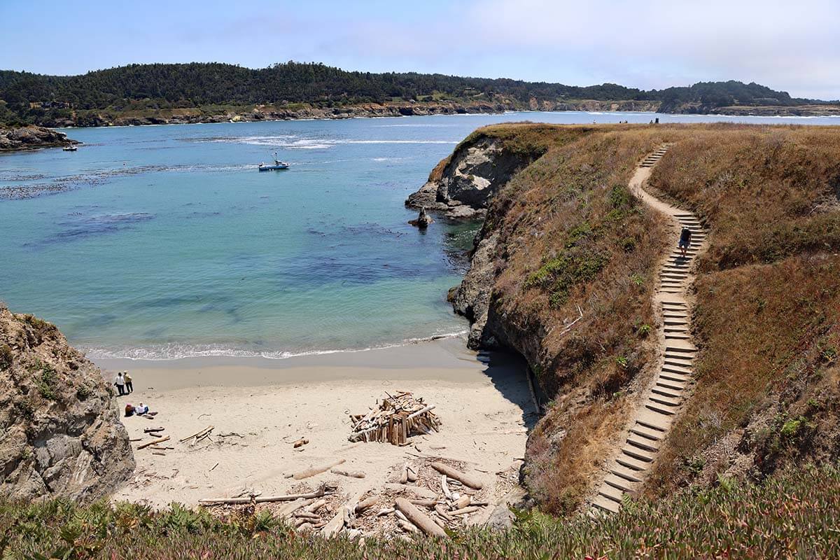
Next up is Mendocino, a charming coastal town that’s worth at least an hour of your time. Explore its rugged coastline, browse art galleries, and wander through the shops. You could easily have lunch here, but we opted for a picnic near the beach to save time.
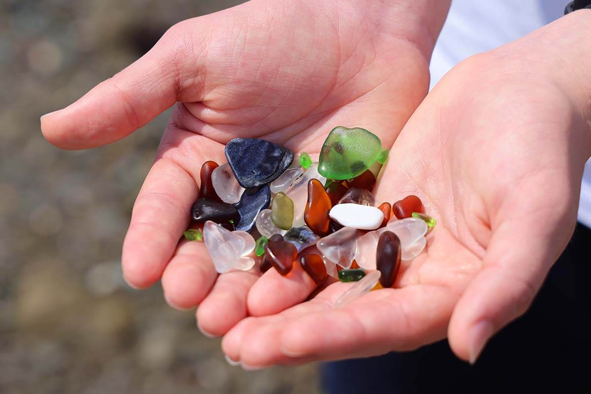
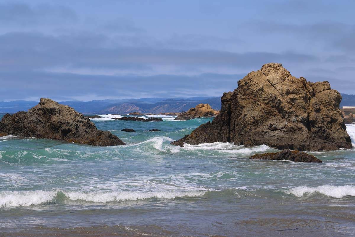
From here, drive to Fort Bragg to visit Glass Beach, famous for the colorful pieces of sea glass scattered along the shore.
Sadly, much of it has been taken over the years, so you may have to search a bit to spot them. Still, it’s a fun stop, and our teenagers enjoyed the hunt.
TIP: Flip-flops or water shoes are handy here if you want to avoid getting your shoes wet (speaking from experience :)).
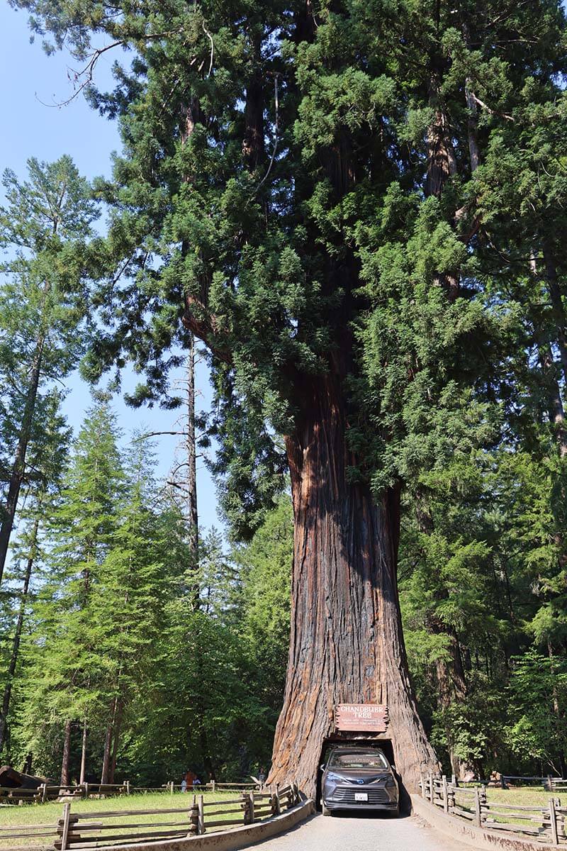
Next, drive north and don’t miss a Drive-Thru Tree in Leggett. There are two in this area – the Shrine Drive Thru Tree on the Avenue of the Giants, and the Drive-Thru Tree Park in Leggett. The Leggett one is nicer, with a beautiful tree and a slightly bigger opening.
If you have a standard-sized car, you can probably drive through it (most cars passed without any issues when we were there). Our van was too large, so we walked through instead. Either way, it’s a quirky and fun stop that’s worth the small fee.
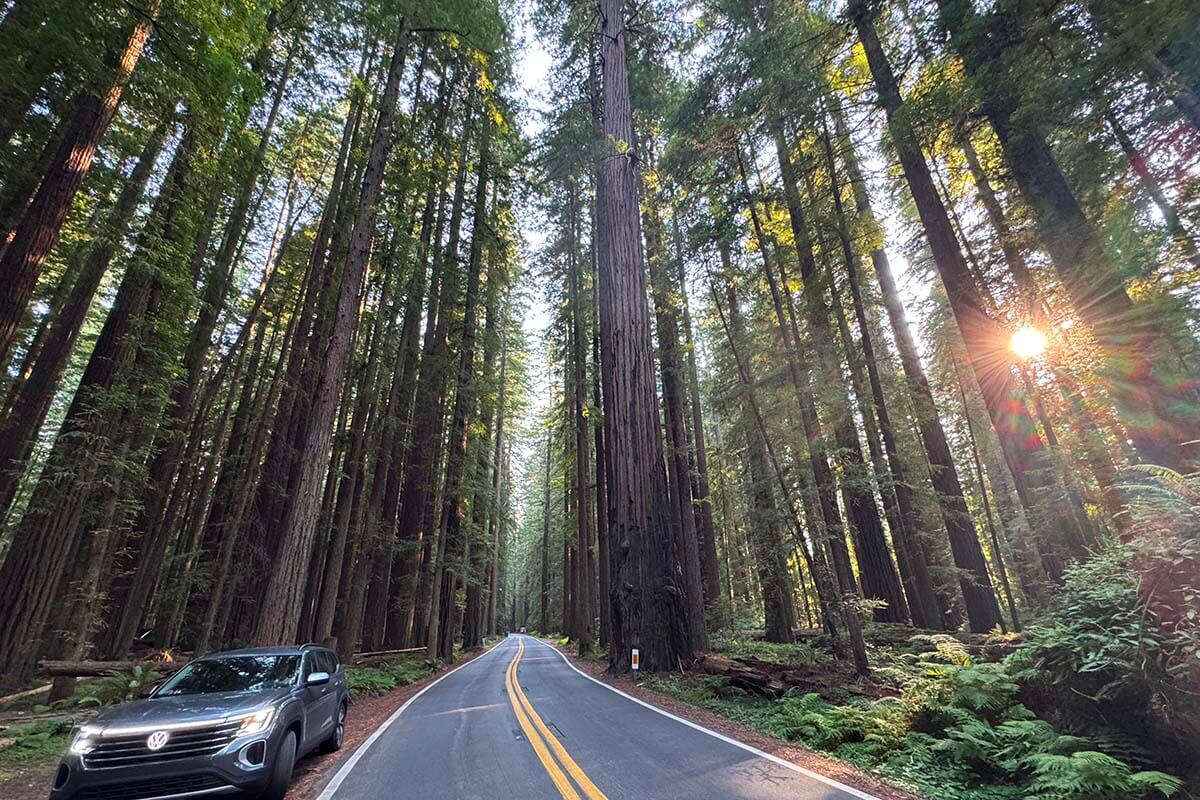
The last stretch of the day takes you along the Avenue of the Giants in Humboldt Redwoods State Park. You can stop for short hikes or simply enjoy the towering trees from the road. Since we arrived in the late afternoon, we focused on photo stops and saved the hiking for the next day.
Where to stay: For this itinerary, it’s best to overnight north of the Avenue of the Giants. We stayed at the Best Western Country Inn in Fortuna. If you don’t mind adding about 30 minutes to the day, you could also stay in the historic town of Eureka.
Where to eat: If you stay in Fortuna, as we did, for dinner, I recommend the Eel River Brewing Company -right near the hotel and a favorite with locals.
Day 5: Redwood National and State Parks
DRIVING TIME/DISTANCE: 2h30. 130 miles (210km).
There are so many great places to stop on this day, so pick the ones that interest you most, or decide based on the weather, as we did. The Northern California coast can be notoriously foggy, even when it’s sunny inland. If the views are hidden in the mist, some stops might not be worth the detour.
You could start your day with a quick visit to Eureka to explore its historic old town, known for its Victorian architecture. A bit further north, you can also stop in Trinidad or visit Sue-meg State Park.
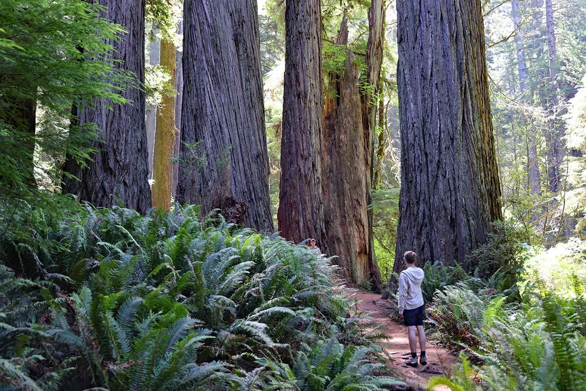
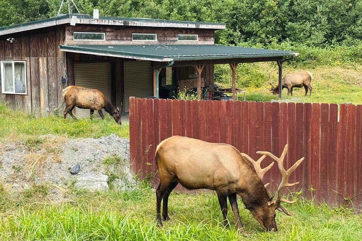
The main highlight today is Redwood National and State Parks. As you drive toward the redwoods, watch for Elk Meadow, a great place to spot elk. I recommend stopping at the Big Tree Wayside (park here, not at Elk Prairie Campground). The main highlights are the 1,500-year-old Big Tree and the short Circle Trail. This easy 10-15 minute walk is packed with enormous, impressive trees.
We also did the Cathedral Trees Trail, which can be done as a loop starting from the same area. It’s about 2.5 miles and took us 1 hour. Some sections were beautiful, others a bit dull, and overall, we didn’t feel the full loop was worth it, especially if you’ve already done the Circle Trail.
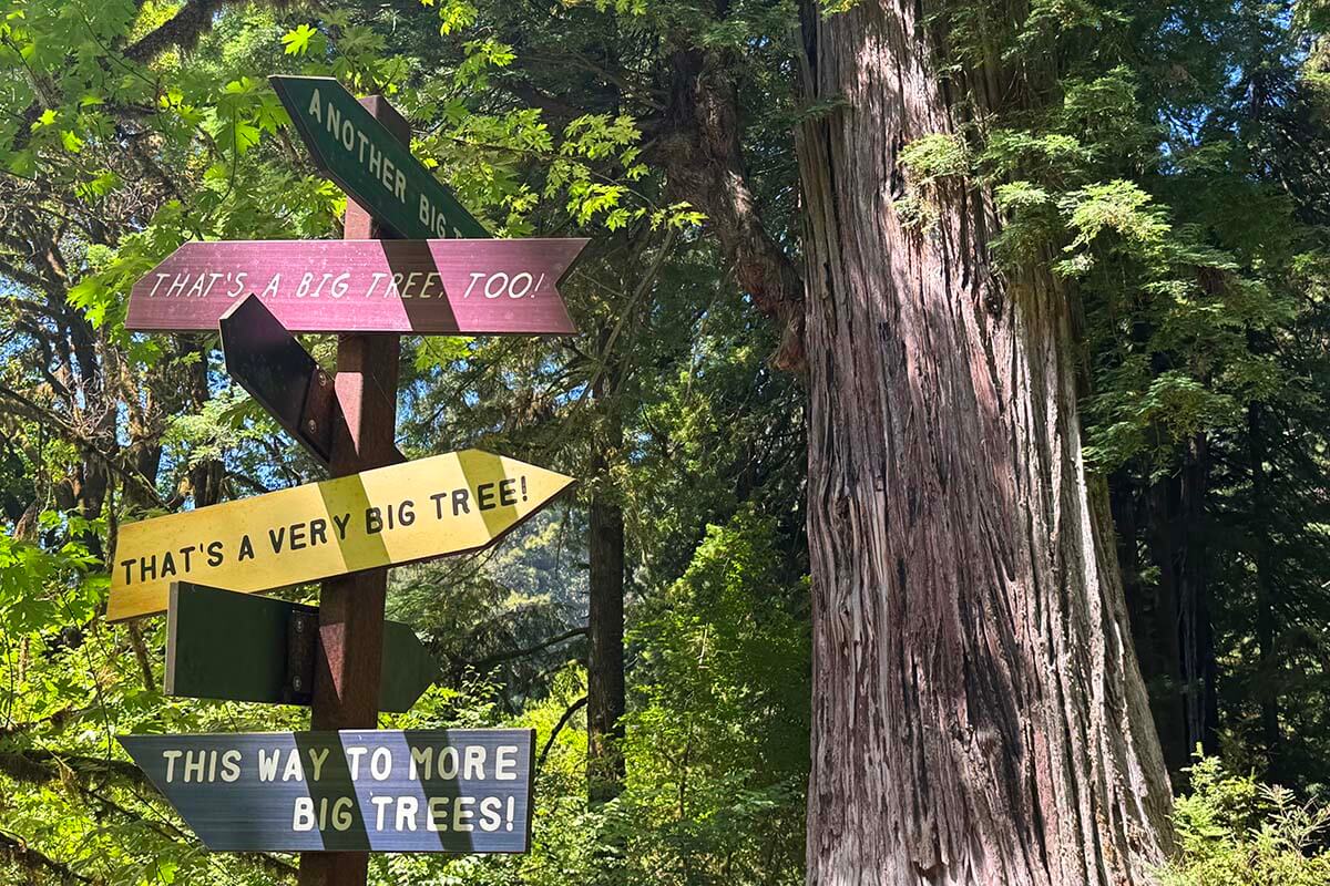
As you head north, stop at the Klamath River Overlook for sweeping views. If you’re traveling with kids or enjoy quirky roadside attractions, you might also like the Trees of Mystery, which features an aerial tramway, canopy trail, wood carvings, and of course, more giant trees. Expect to spend at least 2 hours here.
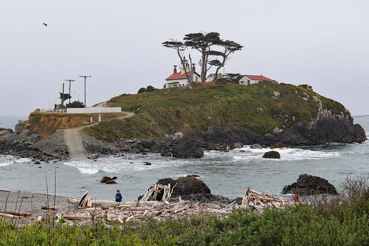
Crescent City is another nice place to visit if you still have time and energy. Depending on the tide, you may be able to visit the Battery Point Lighthouse. Otherwise, check out the Beachfront Park or visit Ocean World Aquarium.
Where to stay: You could overnight in Crescent City or cross the Oregon border and stay in Brookings, as we did. We stayed at Beachfront Inn, right on the beach. If you arrive in the late afternoon, you can explore the beach, enjoy the hot tub and the pool, etc.
Where to eat: There are lots of restaurants in both Crescent City and Brookings. We had dinner at Catalyst Seafood Restaurant – it was recommended by our hotel as the best option nearby.
Day 6: Oregon Coast, Oregon Caves & Drive to Crater Lake
DRIVING TIME/DISTANCE: 4h20. 220 miles (355km). Add 36 miles, 1 hour drive, if you make a detour to Oregon Caves National Monument.
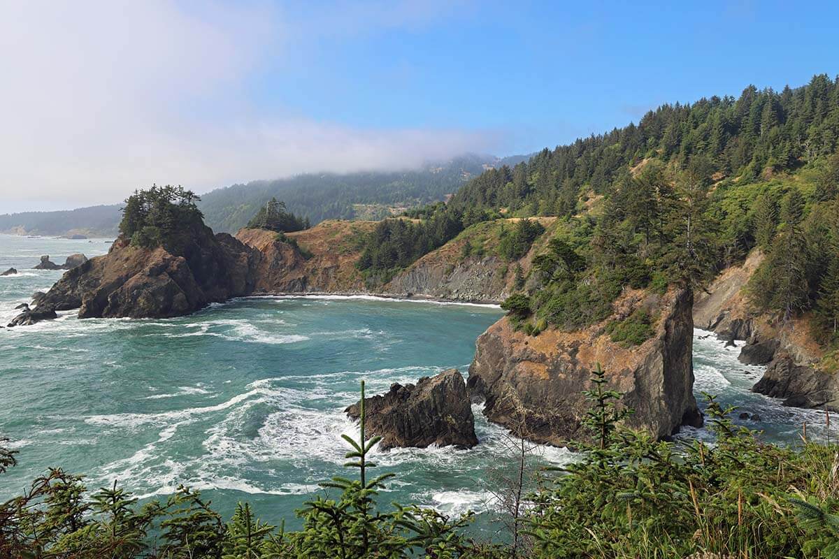
Famous for its rugged scenic coastline, the coast of Oregon is worth a trip in its own right. But you can see some stunning places even if you only have an hour or two in the area north of Brookings. Depending on the weather and your interests, you could visit some of the beaches and viewpoints in the evening on day 5 of this itinerary or in the morning on day 6.
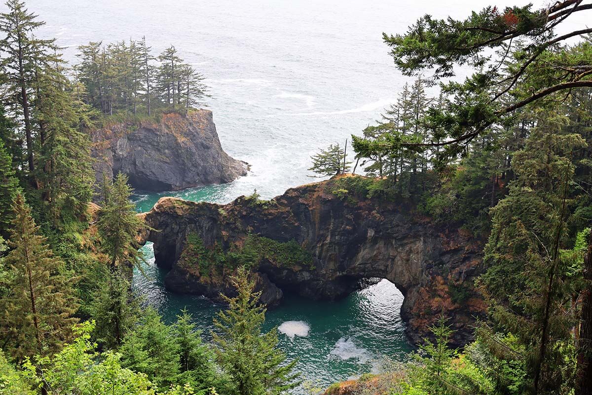
Some of the nicest places to visit in this area are located along the Samuel H. Boardman State Scenic Corridor. Don’t miss Natural Bridges and Arch Rock State Park – the best views here can be enjoyed without much walking.
Secret Beach is also well worth seeing, but parking is extremely limited, and it’s quite a hike. Harris Beach, Lone Ranch Beach, and Pistol River State Scenic Viewpoint are all nice to see if you have more time, but not a must.
Next, drive back south toward Crescent City and head inland toward Crater Lake via Hwy 199. Along the way, you could make a detour to Oregon Caves National Monument & Preserve. However, make sure to check online if they are open and reserve a tour in advance. We were passing by on one of their closing days, so we were not able to visit. Count about 3 hours for a visit – about 30-45 minutes drive each way, plus 1.5 hours for a tour.
The drive to Crater Lake National Park is quite long and – in the summer – it gets really hot as you are heading inland. We had a few nice nature stops indicated in our itinerary, such as Prospect State Scenic Viewpoint, Avenue of the Boulders, and Natural Bridge (all indicated on our map), but with temperatures in the high 90s (35°C+), we decided to skip everything and head straight to Crater Lake National Park where it was significantly cooler.
On the way, we stopped at 62 Burgers And Brew in Shady Cove for lunch. The place might look very simple, but the food was fresh and really delicious. One of the best lunch stops on this trip.
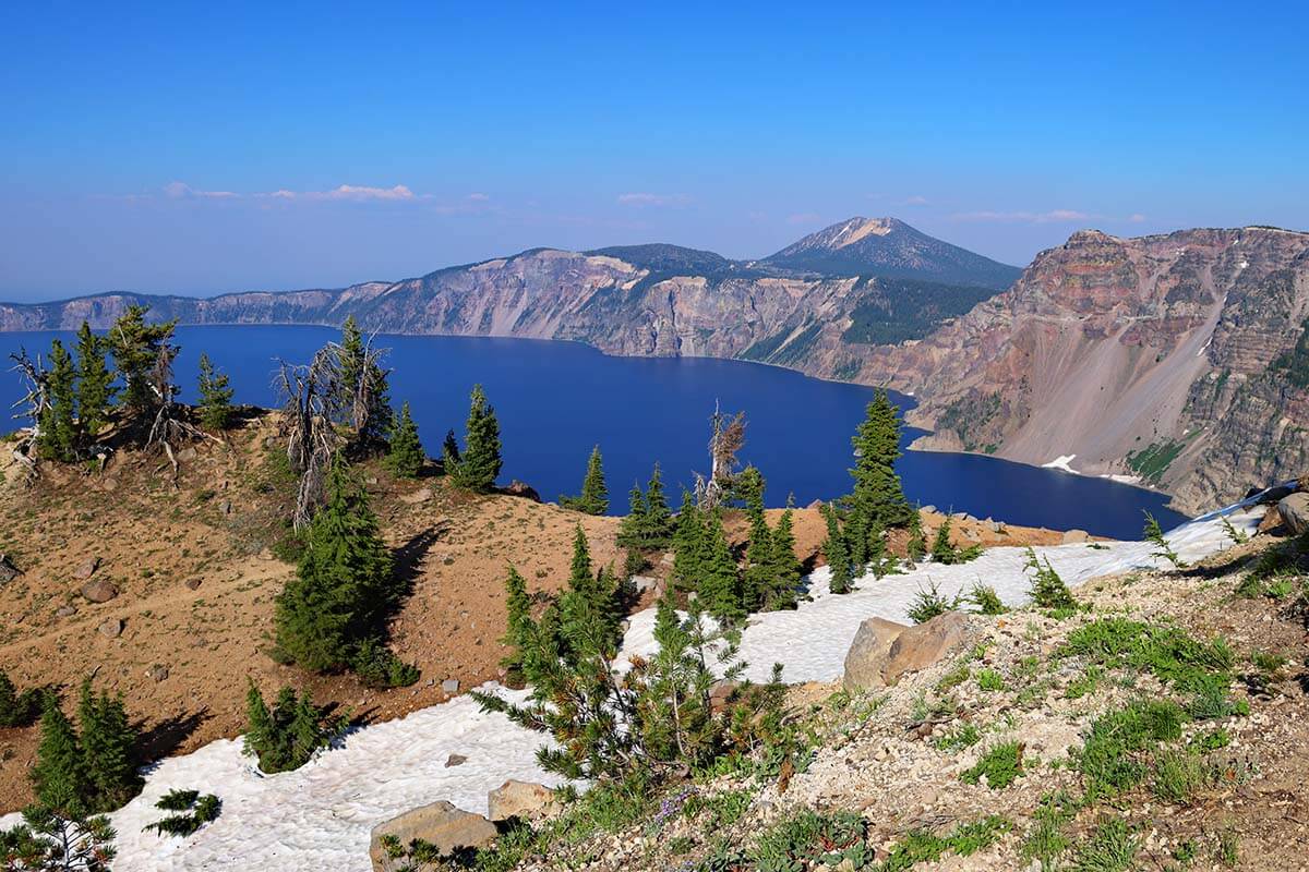
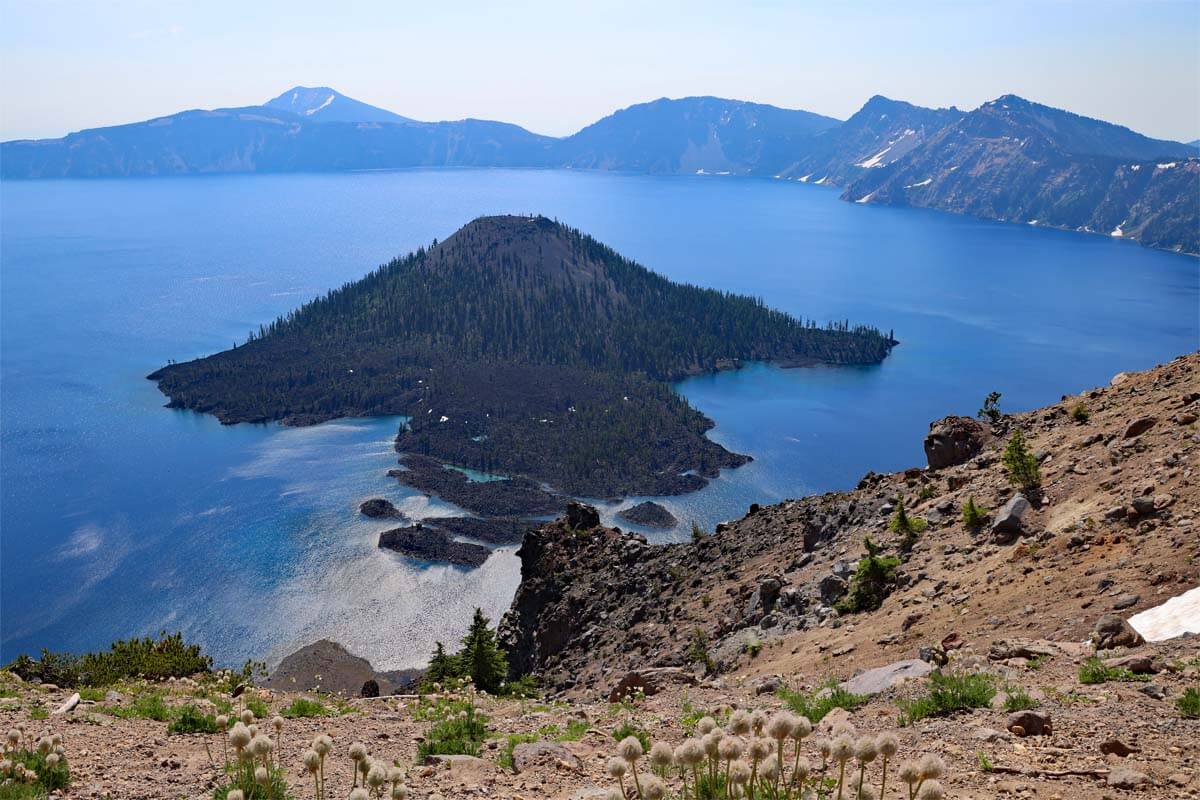
We arrived at Crater Lake National Park around 4.30 pm and decided to do some hiking before heading to our accommodation. We parked the car at the Crater Lake Lodge and did the Garfield Peak Trail. It’s 3.4 miles (5.5km) round trip and takes about 2-3 hours. The peak itself was still closed due to snow (we were here on July 16), so we had to stop a bit before that, at the viewpoint where you can see the entire lake. It took us about 1 hour to get there and 40 minutes to get back, and it was totally worth it – the scenery is incredible!
Where to stay: Crater Lake Lodge is the best place to stay for exploring the park. However, unless you book many months in advance or get extremely lucky, it’s practically impossible to get a room here. We kept on checking for several months, but it was always sold out. We stayed at the Aspen Inn in Fort Klamath, 17 miles, 22 minutes drive from the South entrance of the national park. Either way, you have to book your lodging here well in advance since the options are very limited.
Where to eat: There are just a few restaurants here: the Crater Lake Lodge (if you want to dine here, be sure to reserve in advance), Rim Village Café (limited options), and Annie Creek Restaurant at Mazama Campground. We had dinner at Annie Creek Restaurant before heading to our hotel.
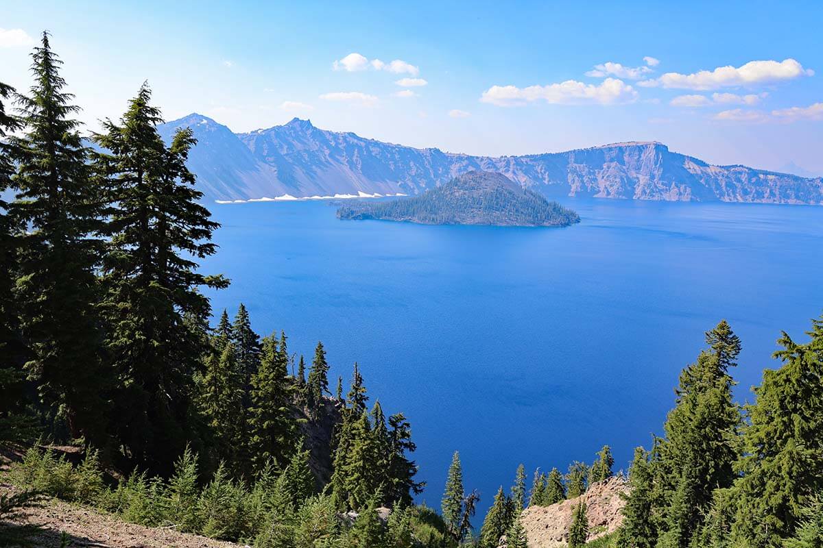
Day 7: Crater Lake National Park
DRIVING TIME/DISTANCE: 2h. 60 miles (96km). Less if you stay at Crater Lake Lodge.
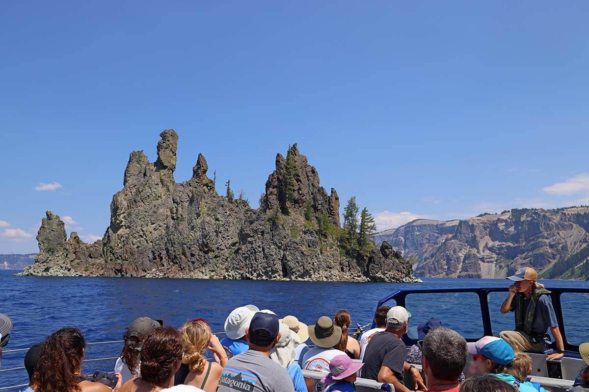
Crater Lake National Park might be small, but it has a lot to offer. That said, unless you plan to do every single hike in the park, one day is plenty of time to explore all the top spots, including boat tours on the lake. Even if you opt for the Wizard Island tour (+-5 hours), you’ll still have plenty of time left to see the main highlights inside the park.
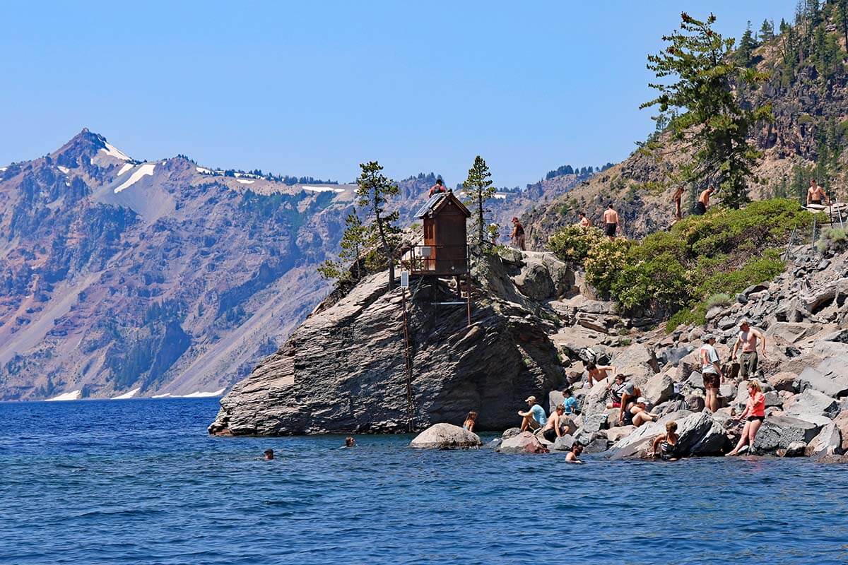
We opted for the Standard Lake Cruise, which took a good part of the day. The boat tour itself is only 2 hours, but you have to allow enough time to get there, find parking, and hike down to the lake where the boats dock. The Cleetwood Cove Trail is just 1 mile long, but it drops 700 feet (213 meters) to the lake shore. It took us 25 minutes to hike down and 35 minutes to hike back up after the boat tour.
The dock area is also the only place along the rim where you can swim. Even in summer, the surface water averages just 60°F (16°C), but plenty of people were in the water when we visited.
Good to know: Boat tours run from early July to mid-September and are extremely popular. Advance tickets sell out weeks or months ahead, but a portion is released 24 hours before each tour (e.g., at 9:30 AM, 10 AM, etc.). This gives you multiple chances to book last-minute, just be quick, as they go fast. You can check availability here.
In the afternoon, we explored all the viewpoints along the rim drive and did a few short hikes. Some of the top places not to miss include Discovery Point, Watchman Overlook, Phantom Ship Overlook, Vidae Falls, and Pinnacles Overlook.
Where to stay: Same accommodation as on the previous night.
LEARN MORE: Best Things to Do in Crater Lake National Park
Day 8: Lassen Volcanic National Park
DRIVING TIME/DISTANCE: 5h. 280 miles (450km).
Another long drive today, so leave on time. The first stretch – from the Crater Lake area to Lassen Volcanic National Park – is the longest. Depending on where you stayed near Crater Lake, it will take about 3.5–4 hours to reach the park’s northern entrance. The good news is that once you’re here, you can explore at a relaxed pace, as your hotel for the night isn’t far from where you exit the park.
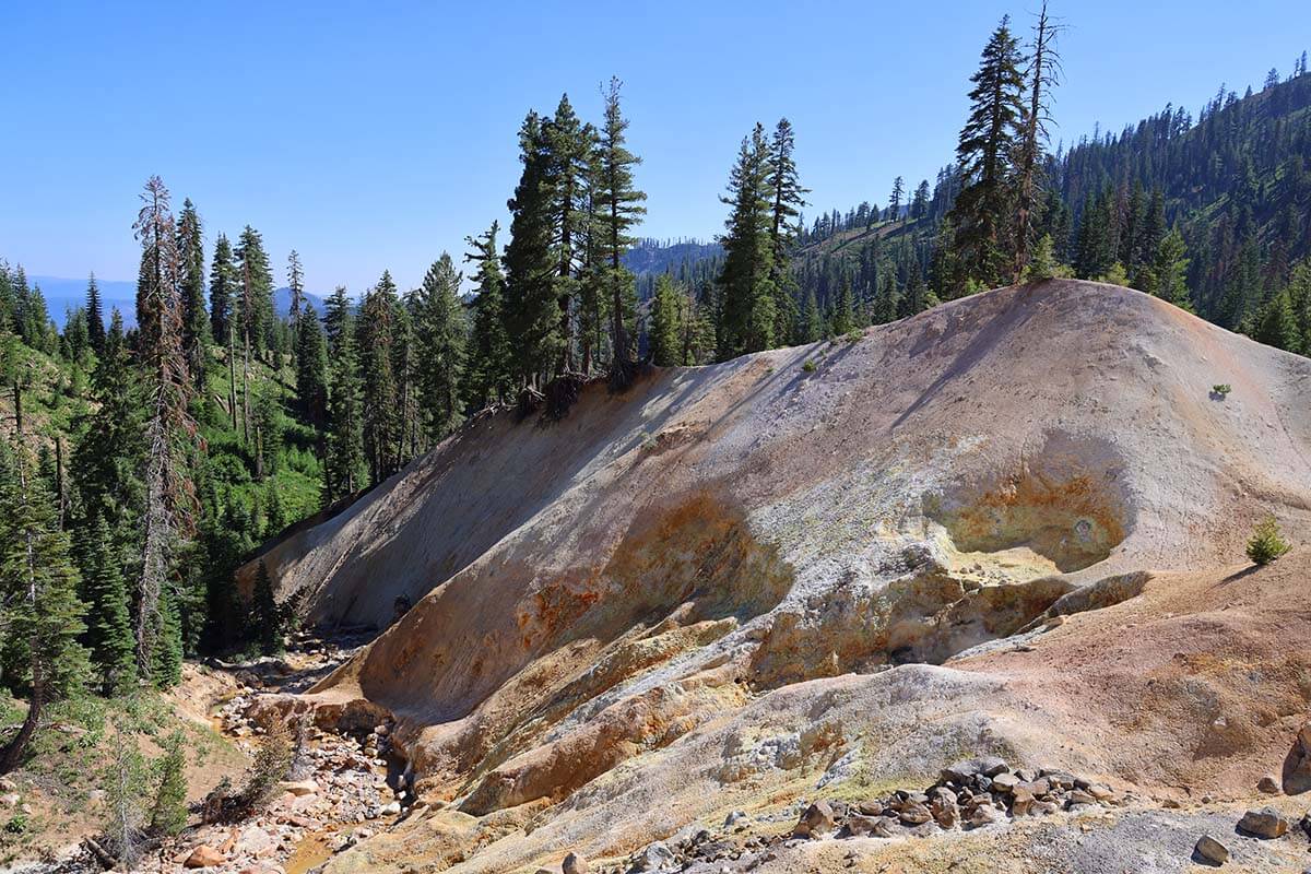
Lassen is one of the lesser-known national parks and a bit of a hidden gem. Due to its high elevation, it’s usually only accessible from late spring to fall. We visited in mid-July, and some trails were still closed due to snow.
Start at Manzanita Lake. You can walk the loop trail around the lake (about 40 minutes) or just head to the Lassen Peak Vista Point (marked on our map). If you want to linger, kayak rentals are available. We walked the full loop around Manzanita and also explored nearby Reflection Lake, spending just over an hour here.
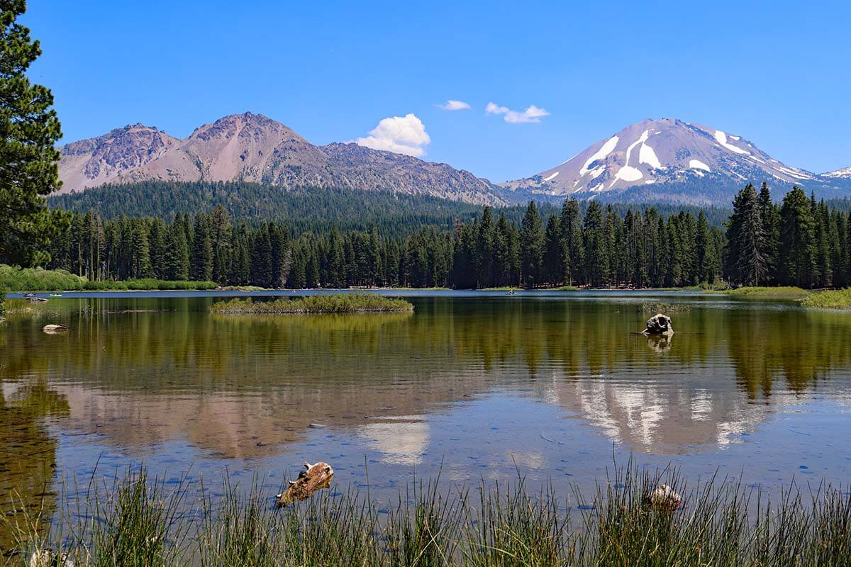
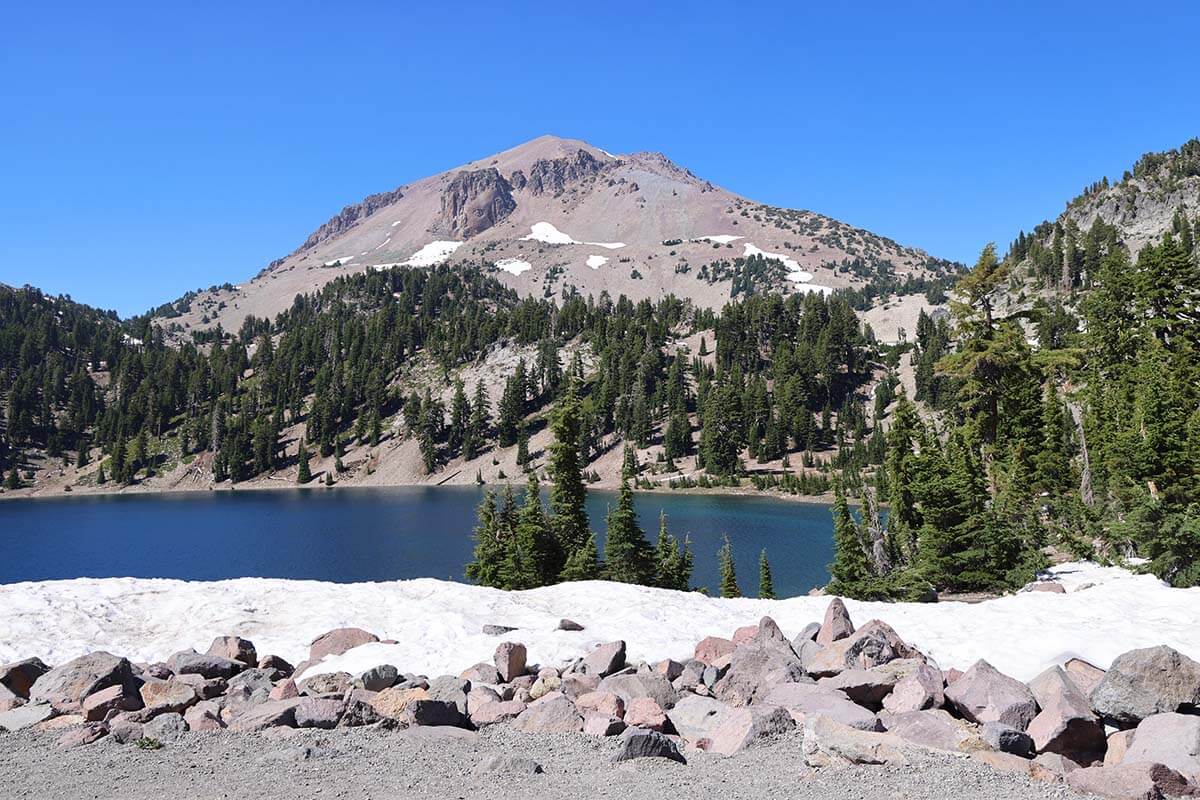
Next, follow the park’s main road, a 30-mile (48 km) scenic drive where all the major sights are located. The highlights include the Devastated Area, Lassen Peak Viewpoint (the summit hike itself takes 3–4 hours), Lake Helen, and Emerald Lake.
If the trail is open, the hike to Bumpass Hell (about 2 hours round trip) is one of the must-dos. End your visit with a stop at Sulphur Works for its bubbling mud pots and steam vents.
Where to stay: Just like at Crater Lake, accommodation options around Lassen are limited. The best place to stay for this itinerary is Chester, about 30 miles, half an hour drive from the south entrance. We stayed at Antlers Inn.
Where to eat: There are quite a few good restaurants in Chester. We had dinner at Bing’s Lake Almanor Bistro near the hotel, and it was quite good.
LEARN MORE: Best Things to Do in Lassen Volcanic
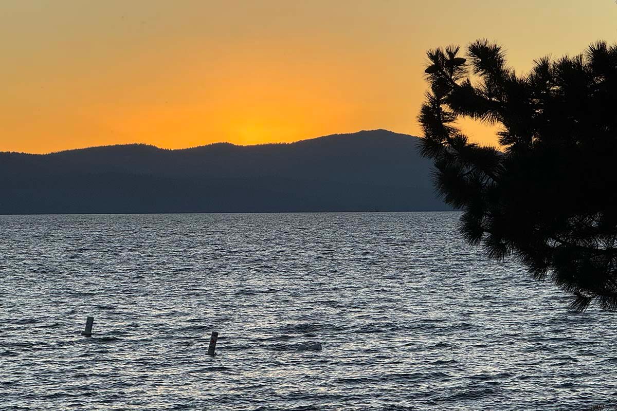
Day 9: Truckee & Lake Tahoe East Shore
DRIVING TIME/DISTANCE: 3.5h. 160 miles (258km). If staying in the north, it’s 2h45, 135 miles (217km).
Leave Chester in the morning and head to Truckee, a charming little town worth a quick stop on the way to Lake Tahoe. Stroll along the main street, browse the shops, and grab lunch. We ate at Old Town Tap. If you want more time at Lake Tahoe, you can also skip Truckee.
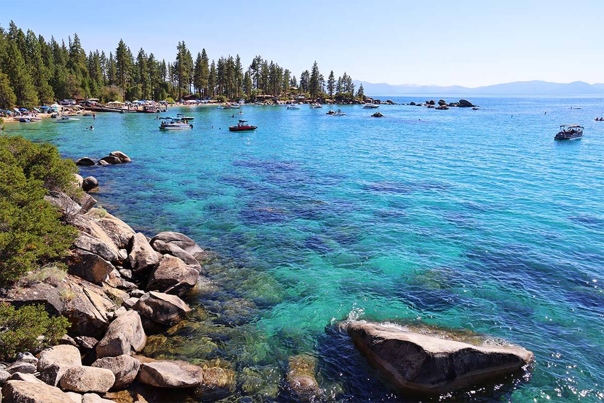
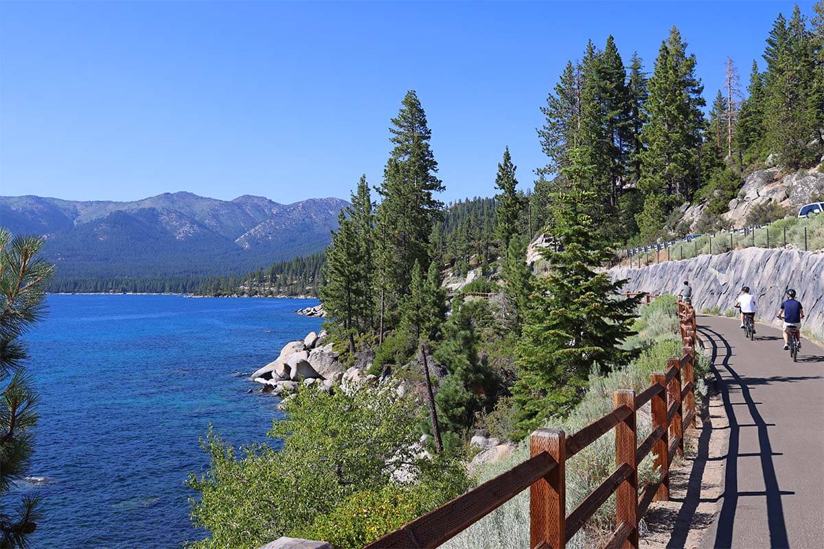
Next, continue to Incline Village on Lake Tahoe’s north shore. There are several great spots along the northeast shore, but in summer, parking can be difficult (or impossible) at the most popular places. That’s why we recommend exploring by e-bike (regular bikes can be too exhausting here due to the hilly terrain).
Park at at Hyatt Regency Lake Tahoe Resort and rent e-bikes from the shop nearby (reserve in advance to avoid wasting time comparing options). This is the most convenient location due to proximity to the lake and easy parking (+ the bike shop can validate your parking ticket before you leave).
Ride the Tahoe East Shore Trail, stopping at Hidden Beach, Memorial Point Scenic Overlook, and Sand Harbor. Sand Harbor has restrooms and a restaurant, so if you bring swimwear and towels, you could easily spend a couple of hours here in summer. Back in Incline Village, you can also bike along Lakeshore Blvd.
Alternative activity: If you don’t feel like biking but want to explore Sand Harbor without the stress, consider this highly-rated transparent kayak tour. They’ll take care of transportation and parking, saving you a lot of hassle.
Good to know: All of these spots are accessible via safe bike paths, and the rental shop will provide a map. Two hours is enough to see everything at a relaxed pace (you could even stop for a drink at Sand Harbor), but if you want beach time, rent the bikes for the whole day; the price difference is not that big.
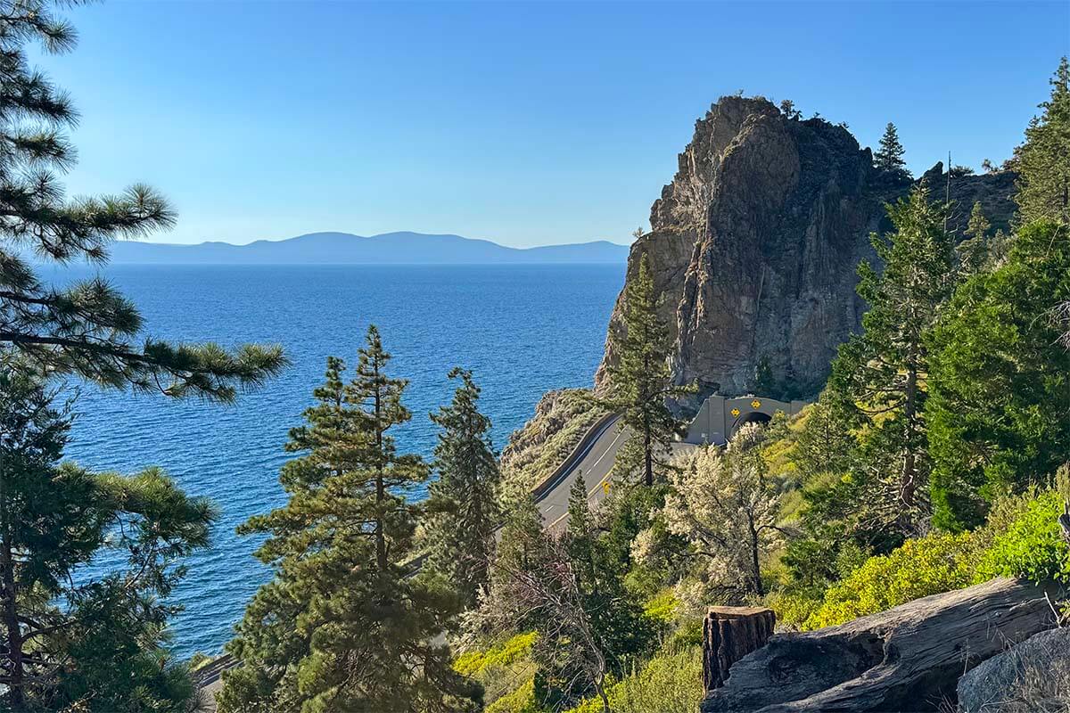
After returning the bikes, drive to South Lake Tahoe (unless you plan to stay in the north). Optional stops along the way include Secret Cove (adult beach) and Cave Rock.
Where to stay: We stayed two nights in South Lake Tahoe. Our first hotel was a disaster (despite good reviews), so we switched to The Landing Resort & SPA and loved it. It’s right on the lake, with free beach access (otherwise very expensive) and a nice pool area. Yes, it’s pricier than most, but worth it if you want to enjoy your stay in this touristy area.
Alternative place to stay: If you don’t mind changing hotels more often, spend one night in the north and one in the south. In that case, stay at the Hyatt Resort on this night – it’s right by the e-bike rental, so you could also arrive early, spend the day exploring, and enjoy a relaxing evening at the hotel.
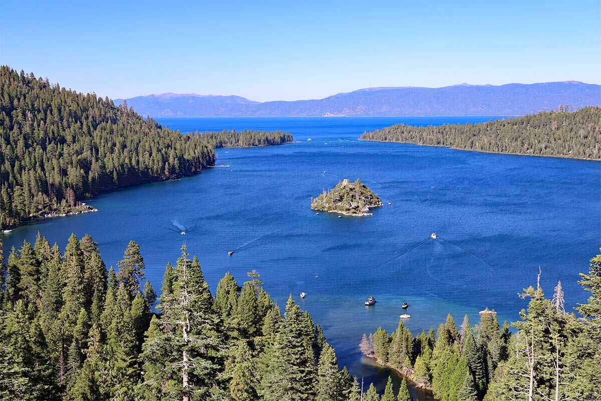
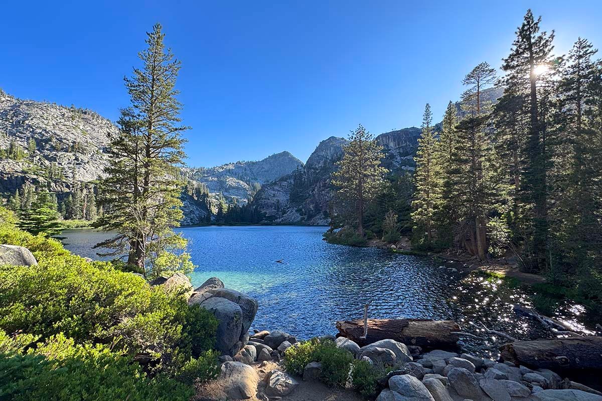
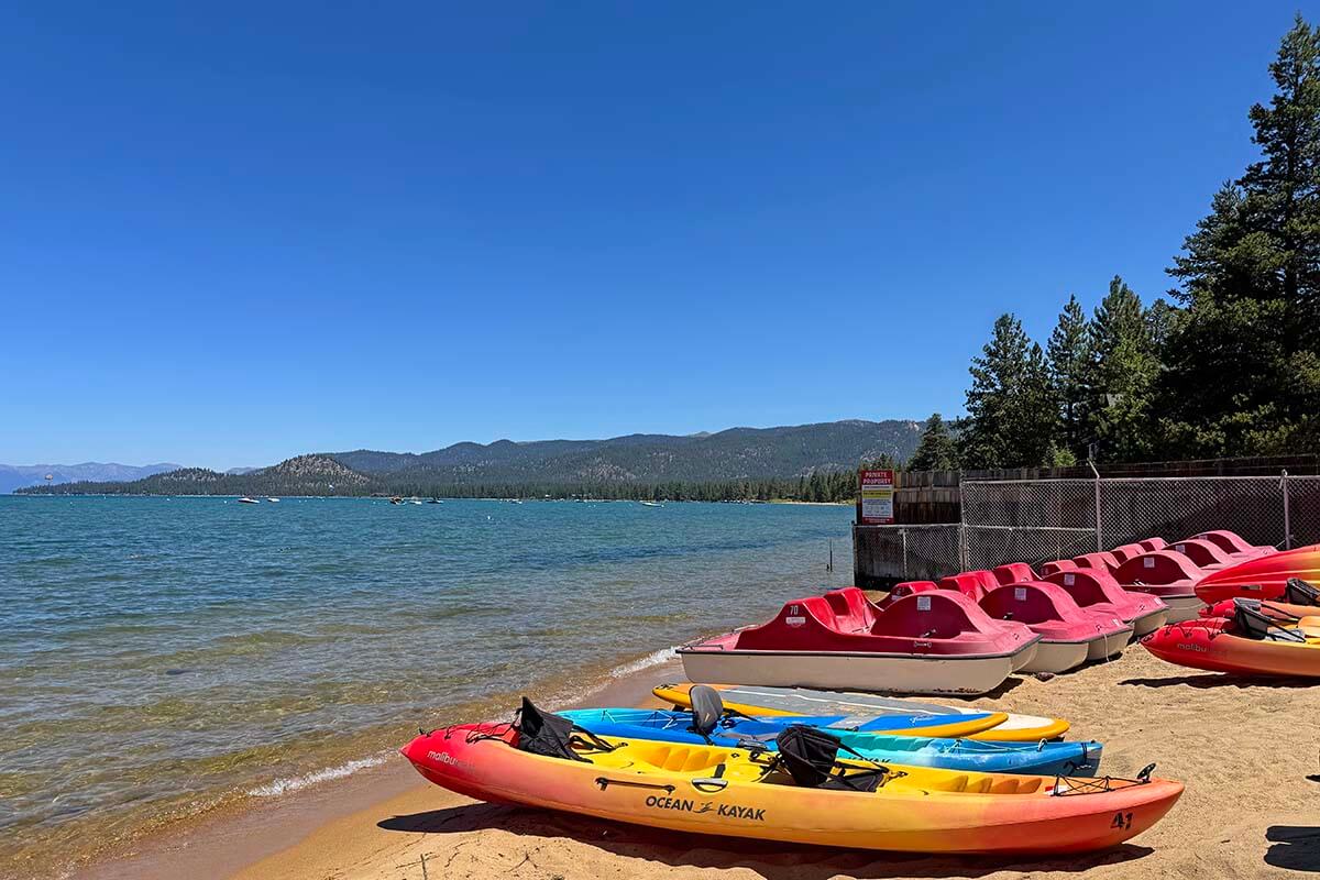
Day 10: Lake Tahoe South Shore
DRIVING TIME/DISTANCE: 1h. 30 miles (48km), if you visit Emerald Bay.
If you want to slow down your trip with a more relaxing day, South Lake Tahoe is the perfect place for that! You can spend the day by the hotel pool, relax on the beach, or try one of the many activities: lake cruises, kayaking, biking, or sightseeing.
There’s also a gondola ride at Heavenly Ski Resort, but it’s pricey, and the views aren’t that impressive. If you want to splurge on something, then consider this highly-rated helicopter tour!
We stopped at Inspiration Point, the Emerald Bay Lookouts (see our map), and hiked to Eagle Falls and Eagle Lake (the hike took about an hour).
Even at 5–6 PM, the area was still busy, but visiting in the late afternoon turned out to be a good call. Parking at viewpoints and trailheads is very limited, and in the mornings you often need to arrive before 9 AM to get a spot. Plus, if you move your car, it’s unlikely you’ll find parking at the next stop.
Where to stay/eat: Same as the previous night, The Landing Resort & SPA. If you want dinner at the hotel, it’s best to book a table in advance.
READ ALSO: How to See The Best of Lake Tahoe in 1 Day
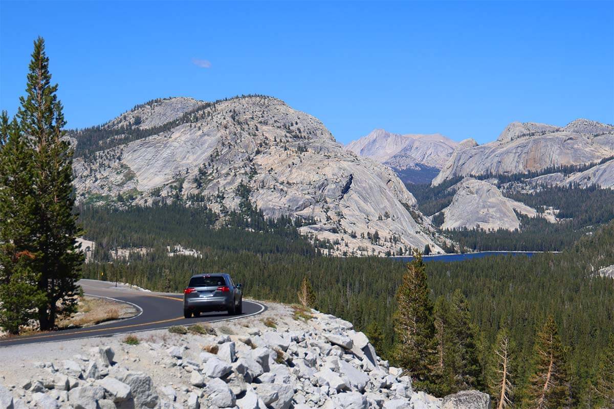
Day 11: Drive to Yosemite via Tioga Pass
DRIVING TIME/DISTANCE: 4-5h. +-200 miles (320km), depending on route and stops.
Today is a long but scenic drive to Yosemite National Park. We took Hwy 89 via Monitor Pass – a beautiful road and a way to avoid crossing into Nevada (California has fruit checks at the border, and we didn’t want to explain our daily picnic fruit purchases).
In summer, Tioga Pass is open and is by far the most scenic way into the park (closed in winter/spring due to snow – check road conditions if traveling in early summer!). If you have time, stop at Mono Lake Vista Point or the South Tufa Interpretive Trail (short detour). Just before the park entrance, visit Tioga Lake.
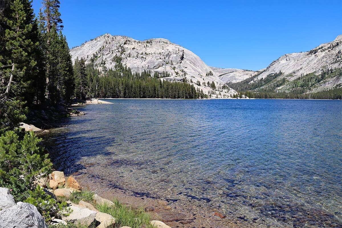
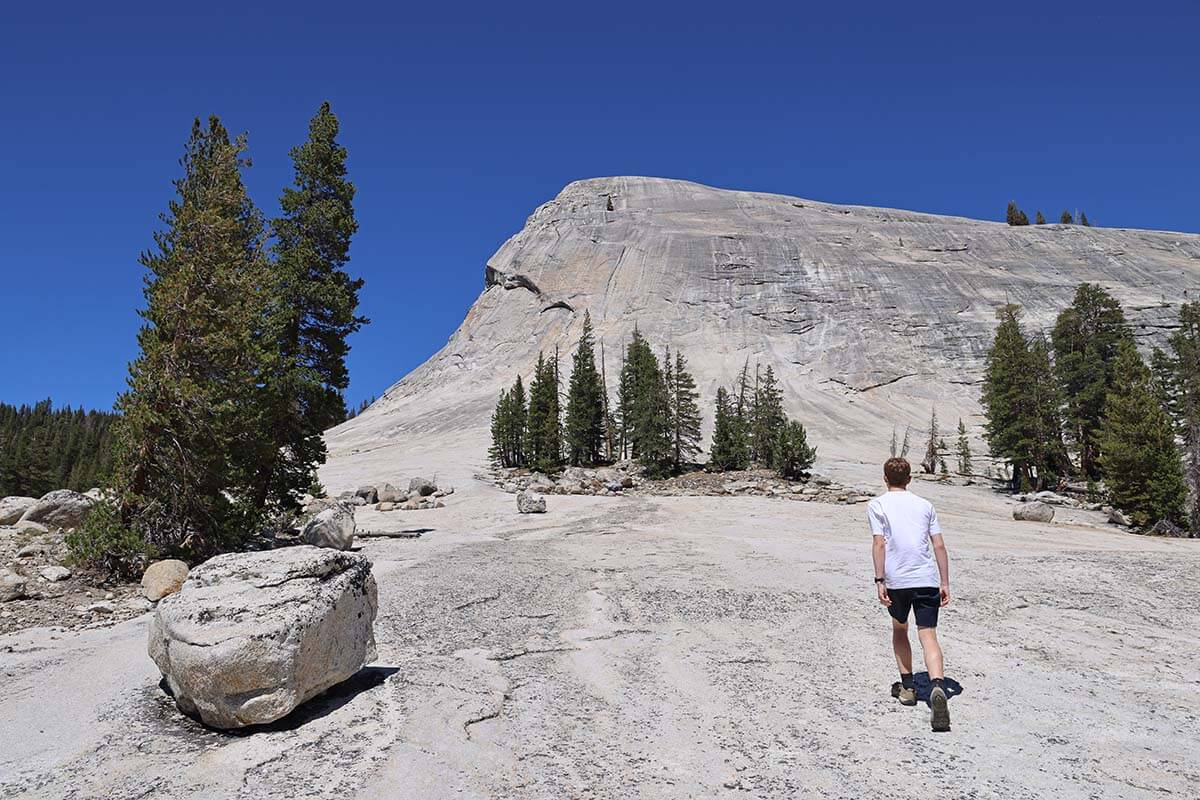
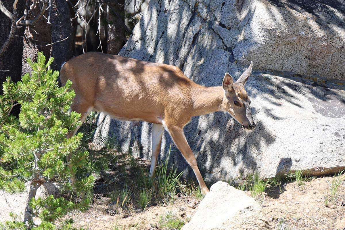
Inside Yosemite, highlights along Tioga Road include Lembert Dome, Tuolumne Meadows (great for a short walk and wildlife spotting), Tenaya Lake (swimming possible), and Olmsted Point.
From here, your options depend on time and where you’re staying. If you didn’t get enough of big trees earlier on this trip, you could hike to the Dead Giant Tunnel Tree (1 mile each way, steep return). Alternatively, explore Yosemite Valley (Lower Yosemite Fall Vista Point, Bridalveil Fall Viewpoint), or head straight to Tunnel View to save some time the next day.
Where to stay: If possible, book inside Yosemite – it saves time, avoids re-entry reservations, and lets you explore more. Best options include The Ahwahnee, Yosemite Valley Lodge, and Yosemite West rentals. Outside the park, Yosemite View Lodge is one of the closest choices. We stayed at Curry Village Cabins (not tents – those have shared facilities). Even the cabins are rather basic; you stay here for the location.
Where to eat: Dining is limited in Yosemite Valley, and parking is challenging, so it’s best to eat close to your accommodation. We ate at Curry Village Pizza Deck – pizza was fine, but the wait was 1–1.5 hours, so plan to eat early or check out other eateries.
READ ALSO: Yosemite Travel Guide & Tips
Day 12: Yosemite National Park & Drive to the Coast
DRIVING TIME/DISTANCE: 5h. +-250 miles (400km), depending on route and stops.
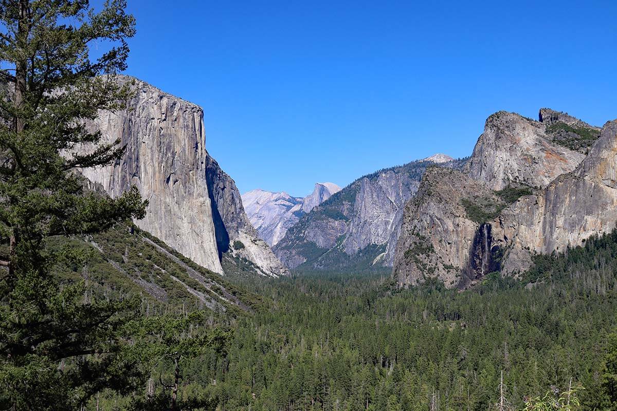
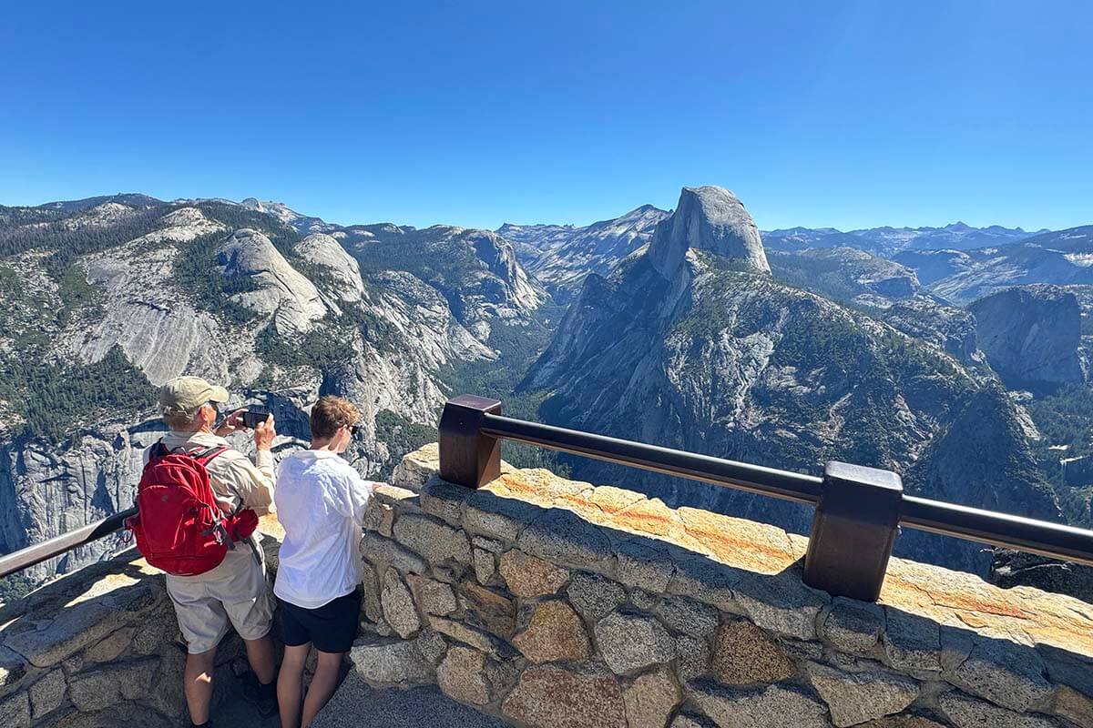
Start your day with a quick photo stop at Tunnel View, one of Yosemite’s most iconic viewpoints. Then head to Glacier Point Road. The main highlight is Glacier Point at the very end of the road.
Optional: We did a Four-Mile Trail starting from here and ending in Yosemite Valley, but that requires half a day and advance planning (such as booking a shuttle to Glacier Point).
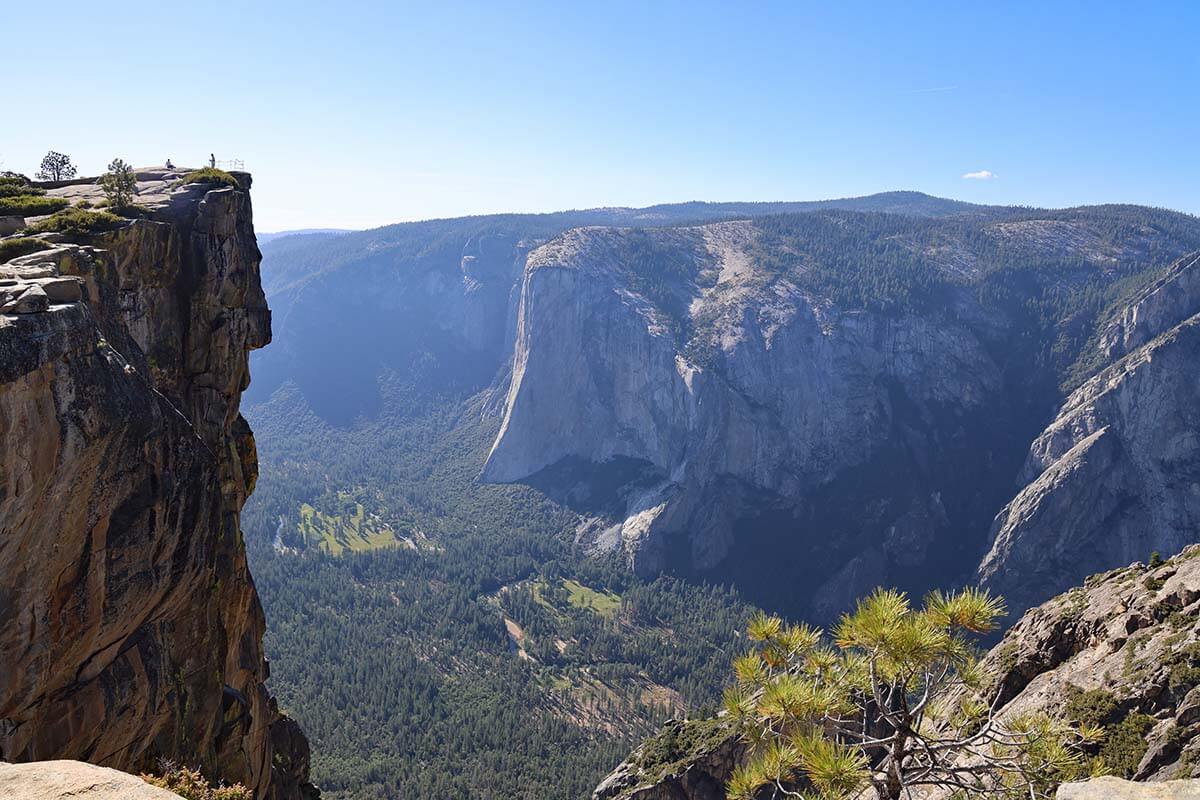
For easier – and very rewarding – hiking options, consider hiking to Taft Point and/or Sentinel Dome. These hikes start on Glacier Point Road, making it much simpler to add to any itinerary. We recommend at least doing Taft Point – it’s a short (1.2 miles / 2 km one way), easy hike with spectacular views. You can also make a loop via Sentinel Dome, but that adds 1.5–2 hours. Whatever you choose, start early since it gets busy and parking is limited.
Continue south toward Wawona and, if you’re interested, stop at Mariposa Grove. This giant sequoia forest is a Yosemite highlight, but if you’ve already visited the Redwoods earlier in the trip, it may feel repetitive. It also requires a free shuttle ride from the parking area, which can mean long waits. If time allows, it’s still worth a visit.
LEARN MORE: Taft Point Hike
In the afternoon, leave Yosemite and drive to California’s Central Coast. From Yosemite’s South Entrance, it’s about 4 hours (200 miles) to San Simeon.
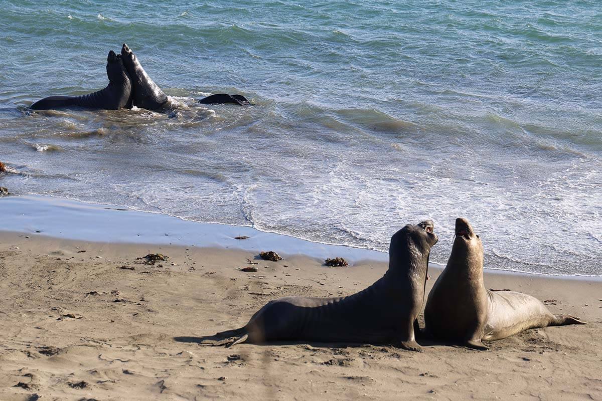
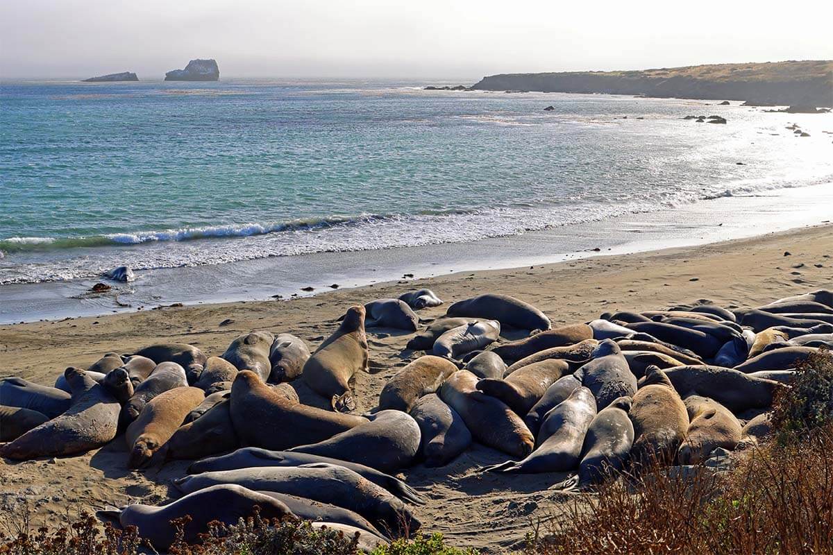
If you still have energy after checking in, explore the San Simeon coastline, visit the elephant seal viewing area, or catch the sunset.
Where to stay: San Simeon has plenty of hotels. We stayed at the Quality Inn at Hearst Castle.
Where to eat: There are several dining options at San Simeon. We had dinner at Manta Rey Restaurant right next to the hotel – good food and convenient location.
Day 13: Hearst Castle, Big Sur & Point Lobos
DRIVING TIME/DISTANCE: 2.5h. 100 miles (160km).
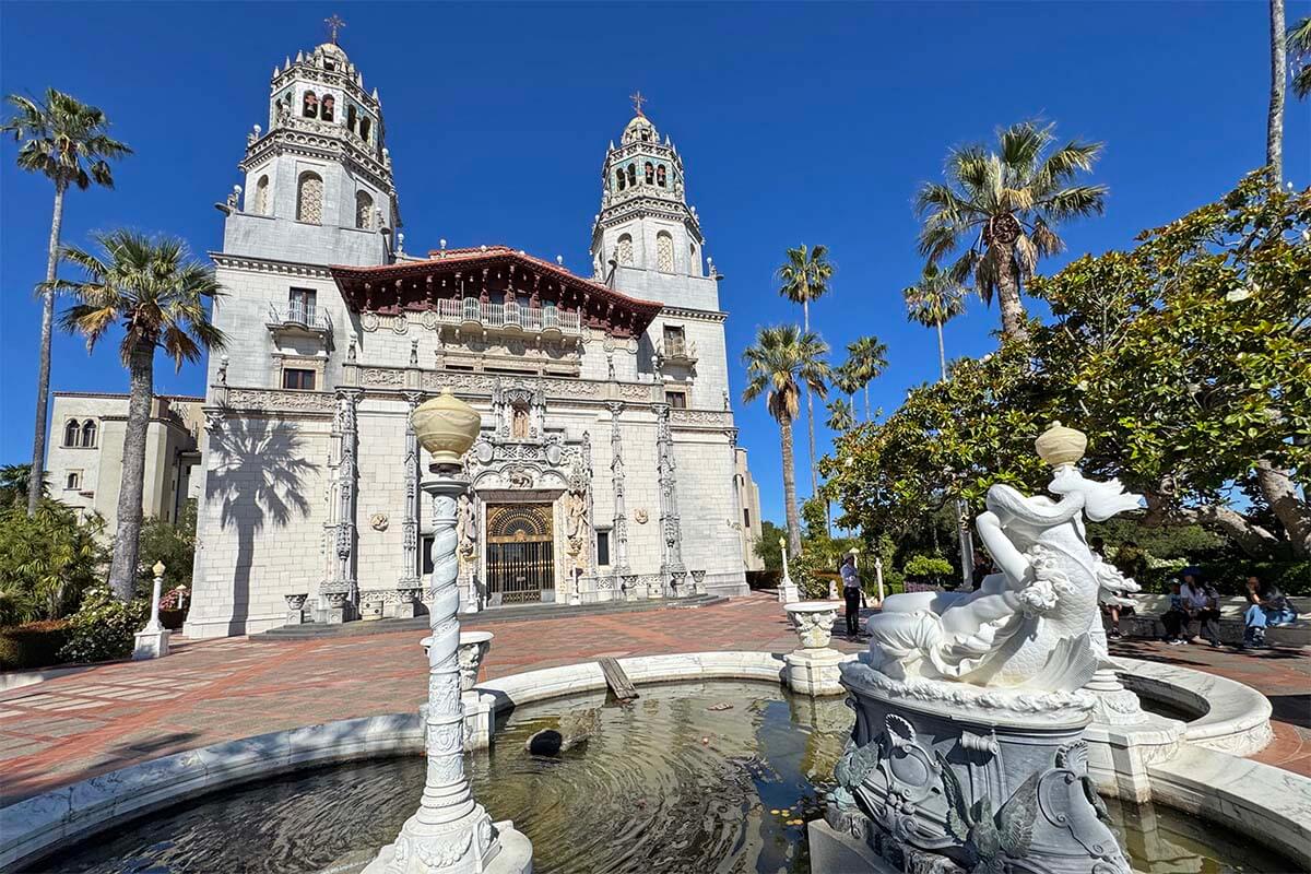
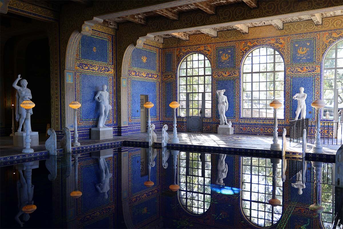
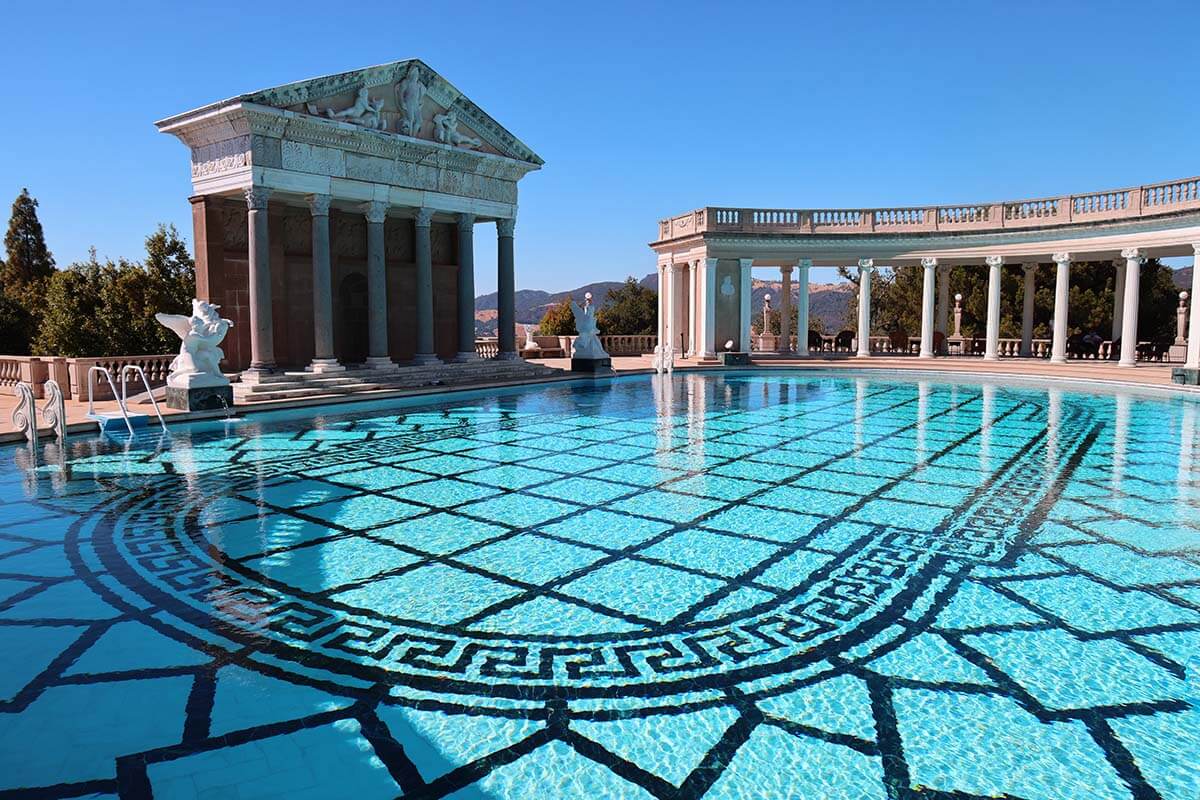
Start your day with a tour of Hearst Castle in San Simeon. Check their website for opening times and book tickets in advance, especially in summer and on weekends. If it’s your first visit, the Grand Rooms Tour is the best introduction to the estate.
If not done the night before, stop by the elephant seal rookery just north of San Simeon. There’s a boardwalk where you can get a great view of these massive animals lazing on the beach.
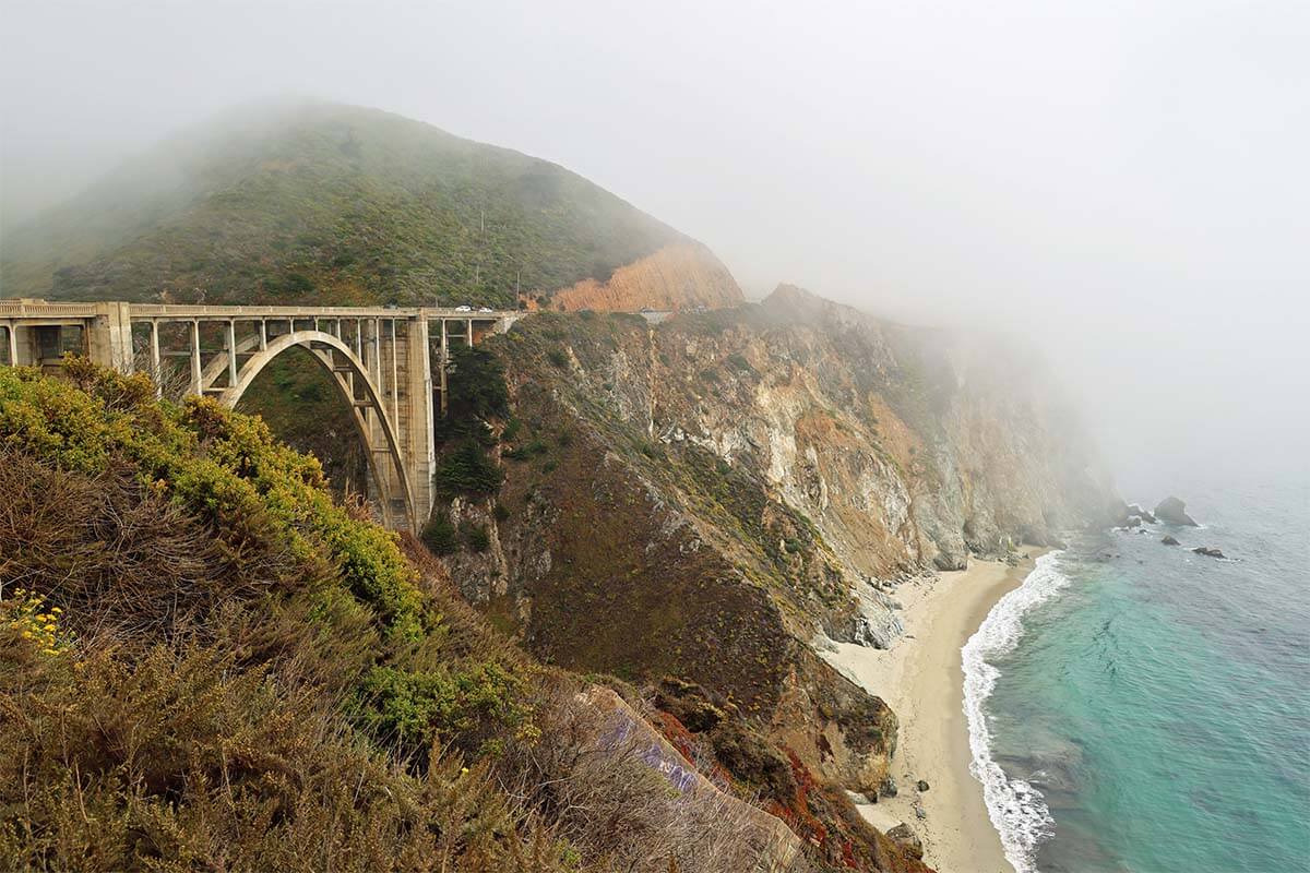
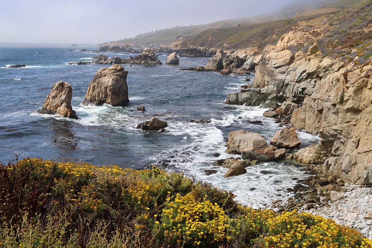
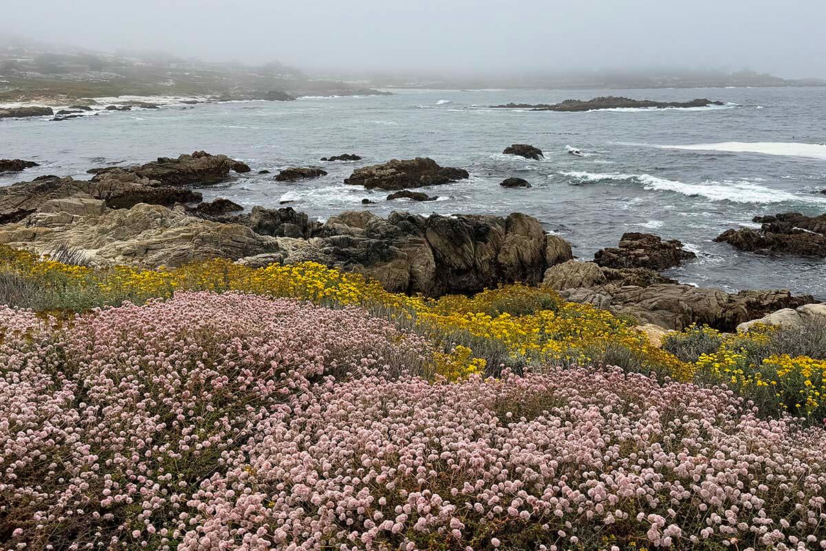
From here, drive north along Highway 1 through Big Sur, one of California’s most scenic coastal routes. You’ll pass countless viewpoints – too many to name. Don’t miss Bixby Bridge Vista Point and McWay Falls.
Good to know: The weather can be unpredictable, and fog can roll in quickly here. So if you get a clear view you love, stop for the photo right away – it might not look the same a few miles later. To give you an idea of how quickly it can change, all the pictures below were taken within one hour, and there were moments when we were driving in the clouds with nothing to see at all…
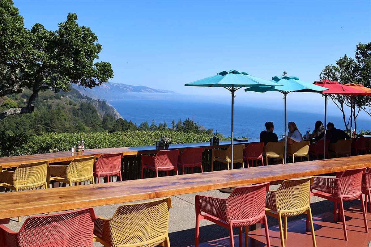
For lunch, consider Nepenthe in Big Sur. The views are incredible, but be aware that the food is very pricey. Otherwise, it’s still worth stopping for a drink or just to enjoy the views.
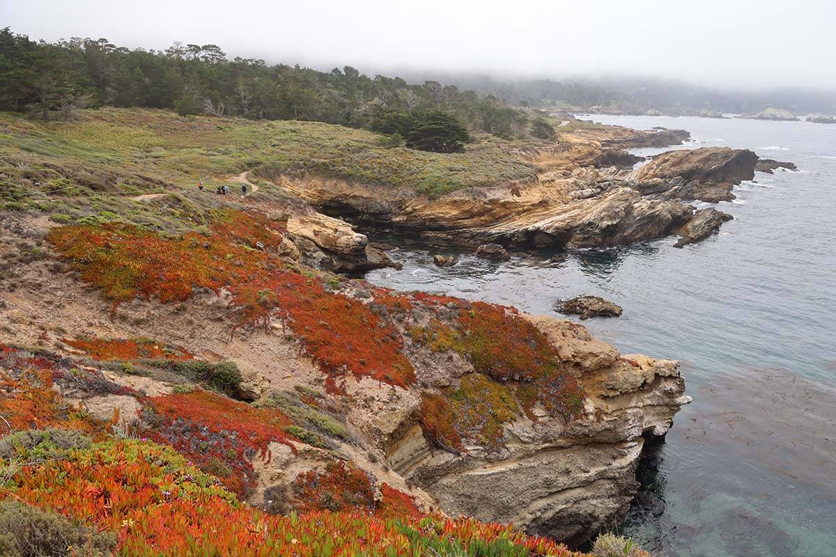
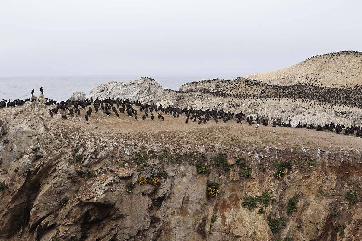
In the afternoon, head to Point Lobos State Natural Reserve. Parking inside is limited, so you may need to leave your car along the road. If you plan to hike the full coastal loop, it doesn’t matter much where you start – the whole coastline is stunning. You’ll need 2.5–3 hours for the complete loop, but you can also make a shorter visit.
If you have energy left, stop in Carmel-by-the-Sea to explore the beach, visit Carmel Mission, or simply stroll through town before continuing to Monterey.
Where to stay: Monterey has plenty of accommodation options for all budgets. We stayed at Monterey Bay Lodge, which offered good value. If you want to be right in the heart of town, the Portola Hotel & Spa and Hotel Pacific have the most central location.
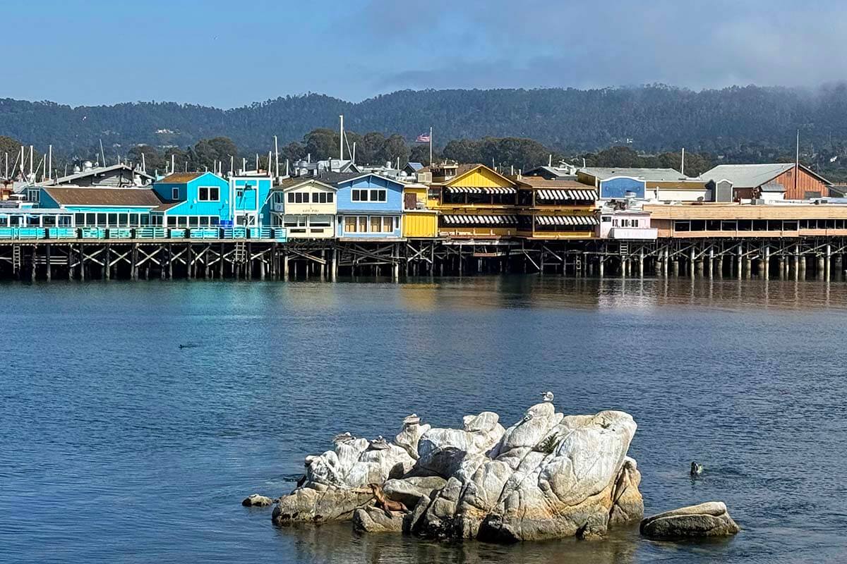
Where to eat: Monterey has plenty of restaurants, especially downtown, at Fisherman’s Wharf, and around Cannery Row. Old Fisherman’s Grotto and The Sardine Factory are popular choices. We really enjoyed the more casual Sandbar & Grill, which also seems to be a local favorite.
Day 14: Monterey, 17-Mile Drive & Whale Watching
DRIVING TIME/DISTANCE to SFO Airport: 2h. 107 miles (170km).
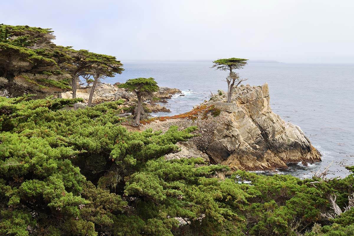
Start your day with the 17-Mile Drive through Pebble Beach. You can do it by car (pay a small entry fee), rent an e-bike, or join a guided e-bike tour. The route is easy to follow and takes you past famous golf courses, rugged coastline, and iconic stops like Lone Cypress.
If you’re doing it by car, allow 1-2 hours; otherwise, 2–3 hours to enjoy the viewpoints without rushing. Alternatively, you can also opt for a GoCar tour of Monterey and Pacific Grove.
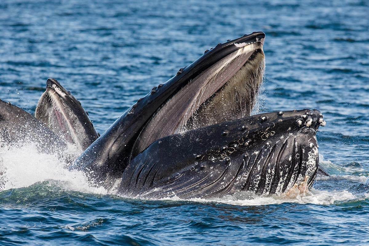
In the afternoon, join a whale watching tour from Fisherman’s Wharf. Monterey Bay is one of the best places in the world to spot whales year-round, and going later in the day can mean less morning fog. Tours usually last about 3-4 hours, so bring layers and seasickness medication if needed – the Pacific can be choppy.
Spend the late afternoon and evening exploring downtown Monterey, Fisherman’s Wharf, and Cannery Row. This is when the town is liveliest, with shops, galleries, and plenty of restaurants open.
The Monterey Bay Aquarium is one of the top attractions in the region and is worth the time if you’re interested in marine life or are visiting with kids. However, you need at least 2–3 hours to see the exhibits properly, so if you want to visit, you may have to rearrange this itinerary a bit. For example, you could take a whale watching tour at sunset.
Where to stay: Spend another night in Monterey or drive to San Francisco/SFO Airport if you’re ending your trip. If you need a hotel close to the airport, Aloft is a convenient choice with a free airport shuttle (so you could return your rental car earlier). However, check the fine print if you have a car – some hotels charge ridiculously high parking fees. The Dylan Hotel is a good alternative with free parking (always confirm in case policies change).
READ ALSO: One Day in Monterey: Itinerary with Best Things to Do
So, this is our recommended two-week Northern California road trip itinerary. As you can see, it’s packed with stunning sights from start to finish. Whether you’re hiking in national parks, pedaling along scenic shorelines, or tasting fresh seafood by the ocean, the variety of scenery and experiences makes it a fun and well-balanced trip.
With flexible stops and plenty of options along the way, you can easily adapt this itinerary to match your travel style and pace. If you’re traveling in summer, book accommodations and popular activities well in advance, as they can sell out quickly.
Have a great trip!
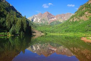
Looking for more road trip ideas in the USA? Check out our Colorado – Utah – Wyoming itinerary that includes highlights such as the Colorado Rockies, Yellowstone, Arches, and so much more!
More Travel Inspiration for The Southwest:
- California:
- Nevada:
- Arizona:
- Utah:
- For many more destinations, please see our USA travel page.
TIP: Did you find this guide helpful? Bookmark this post for later, share it with your friends, and save it to Pinterest to inspire your next trip.

Nice shots
Thanks, Julius. 🙂