Grand Canyon of the Yellowstone: Best Viewpoints, Things to Do & Map
This site contains affiliate links, which means that we may earn a small commission, at no cost to you, for qualifying purchases. It supports the work that goes into keeping this content free. Thanks for reading! More info: Privacy Policy.
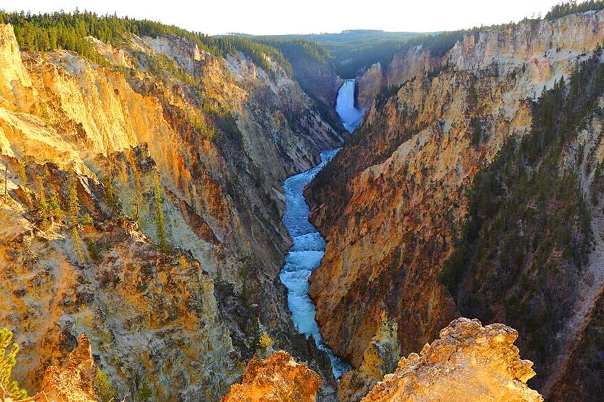
Did you know that Yellowstone National Park in Wyoming has its own Grand Canyon? While it may not be as big or as well-known as the Grand Canyon in Arizona, Grand Cayon of the Yellowstone is no less impressive, with its colorful canyon walls and thundering waterfalls producing stunning vistas and endless photo opportunities.
Yellowstone Canyon is one of the absolute best places to see in Yellowstone National Park!
But what exactly can you do at the Grand Canyon of the Yellowstone? And what are the best (short) hikes or viewpoints you shouldn’t miss when visiting this impressive canyon?
This article should answer all your questions and give you a better idea of what to expect and how to best plan your visit to the Yellowstone Canyon. Further below, you can find a list of the best viewpoints and short hikes at the Yellowstone Canyon as well as the map of this area. Find out!
TIP: If you want to see the best views of the Yellowstone Canyon but are not sure where to start, join this highly-rated hiking tour!
Grand Canyon of Yellowstone – Introduction
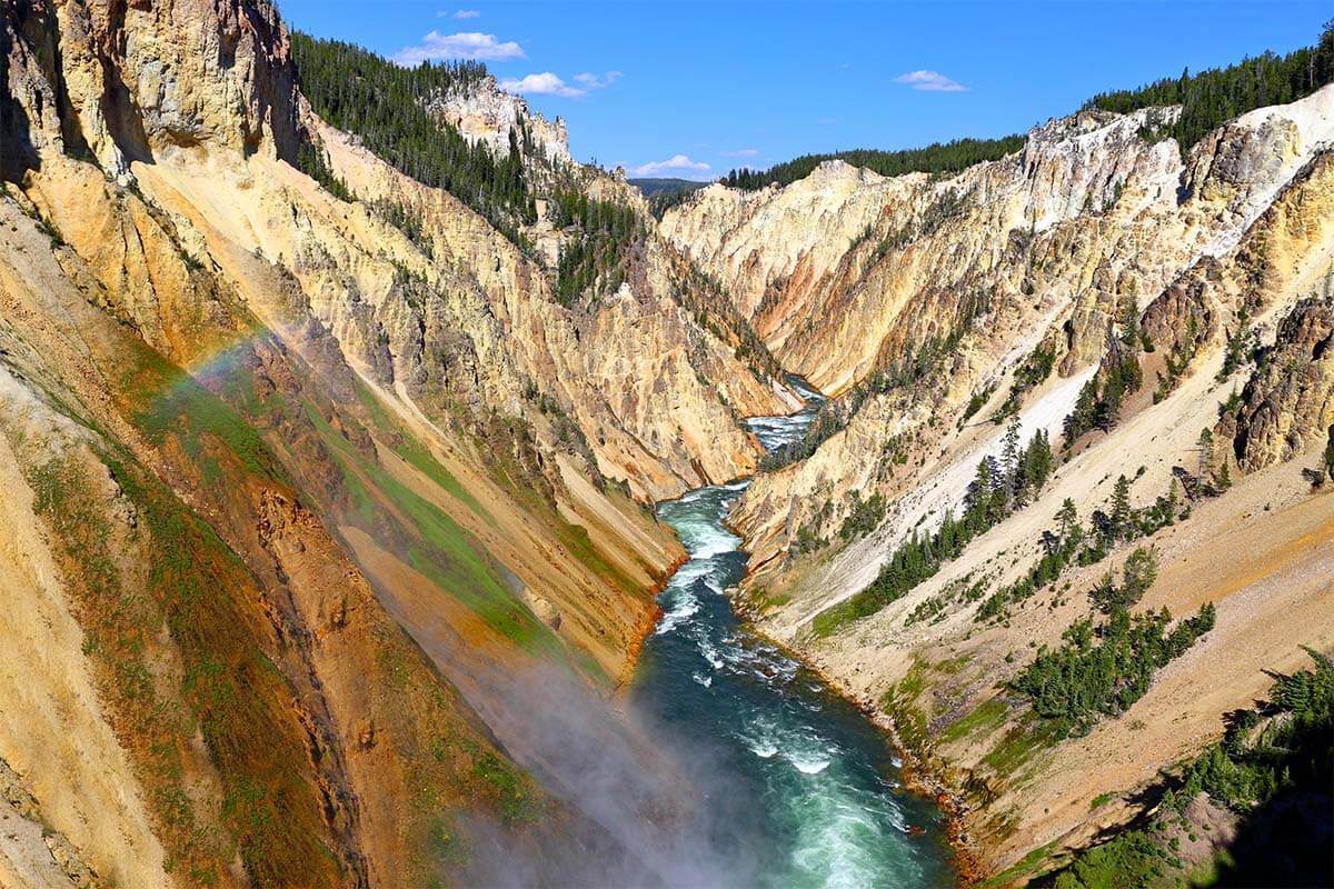
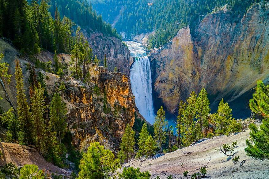
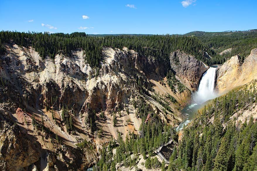
The Grand Canyon of Yellowstone is about 20 miles (32 km) long and between 800 to 1200 ft (240 – 360 m) deep. It is the Canyon into which the Yellowstone River flows as it plunges 308 ft (94 m) over the Lower Yellowstone Falls.
It became popular after descriptions of its beauty were shared by explorers, after their expeditions in the late 19th century.
The story of Yellowstone Canyon began around 600,000 years ago when a volcanic eruption emptied all the magma from a large underground chamber. Over time, the roof of the chamber collapsed, forming a 30-mile-wide caldera that gradually began to fill with sediments and lava.
This continued for hundreds of thousands of years, with the Canyon itself forming around 160,000 to 140,000 years ago. At that point, it would have been both shallower and narrower than it is now, but the hot water in the earth’s crust softened the rocks. This allowed the river to easily erode them away, making the Canyon wider and deeper.
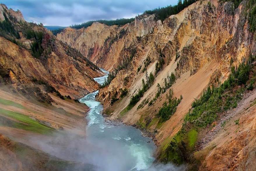
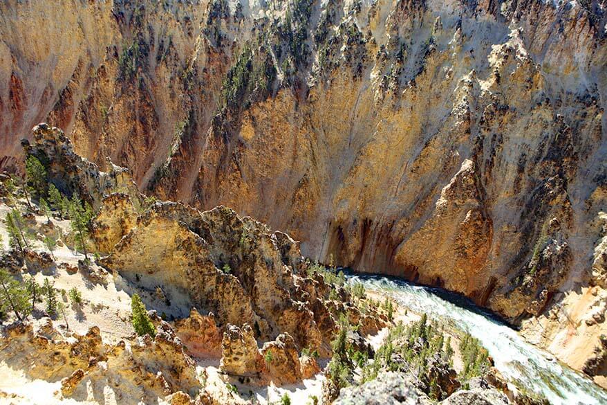
The result is the stunning natural spectacle we see today, with puffs of steam on the Canyon walls marking the spots where hydrothermal activity still takes place. This activity causes a rainbow of colors in the rocks.
The absence or presence of water in different rock compounds produces a variety of different brightly colored hues – including reds, oranges, and golds, whereas the subtle pastels tend to indicate the presence of hot springs and steam vents. You can also see areas of oxidation, where iron compounds in the rhyolite rock have been essentially cooked, causing the canyon to ‘rust’.

What to Expect
Yellowstone’s Grand Canyon can be enjoyed from various outlooks, each offering its own perspective of geology and color, and the power of the waterfalls. Its beauty is ever-changing, with the different seasons and even the time of day influencing the colors and the majesty of the environment.
There are fantastic – and differing – views from both the North and South rims, with several miles of hiking trails connecting the viewpoints. Further below, you can find a complete overview of all the best places and short hikes.
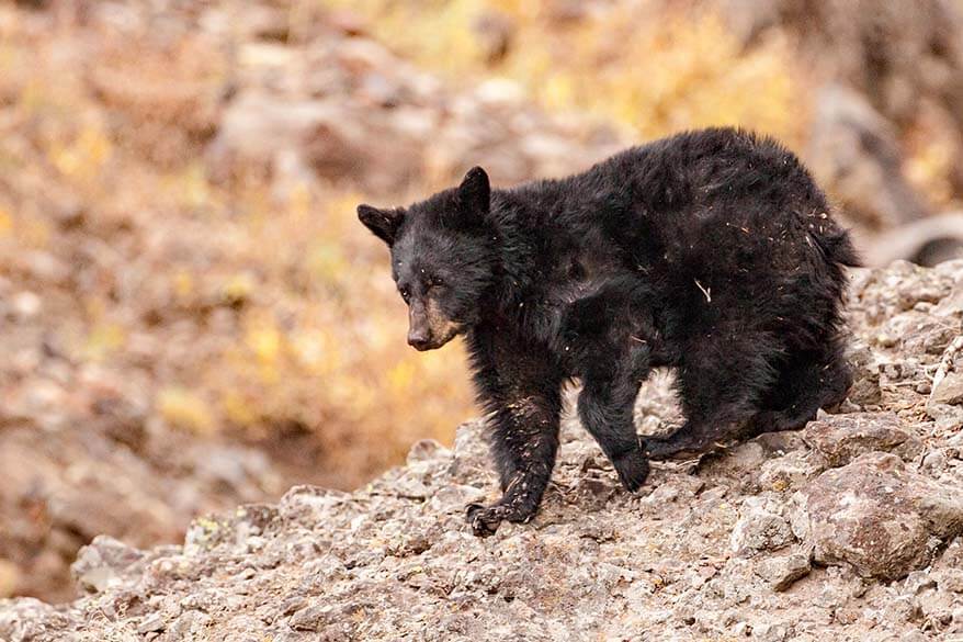
In addition to the sweeping canyon walls, you can also spot interesting wildlife, such as ravens, swallows, and – in July – a beautiful plethora of butterflies.
Most popular of all are the ospreys, which tend to nest near the Canyon Village area. Migrating to the region between mid-April and early May, the ospreys mate a few weeks later and the females lay eggs which hatch in 6 to 8 weeks. If you’re there at the right time, you may be lucky enough to see the young, which are nearly as big as their parents by mid- to late-August! In September, the entire osprey family leaves the Canyon.
How to Explore the Yellowstone Canyon
You can visit both sides of the Yellowstone Canyon – the North Rim and the South Rim. Both sides are accessible by car and/or on foot. While parts of the Canyon and the falls can only be reached using the hiking trails, others can be reached by car and a short walk along paved walkways.
The North Rim Drive is a one-way route that, initially, takes you to the Brink of the Lower Falls lookout point. From there, you can then drive on to Lookout Point, then to Grand View, and finally to Inspiration Point. If you want to, you can also hike between all these points – see below.
The 3.8 miles (6km) North Rim Trail – paved in some stretches and crossing pristine pine forests in others – crosses the northwest wall of the canyon, with some sections parallel to the North Rim Drive. This makes it easy to hike the trail in sections if you prefer. At its northeast end it begins at Inspiration Point, then runs southwest past the Upper Falls. It reaches a bridge that crosses over to the South Rim.
The South Rim Trail begins at the Chittenden Bridge on the south side, then follows the river downstream for almost 2 miles (3,2 km) and ends near Artist’s Point. This gives you an opposing view of the canyon. You can also drive to the main viewpoints of the South Rim by car.
Ideally, you should visit both rims if time allows. Below, you can read more about all the best viewpoints of Yellowstone Canyon and the things that you shouldn’t miss. Further below, you can find some suggestions on how to plan your visit, depending on how much time you have.
TIP: For the best lighting, visit the South Rim in the morning and the North Rim in the afternoon. Try to get to the most popular viewpoints first thing in the morning. The Canyon is quiet until about 10 AM; after that, it can get really busy, especially if you are traveling in summer.
Hiking tip: If you want to see some of the best views of the Yellowstone Canyon, go hiking! If you are not sure where to start or rather not hike in the bear territory alone, take a look at this highly-rated hiking tour that brings you to the most beautiful places along the Yellowstone Rim.
Best Viewpoints & Short Hikes of the Yellowstone Canyon
Below is the list of the best viewpoints and short hikes from where you can appreciate the Grand Canyon of the Yellowstone in all its glory.
I have included information about accessing these lookouts by road, plus extra details for those interested in hiking the routes. It’s worth noting that most of the trails on both the North and South Rims have fairly steep grades or stairs. With less dangerous drop-offs, the South Rim Trail is considered to be more family-friendly.
On the other hand, we visited most of the viewpoints and did a few short hikes at the Yellowstone Canyon with kids (age 5-7 at that time), and we didn’t find it overly challenging.
Good to know: Various improvement projects in the region mean that not all viewpoints and/or hiking trails are always open. I recommend checking the park website for up-to-date information before visiting.
Best viewpoints of the SOUTH RIM:
Best viewpoints of the NORTH RIM:
- Brink of the Upper Falls
- Brink of the Lower Falls
- Lookout Point
- Grand View
- Inspiration Point
- Silver Cord Cascade Overlook & Seven Mile Hole Trail
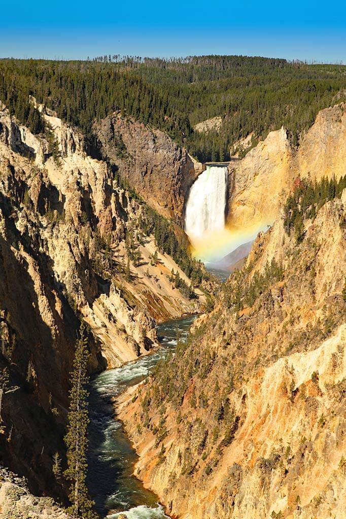
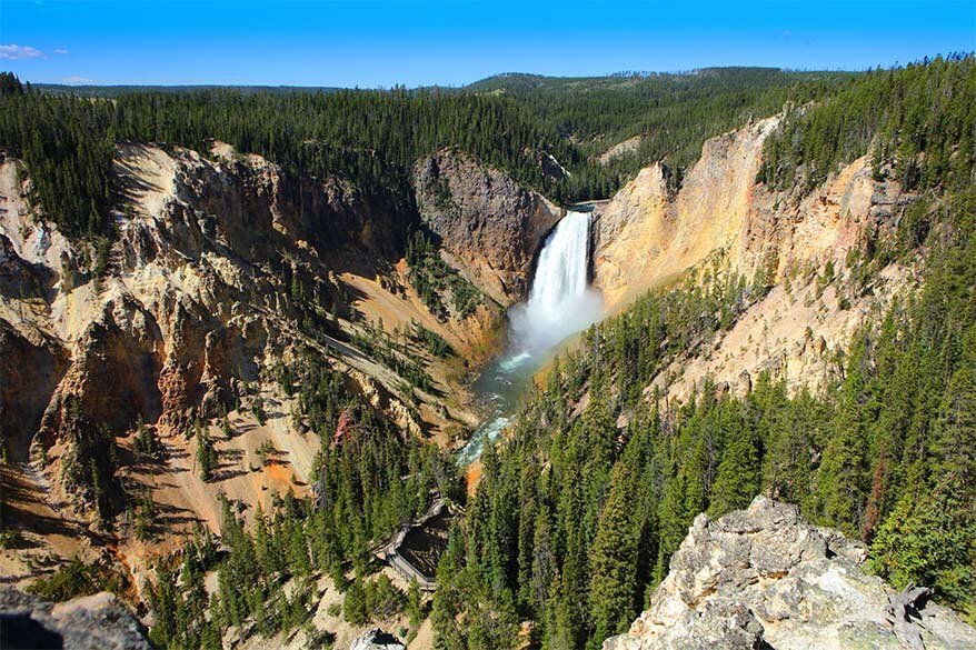
Artist Point
The most popular viewpoint of the Canyon, Artist Point is a very short walk along a paved trail from a large parking lot on South Rim Drive. The view of the Lower Falls from Artist Point is exceptional and not to be missed!
This viewpoint gets its name because it was believed that it was here that artist Thomas Moran stood in 1883 when he sketched the canyon. In reality, he made his sketches on the North Rim. However, the spot still seems to fit the name perfectly, as it gives some of the most beautiful, inspiring views of the Yellowstone Canyon. This is the place to get the very best photographs, particularly as the sun comes up!
Good to know: Keep in mind that Artist Point is one of the most popular places to see in Yellowstone. The best time to visit is in the morning before 10 AM.
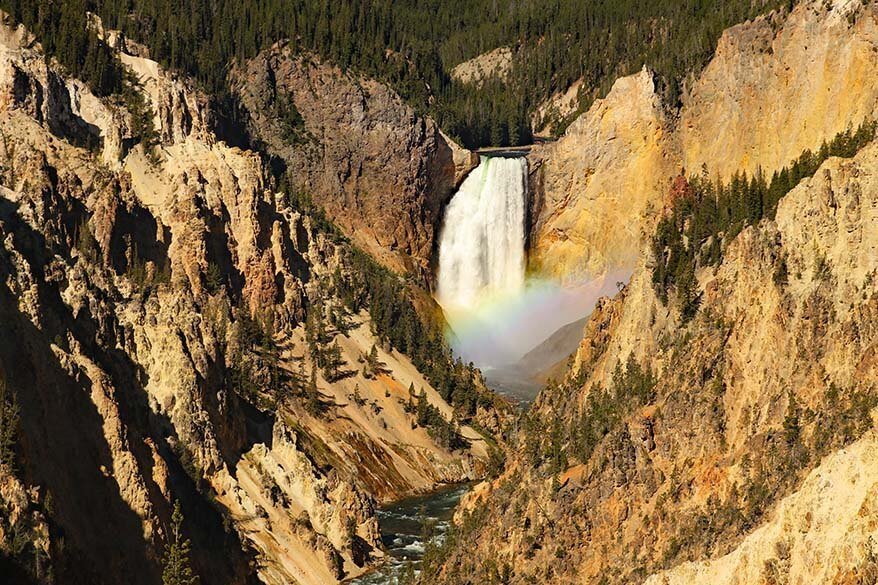
TIP: At certain times, you can see a rainbow over the Lower Falls from the Artist Point. This, of course, depends on the light conditions and the weather. In general, the best time to see a rainbow from the Artist Point is around 9.45 AM – 10 AM on a sunny summer morning.
Artist Point to Point Sublime Hike
After visiting Artist Point, you can continue your journey on foot and follow the South Rim Trail east along the canyon, to Point Sublime. This is a very popular hike at Yellowstone Canyon, offering amazing views of the canyon.
Point Sublime is actually not that spectacular, but the scenery along the trail is well worth it. This is an easy trail of about 1.5 miles (2.4km) each way (so about 3 miles (5km) in total). But you should know that there are steep drops along the way.
The trail starts at the east end of the parking area, at the very end of the South Rim Drive. Follow the wide trail that extends beyond the end of the road. This leads you through pine forests along the rim of the canyon, through which you can catch glimpses of the Lower Falls.
No special skill is required. This is a rather popular hiking trail that most people should be able to do. So most likely, you won’t be alone here. However, you should know that this is bear territory. So you should probably carry bear spray if hiking here.
Upper Falls Viewpoint
This is one of the best places from where you can see the Upper Falls of the Yellowstone.
The viewpoint is located just near a car park and doesn’t require much effort. It’s well worth a quick stop if you are passing by.
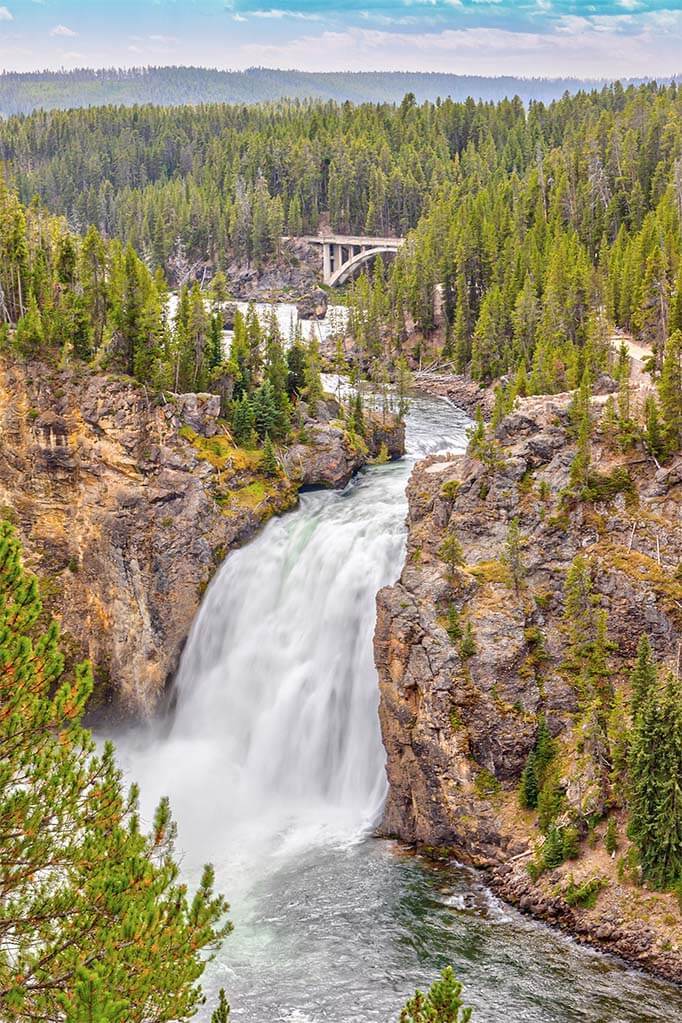
Brink of the Upper Falls
Brink of the Upper Falls is another nice viewpoint from where you can see the waterfall from close by. The scenery here is not as spectacular as the Brink of the Lower Falls (see below). Still, it’s very impressive to see the power of the river from so close by!
You can reach this viewpoint after an easy short hike of 0.25 miles round trip. There are only a few stairs to negotiate. So if you have the time, you may want to check it out as well.
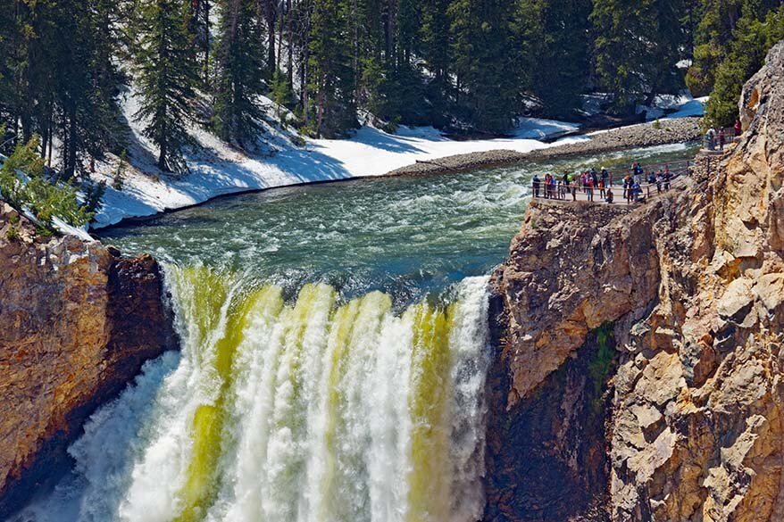
Brink of the Lower Falls
Just as its name indicates, the Brink of the Lower Falls viewpoint is situated at the very spot where the river spills over into the Canyon below. While you can’t see the entire Falls from here, it gives you a real sense of the river’s power. You can also see the Upper Falls of the Yellowstone River from this point.
The top of this viewpoint is paved and fully wheelchair-accessible, using the sidewalk along the parking lot.
But if you want to get even closer and experience the thunderous power of the Falls, you should take the Brink of the Lower Falls hiking trail. This short hike starts beside the washrooms at the parking lot.
The hike isn’t long (just 0.7 miles (1.1 km) round trip), but it’s relatively steep. There is unpaved descent of 600 ft (180 m), which switchbacks down the side of the canyon walls. Although there are a couple of spots to stop and rest, it’s a relatively arduous trail and the returning ascent can be quite difficult.
The views are well worth the extra effort, however. So if you are physically capable, don’t miss this place. Nowhere else in Yellowstone can you feel the power of the falls as you do here!
Lookout Point
It’s possible to drive right up to a parking lot for Lookout Point on the North Rim Drive. From the parking area, you just follow a short walkway of just 13 steps to the viewpoint. From here you can enjoy a panoramic outlook, which includes the Lower Falls to the west.
The spot received its name after an early Park superintendent – noticing how popular the point was with visitors – had a railing installed here in 1880.
Wheelchair users can use the sidewalk that runs from the parking lot to go on to the parking lot for the Grand View (below).
Lookout Point shares its parking lot with Red Rock Point. This viewing platform is situated just downstream from the falls and can be reached on foot from Lookout Point. It’s well worth a look if you don’t mind a strenuous hiking trail down into the canyon (and back). Since this hike is very steep and offers similar views as Lookout Point, it’s somewhat less popular.
Update: A loyal reader who recently visited Yellowstone suggested that I absolutely have to mention that Red Rock Point is definitely worth it. According to them, the views are even better than from the Lookout Point. So – once again – if you don’t mind a steep walk, check it out.
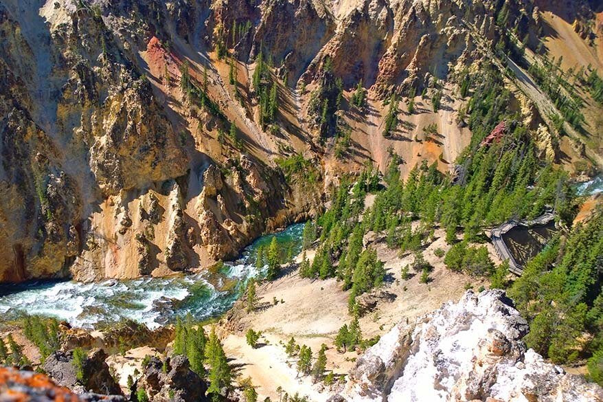
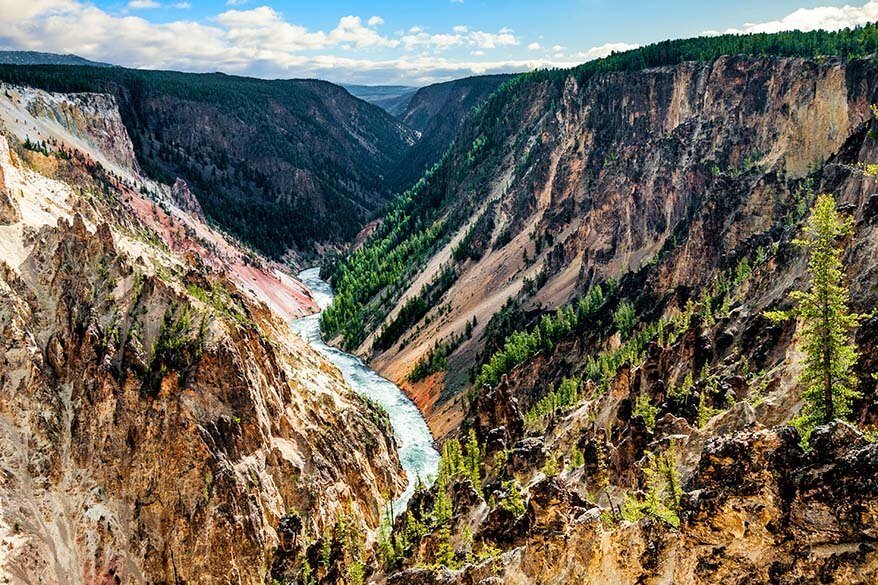
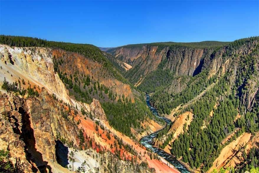
Grand View
Just a short walk northeast of Lookout Point, you’ll find another popular viewpoint, Grand View. Offering spectacular views in all directions, Grand View allows you to walk close to the canyon rim.
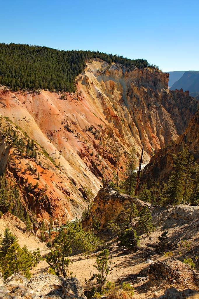
It’s a great spot to see the twists of the Yellowstone River below and in particular to appreciate the contrasting colors of the canyon. It’s also a good place to see the best views of the South Rim from the North Rim.
Some areas can be quite perilous, so it’s very important to stay on the designated trail. It’s worth noting that there’s no view of the falls from this point.
Good to know: Grand View has its own parking area, but it can also be reached via a wheelchair-accessible trail from Lookout Point.
Inspiration Point
Newly renovated and recently reopened, Inspiration Point is the last viewpoint along the North Rim Drive. It once extended out significantly further, but an earthquake in 1975 caused a large section of the point to be cut off.
Perhaps not quite as inspiring as its name suggests, this lookout nevertheless gives you amazing views over the Canyon. It is also the point where the canyon becomes wider, and you’ll notice that the canyon walls go from pastel colors to greens.
Inspiration Point is just a few steps from the road, so it’s very easy to access by car. If you want to, you can also walk down 50 steps into the canyon, for a different view.
Silver Cord Cascade Overlook & Seven Mile Hole Trail
If you want to explore the North Rim even further, you can opt to hike (part of) the Cascade Overlook Trail. This trail starts at the Glacial Boulder and goes to Silver Cord Cascade Overlook, a very narrow waterfall.
If you follow this trail further, you can do the Seven Mile Hole Trail. This strenuous hike to the canyon bottom is only for keen hikers who want to explore Yellowstone Canyon deeper. While spectacular, this hike is over 10 miles in length and needs a full day to accomplish.
None of these is an absolute must unless you have lots of time in Yellowstone and are looking to get really off the beaten path. Since you’ll likely be alone on these trails, make sure to carry bear spray.
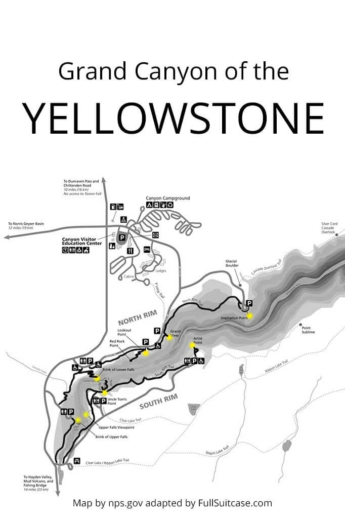
Map
To make it easier to plan your trip, I created this map indicating all the best things to do at the Grand Canyon of the Yellowstone.
On this map, you can also find the trailheads of the short hikes mentioned in this article.
How to use this map: Use your computer mouse (or fingers) to zoom in or out. Click on the icons to get more information about each place. Click the arrow on the top left corner for the index. Click the star next to the map’s title to add it to your Google Maps account. To view the saved map on your smartphone or PC, open Google Maps, click the menu and go to ‘Your Places’/’Maps’. If you want to print the map or see it in a bigger window, click on ‘View larger map’ in the top right corner.
How to Plan Your Time
If you are visiting Yellowstone National Park for just a few days, you’ll likely have just a couple of hours at the Grand Canyon of the Yellowstone River.
Below are some suggestions for how to best plan your time in this area, depending on how much time you have.
- If you have just one day in Yellowstone and are really short on time and can only visit one viewpoint, make it Artist Point – the views are incredible!
- If you have at least 1.5 hours, visit Artist Point and drive the North Rim stopping at at least two viewpoints.
- If you have at least two days in Yellowstone, you can likely allocate 2-3 hours for visiting the Yellowstone Canyon. In that case, in addition to Artist Point, drive the North Rim Drive, stopping at all the main viewpoints.
- If you have at least half a day in this area, in addition to the main viewpoints on both sides of the canyon, you can also do the Point Sublime hike or book this popular hiking tour (it starts early in the morning and takes about 6 hours).
- If you have one day at the Grand Canyon of the Yellowstone, you could opt to hike along both rims enjoying all the viewpoints along the way, or take a longer hike in the nearby area.
More tips for your trip to Yellowstone:
- How to plan your trip: Yellowstone Itinerary
- Where to stay: Where to Stay in Yellowstone and Best Hotels Near Yellowstone
- Essential tips: Yellowstone Travel Tips
- When to go: Best Time to Visit Yellowstone
- What to see: Best Things to Do in Yellowstone & Best Places on Yellowstone South Loop
- Two parks in one trip: Grand Teton & Yellowstone Itinerary
- Nearby: What to Do In & Near Jackson Hole & Jenny Lake in Grand Teton NP
READ ALSO: Yellowstone Travel Guide – overview of all our articles and travel tips for Yellowstone National Park
TIP: Save this guide for later, share it with your friends, or pin it to Pinterest so you can easily come back to it when planning your trip.


I’ve been here 6 times and I love it so much but last visit was late 70s
I’m sure a lot has changed since that time – not that much the scenery likely, but the number of people and infrastructure…
Happy travels, Sharon!
May I please get a copy of the Map for the Grand Canyon of the Yellowstone Area?
Thanks
Hi Ben, you can find/print this map here.
All of your info is so detailed and helpful! Thank you so much! The photos are breathtaking and we can’t wait to visit in June 2021. I’m trying to get a binder ready for our trip full of maps and guides. How can I print your awesome maps of the places we want to visit? Mammoth Hot Springs map, Yellowstone Grand Canyon Map, etc.
Thank you for sharing all of this valuable information with us all! It sure makes it not seem so overwhelming trying to plan our trip!
Hi Angie, glad that you found our guides helpful.
If you want to print an entire article, you can try saving the file by choosing ‘Print to pdf’ and then selective the pages you want to be printed once you have that file saved to your computer.
If you are just looking to print the maps that we created, here you can find the image files. You should be able to just print them straight from your browser:
– Grand Canyon of the Yellowstone Map
– Upper Geyser Basin Map
– Mammoth Hot Springs Map
Also, for the Upper Geyser Basin, we have a separate printable with all the details that you can download if you subscribe to our newsletter – you can find the form in the article. We didn’t have the time to make printables for all these areas. But if you already have a map, you can just print these maps and indicate the places that interest you the most.
Have a great time in Yellowstone!